Rollinsville, Colorado
Looking for the best hiking in Rollinsville? We've got you covered with the top trails, trips, hiking, backpacking, camping and more around Rollinsville. The detailed guides, photos, and reviews are all submitted by the Outbound community.
Top Hiking Spots in and near Rollinsville
-
Ward, Colorado
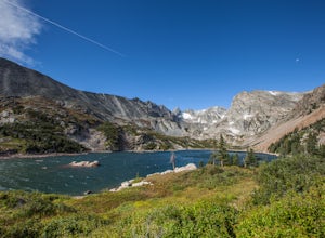
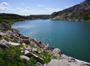
Lake Isabelle via Long Lake Trailhead
4.54.09 mi / 374 ft gainStart at the Pawnee Pass Trail No. 907 Trailhead. Long Lake is about 2 tenths of a mile and Lake Isabelle is 2 miles from the trailhead. Keep an eye out for moose grazing in the bushes or in the water near Long Lake. This is a 4 mile out and back hike with well marked trails. For an 8.75 mile hi...Read more -
Ward, Colorado
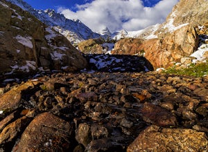
Isabelle Glacier
5.08.62 mi / 1578 ft gainGetting There The trailhead can be reached from Boulder by driving west through Boulder Canyon on Highway 42 to Nederland, then going north on the Peak-to-Peak Highway 72 to the town of Ward. From there, a National Forest Sign on the west side of the highway provides directions to the ranger stat...Read more -
Ward, Colorado
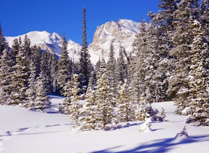
Snowshoe or Ski Lake Isabelle
10 miSpeechless. That’s how this hike will leave you. And not just because of its length. At over 10 miles, this snowshoe exploration is not for the faint of heart. But the language-defying beauty of this hike will make every sore muscle worth it.The Brainard Lake Recreational Area near Ward, Colorado...Read more -
Idaho Springs, Colorado
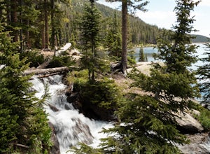
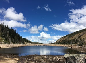
Explore Fall River Reservoir
4.01 mi / 144 ft gainThis spot may be a little more difficult to reach than others, but the payoff is worth it. You'll start by taking a dirt road that splits off from Fall River Road. It is pretty easy going for the first mile or so, but then you'll want to make sure you have a little higher clearance 4x4 vehicle to...Read more -
Ward, Colorado
Hike to Blue Lake
4.66 mi / 1000 ft gainLocated in the Brainard Lake Recreational Area (west of Nederland, CO in the Indian Peaks Wilderness), this gem isn’t exactly a well-kept secret, but it has all the beauty that you could ask for in a relatively easy Colorado hike.To get the full effect of the lake, you may want to plan your hike ...Read more -
Idaho Springs, Colorado
Camp at Chinns Lake
Take the road as if you are going to St. Mary's Glacier, but you will take a left off the road (next to a very nice house) before the road makes a sharp right turn to go up hill. The road is a smooth dirt road for about a mile, but gets very rocky after that and you will need a good off road vehi...Read more -
Boulder, Colorado
Green Mountain via Gregory Canyon and Ranger Trail
5.45 mi / 2313 ft gainGreen Mountain via Gregory Canyon and Ranger Trail is an out-and-back trail that provides a good opportunity to view wildlife located near Boulder, Colorado.Read more -
Boulder, Colorado
Hike the Saddle Rock Trail
5.02.6 mi / 1500 ft gainYou can either start the from the Gregory Canyon Trailhead or the main Chautauqua trail. At the Chautauqua trailhead you will need to pay for parking on Saturdays and Sundays and at the Gregory Canyon Trailhead you will need to pay for parking if your car is not registered in Boulder. If you sta...Read more -
Boulder, Colorado
Woods Quarry via NCAR
4.23.28 mi / 755 ft gainYou can start from Chautauqua Park, but I prefer to start at NCAR, especially since there is ample parking and you can take a bathroom break inside before hitting the trail. From the intersection of Table Mesa Drive and Broadway in Boulder, drive west on Table Mesa to its end at the NCAR buildin...Read more -
Boulder, Colorado
Hike the Red Rocks Loop Trail
3.71 miParking is available on either Canyon or Sunshine Roads. During the weekends it tends to get crowded around sunset so plan accordingly. The entire trail is a loop and is a little over 1 mile in length so it doesn't take too long. The main feature is the massive red sand stone rocks that jut out o...Read more -
Boulder, Colorado
Royal Arch Trail
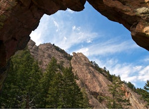
4.43.32 mi / 1220 ft gainRoyal Arch Trail climbs up Boulder's famous Chautauqua Park to an archway formed by sandstone rocks that tower over thirty feet high. Start at the Chautauqua Trail Station by the Ranger Station, and continue up Bluebell Road for 0.7 miles. You will then arrive at a more forested area, where you ...Read more -
Boulder, Colorado
Hike to the 1st Flatiron
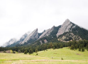
4.62.4 mi / 1422 ft gainStarting at the ever-popular and ever-populated Chautauqua Trailhead, take the main trail (a highway version of a dirt trail) straight towards the Flatirons. Continue going straight passed the Ski Jump trail to your right (0.2 mi.), then at a crossroads with the Bluebell-Baird trail (0.3 mi.) tur...Read more -
Boulder, Colorado
Green Mountain via Chautauqua Park
4.55.24 mi / 2467 ft gainStarting from the popular Chautauqua Park trailhead, head west on the main trail to the first branch off onto a smaller trail that will take you toward Baseline Road. Follow this trail until it eventually connects with Gregory Canyon Trailhead—you can park at this trailhead if you wish, but miss ...Read more -
Boulder, Colorado
Hike the Chautauqua Trail to the Ski Jump Trail
5.01.55 miBeginning at the Chautauqua Trailhead, the Chautauqua Trail goes for 0.6 miles before connecting with the Bluebell-Baird Trail. From here it becomes a choose-your-own-adventure hike. For a short, simple hike you can do with people who aren't ready for lots of elevation gain, take a right and conn...Read more -
Boulder, Colorado
Mount Sanitas Peak Trail
2.57 mi / 1296 ft gainExplore the natural wonders of Boulder, Colorado, with the Mount Sanitas Peak Trail hike. This trail offers stunning vistas of the Rocky Mountain wilderness and Colorado's Front Range. This hike is just over 2.5 miles with about 1300 feet of elevation gain. Parking and Access: Start your hik...Read more -
Boulder, Colorado
Red Rocks and Anemone Trail Loop
1.26 mi / 459 ft gainRed Rocks and Anemone Trail Loop is a loop trail that provides a good opportunity to view wildlife located near Boulder, Colorado.Read more

