Red Feather Lakes, Colorado
Looking for the best hiking in Red Feather Lakes? We've got you covered with the top trails, trips, hiking, backpacking, camping and more around Red Feather Lakes. The detailed guides, photos, and reviews are all submitted by the Outbound community.
Top Hiking Spots in and near Red Feather Lakes
-
Fort Collins, Colorado
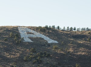
"The A" via the Foothills Trail
5.04.14 mi / 531 ft gainWhy is there an A on the side of the mountain? The "A" stands for Aggies. When Colorado State University was first founded in 1870, it was originally called Colorado Agricultural College. The mascot at the time was The Aggies. Though the college has now become Colorado State and its mascot, The...Read more -
Estes Park, Colorado
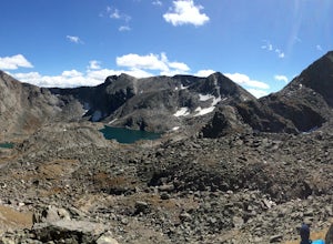
Backpack the Gorge Lakes
11.5 mi / 3200 ft gainStart at the Rock Cut Parking Area. Head east on Trail Ridge Road 0.25 miles to a more gradual and bald western slope leading down into Forest Canyon. This bald is located between two creeks which merge before joining the Big Thompson River (a small creek in mid September). Use the creeks to navi...Read more -
Fort Collins, Colorado
North Shield Pond Trail
3.01.54 mi / 43 ft gainNorth Shield Pond Trail is a loop trail where you may see beautiful wildflowers located near Fort Collins, Colorado.Read more -
Wellington, Colorado
Hike the Mahogany Loop Trail at Soapstone Prairie Natural Area
7.4 mi / 330 ft gainTo get to Soapstone Prairie from Fort Collins, take Highway 287 north out of town, then turn right onto Highway 1. Continue on Highway 1 until it meets with County Road 15. Take County Road 15 north all the way to Rawhide Flats Road, which leads directly into Soapstone Prairie. As you begin to ap...Read more -
Loveland, Colorado
Climb Green Ridge in the Roosevelt National Forest
9.8 mi / 2400 ft gainGreen Ridge is a fantastic series of summits in the Front Range that make for excellence training hikes, but is often forgotten as it lies outside of the nearby Bobcat Ridge Natural Area and just inside of Roosevelt National Forest. The summit itself at 7,402' is fantastic, featuring a nearly 900...Read more -
Loveland, Colorado
Hike the Valley Loop Trail in the Bobcat Ridge Natural Area
4.4 mi / 500 ft gainThe Valley Loop Trail in the Bobcat Ridge Natural Area begins at the main entrance of the Natural Area, just off W County Road 32 C near Masonville, west of Fort Collins and the Horsetooth Reservoir.To get there take West County Road 38 E west from Fort Collins over and around the Horsetooth Rese...Read more -
Loveland, Colorado
Hike the D.R. Trail in the Bobcat Ridge Natural Area
3.76.2 mi / 1050 ft gainD.R. Trail, named for David Rice Pulliam who donated the land to create the Bobcat Ridge Natural Area, is a 3.1 mile spur off the Valley Loop Trail that climbs roughly 1,000' into Mahoney Park before it intersects with the Powerline and Ginny Trails. To get to the start of the trail, take the Val...Read more -
Loveland, Colorado
Hike the Powerline Trail in the Bobcat Ridge Natural Area
3.8 mi / 1100 ft gainPowerline Trail is a 1.9 mile spur off the Valley Loop Trail in the Bobcat Ridge Natural Area that climbs 1,100 feet from the valley floor to Mahoney Park.To get to the start of the trail, take the Valley Loop Trail .9 miles in the Bobcat Ridge Natural Area from the main entrance of the Natural A...Read more -
40.387035,-105.610770
Rocky Mountain NP's Trail Ridge Road
4.939.06 miStart by entering Rocky Mountain National Park through Estes Park, Colorado. After acquiring a map start your ascent on Trail Ridge Rd (the road is closed in winter). The Road will take you up in elevation into the mountains so a good car is strongly recommended. As you wind up the switch backs,...Read more -
Estes Park, Colorado
Hike Deer Mountain
6.03 mi / 1200 ft gainBeginning in Rocky Mountain National Park near the Deer Ridge Junction (where US 34 & US 36 meet), park your car in one of the 20 spots on either side of the road. Start at the trailhead booth and head north, keeping to the right-side trail at the first intersection about a tenth of a mile fr...Read more -
Estes Park, Colorado
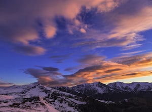
Watch the Sunset at Forest Canyon Overlook
5.00.2 mi / 32 ft gainTrail Ridge Road is an incredible highway that crosses the mountains between Grand Lake and Estes Park, one of the most famous parts of Rocky Mountain National Park. It features incredible views of the Rockies and the Front Range, as well as the unforgettable experience of being immersed in the t...Read more -
Estes Park, Colorado
Mt. Ida via Milner Pass
5.09.28 mi / 2112 ft gainThe hike to Mt. Ida offers some of the most stunning views of Rocky Mountain National Park. How to get there: From the east, take Trail Ridge Road all the way to the west side of the park. You will pass Alpine Visitor Center and the road sharply turns south at Medicine Bow Curve. The trailhead...Read more -
Estes Park, Colorado
Backpack Alpine Terrain to Haynach Lakes
17 miBegin at the Milner Pass Trailhead off of Trail Ridge Road in Rocky Mountain National Park. Commonly used to summit Mount Ida, this trailhead is often popular with summer hikers. The trail climbs steeply through the trees before revealing open slopes of tundra and fantastic panoramic views. Altho...Read more -
Estes Park, Colorado
Hike along Tombstone Ridge
4.3 mi / 3250 ft gainTombstone ridge can be accessed via the ute trail from two directions. The lower trail starts at upper beaver meadows and is ~4.3 miles with 3250 feet of elevation gain. It can also be accessed at the Ute trail crossing along trail ridge road, which leaves you a 1.1 mile hike with just under 300 ...Read more -
Buford, Wyoming
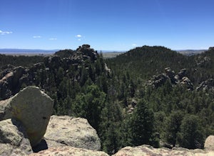
Scramble Twin Mountain
1.7 mi / 500 ft gainThis adventure is located between Laramie and Cheyenne on Happy Jack Road (WY 210). Take Forest Road 707A east for 1.4 miles and th en take a left at the fork (Forest Road 707AG). The trailhead is at the end of the second left turn (only about 200 yards from the fork). The forest roads are not...Read more -
Estes Park, Colorado
Hike to Cub Lake
5.04.6 mi / 645 ft gainRocky Mountain National Park showcases 355 miles of hiking trails, 6 campgrounds, and hundreds of backcountry camp sites. The cost to enter the park is $20.00 per vehicle, I recommend buying the annual National Parks Pass for $80.00. Cub Lake is an excellent trail for viewing wildlife. There ar...Read more

