Pine, Colorado
Looking for the best running in Pine? We've got you covered with the top trails, trips, hiking, backpacking, camping and more around Pine. The detailed guides, photos, and reviews are all submitted by the Outbound community.
Top Running Spots in and near Pine
-
Boulder, Colorado
Sunshine Lion's Lair Loop
5.05.05 mi / 1257 ft gainThis is a mix of trails that will bring you on an easy loop to the peak of Mt Sanitas, but will keep you away from the usual crowds of the more well-known paths up. The hike is a clear path that brings you 5+ miles from around 5,500 ft in elevation to 6,800. You'll start at the Centennial Trail...Read more -
Boulder, Colorado
Mount Sanitas + Sunshine Canyon loop
5.03 mi / 1257 ft gainThis loop takes you up Sunshine Canyon, a milder and less crowded grade when compared to the popular Sanitas ridge. You'll head up the canyon for a bit before reaching the terminus of the canyon trail -- where you'll cross the road to pick up on the Lions Lair connector. Continue following this u...Read more -
Boulder, Colorado
Catch the Sunrise on Sugarloaf
4.51 mi / 400 ft gainTo get there from downtown Boulder, head west on CO 119 and almost 4.5 miles after you have left Boulder, turn right onto Sugarloaf Road. 4 miles after the turn from CO 119, turn right onto Sugarloaf Mountain road (located at the top of the road). If the road starts descending, you've gone too fa...Read more -
Nederland, Colorado
Hike to Diamond Lake in the Indian Peaks Wilderness
5.05.7 mi / 1361 ft gainDiamond Lake is located in the Indian Peaks Wilderness. This is a super popular destination, so make sure you arrive early to get a parking spot (and be sure to follow all parking rules, they do give out tickets at this trailhead and others nearby). The drive to the trailhead is about 4 miles dow...Read more -
Frisco, Colorado
Mount Royal Trail
3.98 mi / 1391 ft gainMount Royal Trail is an out-and-back trail that takes you through a nice forest located near Frisco, Colorado.Read more -
Silverthorne, Colorado
Lily Pad Lake
4.73.27 mi / 531 ft gainLily Pad Lake is a well known destination just outside of Silverthorne and in the Eagle's Nest Wilderness. The trail may be heavily trafficked on the weekends, but solitude can still be found in the early mornings or during the weekdays. The trail starts at the Lily Pad Lake Trailhead, just to t...Read more -
Silverthorne, Colorado
South Willow Falls
4.66.17 miStart at the Willowbrook Trailhead. You’ll hit a “Y” in the trail pretty quickly - go left and you’ll soon be at the first log bridge. There are quite a few water crossings on the trail, but they are easy to maneuver. After hiking in the Willow Creek Open Space for a bit, you’ll enter Eagle’s Ne...Read more -
Boulder, Colorado
Wonderland Lake Trail
5.01.85 mi / 98 ft gainWonderland Lake Trail is a loop trail that takes you by a lake located near Boulder, Colorado.Read more -
Boulder, Colorado
Foothills Trail to Wonderland Lake Loop Trail
2.93 mi / 223 ft gainFoothills Trail to Wonderland Lake Loop Trail is a loop trail that takes you by a lake located near Boulder, Colorado.Read more -
Boulder, Colorado
Hogback Ridge Trail
2.85 mi / 830 ft gainHogback Ridge Trail is a loop trail where you may see beautiful wildflowers located near Manitou Springs, Colorado.Read more -
Boulder, Colorado
Hike the Eagle Sage Loop
4.33.75 mi / 205 ft gainThis is a great trail if you are in the Boulder area and want something fairly easy or quick. This 3.75 loop can be hiked in about an hour and a half since it is fairly flat. The elevation gain is minimal. You start out at the Eagle Trailhead located west of the Boulder Reservoir.Start out at the...Read more -
Ward, Colorado
Pawnee & Buchanan Pass Loop
5.026.98 mi / 6978 ft gainBefore you start your trip, get a camping permit from the Boulder Ranger Station. Plan to spend your first night in the Crater Lake BZ (Backcountry Zone), and your second in Buchanan BZ. If you're feeling particularly sedate, you can easily spend a third night in Coney Creek. Start early in the ...Read more -
Nederland, Colorado
Hike to Columbine Lake
5.07 mi / 1200 ft gainThe hike is about seven miles, give or take, however it feels longer. The elevation gain is little over 1000 feet. The drive here is about 45 minutes from both Granby and Winter Park, and is definitely worth it. You follow a trail dusted with wildflowers for the majority of the hike, and occasio...Read more -
Cascade, Colorado
Manitou Incline
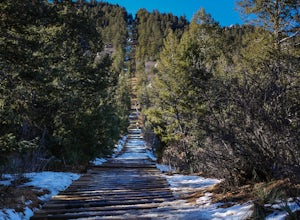
4.73.8 mi / 1949 ft gainIf you're ready for a fitness challenge like no other, look no further than the Manitou Incline. The trail climbs the remnants of an old cog railway bed, gaining 2000 feet of elevation in less than a mile. Busy all year round, the popular trail is used by everyone from Army Rangers and Olympic ho...Read more -
Colorado Springs, Colorado
Perkins Central Garden Trail
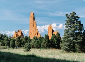
5.01.13 mi / 138 ft gainGarden of the Gods has dozens of hiking trails that cover miles through the park itself. The Perkins Central Garden Trail takes you through the heart of the rock formations and really gives you perspective on the size of these red rocks. This trail also takes you past several areas where rock cl...Read more -
Manitou Springs, Colorado
Hike Red Mountain
2 mi / 750 ft gainThe hike can be started from where the Intemann trail meets Ruxton Ave close to Iron Spring. For parking, you can park at one of the few pay-for parking along the street or park in town and take the bus up to the incline. The hike starts up what seems to be a driveway until you reach a small gate...Read more

