Pine, Colorado
Looking for the best hiking in Pine? We've got you covered with the top trails, trips, hiking, backpacking, camping and more around Pine. The detailed guides, photos, and reviews are all submitted by the Outbound community.
Top Hiking Spots in and near Pine
-
Ward, Colorado
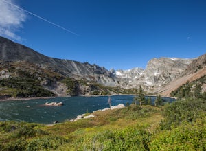
Lake Isabelle via Long Lake Trailhead
4.54.09 mi / 374 ft gainStart at the Pawnee Pass Trail No. 907 Trailhead. Long Lake is about 2 tenths of a mile and Lake Isabelle is 2 miles from the trailhead. Keep an eye out for moose grazing in the bushes or in the water near Long Lake. This is a 4 mile out and back hike with well marked trails. For an 8.75 mile hi...Read more -
Ward, Colorado
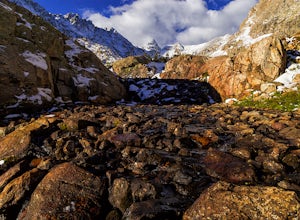
Isabelle Glacier
5.08.62 mi / 1578 ft gainGetting There The trailhead can be reached from Boulder by driving west through Boulder Canyon on Highway 42 to Nederland, then going north on the Peak-to-Peak Highway 72 to the town of Ward. From there, a National Forest Sign on the west side of the highway provides directions to the ranger stat...Read more -
Ward, Colorado
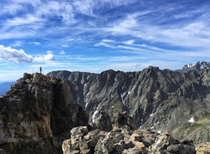
Shoshoni Peak
5.010.61 mi / 2470 ft gainHike one of the most scenic 12ers in Colorado's front range, Shoshoni Peak, with an elevation of 12,967 feet. You can easily combine a summit of Pawnee Peak for wonderful views of multiple alpine cirques. Enjoy wonderful views of the Long Lake Valley, Isabelle Glacier, and Pawnee Pass regions. Fo...Read more -
Ward, Colorado
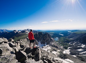
Climb Apache Peak
10 mi / 3280 ft gainStart at the Long Lake Trailhead ($10 parking fee) and head up the trail towards Isabell Lake. You'll pass both Long Lake and Isabelle lake, with spectacular views at both. At Lake Isabelle, be sure to continue straight on the trail, further up the valley, not the right turn up to Pawnee Pass.Con...Read more -
Ward, Colorado
Pawnee & Buchanan Pass Loop
5.026.98 mi / 6978 ft gainBefore you start your trip, get a camping permit from the Boulder Ranger Station. Plan to spend your first night in the Crater Lake BZ (Backcountry Zone), and your second in Buchanan BZ. If you're feeling particularly sedate, you can easily spend a third night in Coney Creek. Start early in the ...Read more -
Ward, Colorado
Pawnee Pass and Pawnee Peak
5.09.95 mi / 2490 ft gainStart at the Long Lake trailhead in the Brainard Lake Recreation area (there's a fee to park, if you don't have a pass). Take the trail towards Lake Isabelle for a few miles, winding through forest and past Long Lake. Signage towards Lake Isabelle and Pawnee Pass is apparent. Just as you reach ...Read more -
Ward, Colorado
Snowshoe or Ski Lake Isabelle
10 miSpeechless. That’s how this hike will leave you. And not just because of its length. At over 10 miles, this snowshoe exploration is not for the faint of heart. But the language-defying beauty of this hike will make every sore muscle worth it.The Brainard Lake Recreational Area near Ward, Colorado...Read more -
Ward, Colorado
Hike to Blue Lake
4.66 mi / 1000 ft gainLocated in the Brainard Lake Recreational Area (west of Nederland, CO in the Indian Peaks Wilderness), this gem isn’t exactly a well-kept secret, but it has all the beauty that you could ask for in a relatively easy Colorado hike.To get the full effect of the lake, you may want to plan your hike ...Read more -
Nederland, Colorado
Hike to Columbine Lake
5.07 mi / 1200 ft gainThe hike is about seven miles, give or take, however it feels longer. The elevation gain is little over 1000 feet. The drive here is about 45 minutes from both Granby and Winter Park, and is definitely worth it. You follow a trail dusted with wildflowers for the majority of the hike, and occasio...Read more -
Colorado Springs, Colorado
Hike to Blodgett Peak
3.04.5 mi / 2325 ft gainGetting There Google Maps + "Blodgett Peak Open Space"= Easy Peasy. The parking lot only accommodates 11 cars with a one of those reserved for handicap. A port-a-potty is the only facility available at the trail head, so plan accordingly. The Hike Starting out at about 7,000 feet the first mile ...Read more -
Fairplay, Colorado
Climb Horseshoe Mountain via Boudoir Couloir
7 mi / 2500 ft gainHorseshoe Mountain is a peak that is ranked in the top 100 tallest peaks in Colorado at 13,898 feet, and it can be done in the summer but is arguably more fun in the spring as a snow climb. Avalanche safety, snow climbing, and snow safety experience is necessary. To get to the trailhead, follo...Read more -
El Paso County, Colorado
Summit Pikes Peak via the Devils Playground Trail
3.05.5 mi / 1348 ft gainThis portion of a trek to the Pikes Peak begins about 13,000 feet. From the parking lot walk across the road back to the Northeast side and look for the hikers trail that begins by paralleling the road. By hiking this path you will have the time to enjoy the amazing views of the mountain range a...Read more -
Silverthorne, Colorado
Backpack to Upper Slate Lake
5.028 mi / 1386 ft gainStarting from the Rock Creek Trailhead parking lot, it is an up and down trek to Upper Slate Lake. The trail map states 10 miles each way, but accounting for switchbacks it ends up being closer to 14 long, hard miles.You will be among aspens and pines for the first half as you have a few moderate...Read more -
Fairplay, Colorado
Hike Mount Sherman
4.210.5 mi / 2100 ft gainA mile South of Fairplay, turn West onto 4 Mile Creek Road (dirt) and follow it for about 8 miles. The road passes a number of excellent camping spots and finally ends at the ruins of an old mine. Parking is available about a quarter mile from the mining area. Don't park at the gate as its possib...Read more -
Divide, Colorado
Hike to Horsethief Falls and Pancake Rocks
4.87.6 mi / 1400 ft gainHorsethief Falls and Pancake Rocks can be found on the west side of Pikes Peak, so if you want to get away from the crowds and the city, put this trail on your to do list.Most of the trail runs through the forest, which makes this an excellent candidate for hiking in July and August when the summ...Read more -
Ward, Colorado
Hike the Ceran St. Vrain Trail
5.04 mi / 1207 ft gainThe Ceran St. Vrain trail north of Jamestown offers the hiker a nice respite from the summer sun as this path runs through dense pine forests. The trail follows the South St. Vrain Creek for most of the way and follows moderate grades throughout. There is no official end to the trail, only that i...Read more

