Parshall, Colorado
Looking for the best fitness in Parshall? We've got you covered with the top trails, trips, hiking, backpacking, camping and more around Parshall. The detailed guides, photos, and reviews are all submitted by the Outbound community.
Top Fitness Spots in and near Parshall
-
Estes Park, Colorado
Green Lake via Glacier Gorge Trail
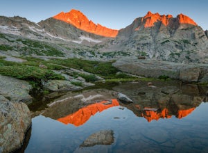
5.011.38 mi / 3400 ft gainBegin at the popular Glacier Gorge trailhead along Bear Lake Road in Rocky Mountain National Park. Arrive VERY early for parking as the lot typically fills by 7:30 am. For the best photography options - choose to either backpack into the Glacier Gorge campsite (reservations must be made early in ...Read more -
Allenspark, Colorado
Hike to Ouzel Falls
4.05.22 mi / 870 ft gainLocated right outside of Rocky Mountain National Park, this hike is perfect for anyone looking to do a little exploring without the cost of a park fee. The drive through the Rocky Mountains to the trailhead is an added bonus. This hike is great because it has multiple attractions all along the wa...Read more -
Allenspark, Colorado
Ouzel & Ogallala Peaks
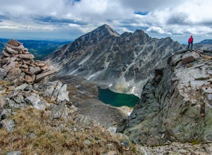
17.18 mi / 4403 ft gainBegin at the Wild Basin Trailhead in southeastern Rocky Mountain National Park near the town of Allenspark. Plan to start before sunrise if attempting this trek as a day trip in order to avoid afternoon thunderstorms above the treeline. This trip can easily be made into a backpacking experience b...Read more -
Frisco, Colorado
Climb Mount Royal
4.7To access the trailhead, drive 4 blocks South to the end of 2nd Avenue from Frisco's Main Street. The trailhead is located around 9,075 feet.Being a popular hike, the trail is clear in the summer months and usually populated by boot prints and snowshoe tracks in the winter. Follow the trail from ...Read more -
Silver Plume, Colorado
Argentine Railroad Grade
5.05.35 mi / 863 ft gainThe Argentine Central Railroad Grade trail is just what it says: it follows the old rail bed of the Argentine Central line. All railway remnants have long since been removed, and in its place is a wide, well-defined trail with an easy grade. With just a 900-foot incline over the course of about t...Read more -
Dillon, Colorado
Hike the 7:30 Mine Road in Silver Plume
4.05 mi / 1200 ft gainWith a name like 7:30 Mine Road, this is one hike I had to investigate to see if it lives up to its name. Even though this is an easier hike than I normally choose, what it lacks in challenging terrain, it makes up for in historic interest. The view isn’t too bad, either.7:30 Mine Road is about t...Read more -
Estes Park, Colorado
Backpack to Odessa Lake via Fern Lake Trailhead
4.09.65 mi / 1890 ft gainOdessa Lake seems to be one of the true hidden gems of Rocky Mountain National Park. Don't get me wrong, you will likely see some folks there, but it is a far cry from the other crowded Bear Lake trailhead lakes. There are two ways to reach Odessa; one, from the Bear Lake Trailhead, and the oth...Read more -
1398 Longs Peak Road, Colorado
Storm Peak and Mount Lady Washington
4.512.57 mi / 5312 ft gainThis adventure began at the Longs Peak trailhead in southeastern Rocky Mountain National Park, Colorado. I followed the Longs Peak trail for 6 miles to the Boulderfield backcountry camping area. This is a fairly steep on-trail climb of 3,360 feet. After setting up camp at 12,760 feet, my partner...Read more -
Estes Park, Colorado
Hike to Cub Lake
5.04.6 mi / 645 ft gainRocky Mountain National Park showcases 355 miles of hiking trails, 6 campgrounds, and hundreds of backcountry camp sites. The cost to enter the park is $20.00 per vehicle, I recommend buying the annual National Parks Pass for $80.00. Cub Lake is an excellent trail for viewing wildlife. There ar...Read more -
Bellvue, Colorado
Winter camp at Zimmerman Lake
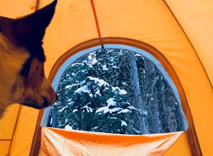
2.7 mi / 518 ft gainThis is a fairly popular snowshoeing and cross country skiing trail in the winter and offers a variety of additional trail options from the lake. Starting at the parking lot, the trailhead is easily accessed and begins the very gradual assent to Lake Zimmerman. Once at the lake, there are beautif...Read more -
Estes Park, Colorado
Hike Deer Mountain
6.03 mi / 1200 ft gainBeginning in Rocky Mountain National Park near the Deer Ridge Junction (where US 34 & US 36 meet), park your car in one of the 20 spots on either side of the road. Start at the trailhead booth and head north, keeping to the right-side trail at the first intersection about a tenth of a mile fr...Read more -
Estes Park, Colorado
Estes Cone
4.08.22 mi / 2275 ft gainThe trail begins on the left on a park service road before reaching a junction with the Storm Pass Trail just past .2 miles. Follow the trail as it enters the forest and continue past the private property signs and over a footbridge. Past the bridge the trail climbs more steadily for just under 2...Read more -
Idaho Springs, Colorado
Hike to Hell's Hole
4.5The name is uninviting, but Hell’s Hole is a scenic, shallow basin in the Mount Evans Wilderness near Idaho Springs. Starting elevation is about 9500 feet. Right after the trailhead, you pass through a few camping sites in the Chicago Creek Picnic Area. About five minutes into the hike is the per...Read more -
Frisco, Colorado
Backpack to the Gore Range's Wheeler and Lost Lakes
4.510 mi / 2200 ft gainThe range offers many remote lakes and peaks which hikers can access from various points of entry. Wheeler and Lost Lakes lie within the boundaries of the Eagle's Nest Wilderness Area.The Gore Trail begins on the north side of the CO-91 pedestrian bridge over I-70. You will follow the trail up al...Read more -
Minturn, Colorado
Climb Mount of the Holy Cross, North Ridge
4.5Just a few miles South Minturn, Colorado, turn onto Tigiwon Road (dirt) and take it about 5 miles to the Half Moon trailhead at . Tigiwon Road is easily accessed by 2WD vehicles and the trailhead should be reachable in the Summer months after the snows have melted.Start early as, at 12 miles, thi...Read more -
Evergreen, Colorado
Hike the Resthouse/Lincoln Lake Trail
4.5While the Mt. Evans Wilderness never has a shortage of visitors, thanks to its proximity to Denver, it is possible to find a more private hike if you know where to look. Lincoln Lake Trail, accessible from Echo Lake year-round, is not as glamorous as its sister trail, Chicago Lakes, but is a wond...Read more

