Parshall, Colorado
Looking for the best backpacking in Parshall? We've got you covered with the top trails, trips, hiking, backpacking, camping and more around Parshall. The detailed guides, photos, and reviews are all submitted by the Outbound community.
Top Backpacking Spots in and near Parshall
-
Idaho Springs, Colorado
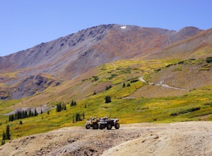
ATV Leavenworth Creek Road (Guanella Pass)
16.6 mi / 3655 ft gainSeptember is famous in Colorado for clear, deep blue skies,sublimely perfect temperatures, and gold-digging – of the leaf variety, thatis. On September 9, wildflower season was recently past and the best of theleaves were yet to come, but it was the perfect, clear and sunny day to checkout the hi...Read more -
Walden, Colorado
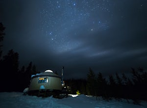
Snowshoe or Ski to Lower Montgomery Pass Yurt
5.6 mi / 853 ft gainThe Lower Montgomery Pass Yurt is a part of the Never Summer Nordic yurt system and can be reserved through their website here. In the summer it can be accessed via a 4WD road but in the winter the road closes and you can either ski, snowshoe, or snowmobile the 2.8 miles to the yurt. The trek beg...Read more -
Estes Park, Colorado
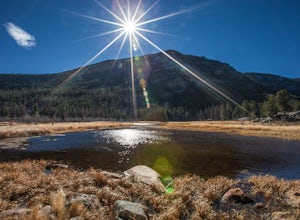
Hike to Cub Lake
5.04.6 mi / 645 ft gainRocky Mountain National Park showcases 355 miles of hiking trails, 6 campgrounds, and hundreds of backcountry camp sites. The cost to enter the park is $20.00 per vehicle, I recommend buying the annual National Parks Pass for $80.00. Cub Lake is an excellent trail for viewing wildlife. There ar...Read more -
Bellvue, Colorado
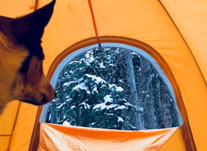
Winter camp at Zimmerman Lake
2.7 mi / 518 ft gainThis is a fairly popular snowshoeing and cross country skiing trail in the winter and offers a variety of additional trail options from the lake. Starting at the parking lot, the trailhead is easily accessed and begins the very gradual assent to Lake Zimmerman. Once at the lake, there are beautif...Read more -
Estes Park, Colorado
Hike Deer Mountain
6.03 mi / 1200 ft gainBeginning in Rocky Mountain National Park near the Deer Ridge Junction (where US 34 & US 36 meet), park your car in one of the 20 spots on either side of the road. Start at the trailhead booth and head north, keeping to the right-side trail at the first intersection about a tenth of a mile fr...Read more -
Frisco, Colorado
Backpack to the Gore Range's Wheeler and Lost Lakes
4.510 mi / 2200 ft gainThe range offers many remote lakes and peaks which hikers can access from various points of entry. Wheeler and Lost Lakes lie within the boundaries of the Eagle's Nest Wilderness Area.The Gore Trail begins on the north side of the CO-91 pedestrian bridge over I-70. You will follow the trail up al...Read more -
Frisco, Colorado
Ski to Janet's Cabin
6 mi / 1900 ft gainJanet's Cabin is located on the eastern slope of the Continental Divide at 11,610 ft, near Copper Mountain ski resort. This hut is one of the rare huts with not only a sauna but indoor bathrooms (composting pits)! The cabin was built in 1990 and due to the location helicopters were required to b...Read more -
Frisco, Colorado
Backpack the Colorado Trail: Copper Mountain to Hagerman Pass
39 miThe Colorado Trail (CT) runs for 483 miles from Denver to Durango, crossing through eight mountain ranges and passing through six wilderness areas. There are great resources on completing a thru-hike of the CT; this post is about Segments 8-9 of the CT from Copper Mountain to Tennessee Pass.These...Read more -
Ward, Colorado
Hike the Ceran St. Vrain Trail
5.04 mi / 1207 ft gainThe Ceran St. Vrain trail north of Jamestown offers the hiker a nice respite from the summer sun as this path runs through dense pine forests. The trail follows the South St. Vrain Creek for most of the way and follows moderate grades throughout. There is no official end to the trail, only that i...Read more -
Dillon, Colorado
Silver Dollar Lake Trail
5.03.93 mi / 945 ft gainGuanella Pass, which connects the charming and historic town of Georgetown in the north to the blink-and-you’ll-miss-it Grant to the south, is a recreational outdoorsman’s dream. Volumes could be written on what this 22-mile scenic byway has to offer. Silver Dollar Lake Trail is just one tiny po...Read more -
Minturn, Colorado
Scramble the Halo Ridge on Mt. Holy Cross
5.015 mi / 5210 ft gainThe Halo Ridge is by no means the easiest route to the summit of Mt. Holy Cross, but it is definitely the most interesting and scenic. You'll begin at the Half Moon (Tigiwon) trailhead, but instead of the popular Halfmoon Trail, you will start on the Fall Creek Trail as it leaves the campground.T...Read more -
Idaho Springs, Colorado
Lower and Upper Chicago Lake
4.59.22 mi / 2270 ft gainFrom the parking lot, stay to the right of Echo Lake and you will run into the Chicago Lakes Trailhead. Follow the switchbacks down and across Chicago Creek. After crossing the creek, follow the sign indicating that the trail follows the dirt road and hang a left; from here, you'll reach the Idah...Read more -
Evergreen, Colorado
Hike the Resthouse/Lincoln Lake Trail
4.5While the Mt. Evans Wilderness never has a shortage of visitors, thanks to its proximity to Denver, it is possible to find a more private hike if you know where to look. Lincoln Lake Trail, accessible from Echo Lake year-round, is not as glamorous as its sister trail, Chicago Lakes, but is a wond...Read more -
Breckenridge, Colorado
Ski or Snowshoe to Section House Hut
5.06.25 mi / 1200 ft gainThere are a couple routes to Section Hut on Boreas Pass, but the best adds trekking through the forest on Baker's Tank trail. Starting at 10,350' at the TH, look for a trail in the woods that starts climbing relatively quickly. Follow this for about 2.5 miles to the junction with the road and B...Read more -
Red Cliff, Colorado
Ski to Fowler-Hilliard Hut
6.5 mi / 2500 ft gainFowler-Hilliard hut sits at 11,500 ft on a forested ridge of Resolution Mountain, with easy access to intermediate and expert backcountry skiing right out the door. This newer hut was built in 2010 after the original hut burned down from a lightning strike. The hut comes stocked with padded mattr...Read more -
Lyons, Colorado
Camp at Coulson Gulch
4.09 miCoulson Gulch is a lightly used area of the Roosevelt National Forest which makes it perfect for a weekend getaway without the crowds. This is a great place to camp out under the stars!To get to Coulson Gulch From Lyons, head west on U.S. Highway 36 for about 9 miles. Turn southwest onto Larimer ...Read more

