Morrison, Colorado
Looking for the best backpacking in Morrison? We've got you covered with the top trails, trips, hiking, backpacking, camping and more around Morrison. The detailed guides, photos, and reviews are all submitted by the Outbound community.
Top Backpacking Spots in and near Morrison
-
Allenspark, Colorado
Sandbeach Lake Trail
4.08.56 mi / 2057 ft gainSandbeach Lake is best known for (as you can probably guess) its wide sandy shore. At nearly 50 feet deep, it is one of Rocky Mountain National Parks deepest lakes. If you are looking to fish at the lake, make sure to bring barbless flies and lures. There are six official campsites (1.8 miles Hol...Read more -
Allenspark, Colorado
Backpack to Bluebird Lake
4.314 mi / 2500 ft gainStarting at the Wild Basin trailhead on the south side of Rocky Mountain National Park, hike through a wet forest towards upper and lower Copeland Falls, located 0.45 miles from the trailhead. From here, continue on the main trail along the North Fork of the Saint Vrain River to Calypso Cascades,...Read more -
Allenspark, Colorado
Hike to Thunder Lake
12 mi / 2275 ft gainStarting at the often-busy Wild Basin TH, the trail passes through dense forests as it follows the North Fork of the Saint Vrain River through the southernmost section of Rocky Mountain National Park. The trail passes alongside the small Copeland Falls before continuing west towards Calypso Casca...Read more -
Allenspark, Colorado
Ouzel & Ogallala Peaks
17.18 mi / 4403 ft gainBegin at the Wild Basin Trailhead in southeastern Rocky Mountain National Park near the town of Allenspark. Plan to start before sunrise if attempting this trek as a day trip in order to avoid afternoon thunderstorms above the treeline. This trip can easily be made into a backpacking experience b...Read more -
Granby, Colorado
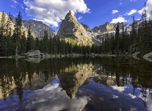
Mirror and Crater Lakes via Cascade Creek Trail
4.614.94 mi / 2421 ft gainStart at the Monarch Lake trailhead (where there is a $5 parking fee unless you have one of the national lands passes) and follow the cascade creek trail around the north side of the lake. After about 1.5 miles the trail splits with the Arapaho pass trail, follow the cascade trail to the left as ...Read more -
Breckenridge, Colorado
Camp at Boreas Pass
9 mi / 1500 ft gainBoreas pass is a high mountain pass in the Rocky Mountains that sits on the Continental Divide at 11,481'. Forest Service Road 33 goes over the pass and has numerous campsites all along its length, with several near the summit that feature breathtaking views of the Tenmile Range and the Breckenri...Read more -
Breckenridge, Colorado
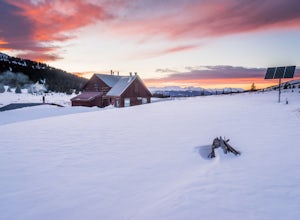
Ski or Snowshoe to Section House Hut
5.06.25 mi / 1200 ft gainThere are a couple routes to Section Hut on Boreas Pass, but the best adds trekking through the forest on Baker's Tank trail. Starting at 10,350' at the TH, look for a trail in the woods that starts climbing relatively quickly. Follow this for about 2.5 miles to the junction with the road and B...Read more -
1398 Longs Peak Road, Colorado
Storm Peak and Mount Lady Washington
4.512.57 mi / 5312 ft gainThis adventure began at the Longs Peak trailhead in southeastern Rocky Mountain National Park, Colorado. I followed the Longs Peak trail for 6 miles to the Boulderfield backcountry camping area. This is a fairly steep on-trail climb of 3,360 feet. After setting up camp at 12,760 feet, my partner...Read more -
Estes Park, Colorado
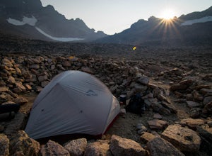
Boulderfield Campground via Longs Peak Trail
11.39 mi / 3337 ft gainBoulder Field is a high alpine backcountry site on Longs Peak, and is a popular camp for backpackers attempting to summit Longs Peak via the Keyhole route. At an impressive elevation of 12,760 feet, Boulder Field is a vast wasteland of rocks that sits 500 feet below the famous Keyhole feature, an...Read more -
Breckenridge, Colorado
Backpack & Fish The Mohawk Lakes
4.06.8 mi / 1940 ft gainThe trailhead is located a few miles out side of Breckenridge Colorado. The trail starts at 10,390' and the first two miles are spent walking through a mix of fir, aspen, and spruce trees until the trail goes parallel to Spruce Creek Road and eventually crosses it and continues over a small dam (...Read more -
Breckenridge, Colorado
Lower Crystal Lake via Crystal Creek Road
5.04.52 mi / 1624 ft gainTo get to the Crystal Lakes start at the Spruce Creek Trailhead. You can hike or drive to the Lower Crystal Lake along Crystal Creek Road. If you choose to drive, you will need a high clearance 4x4 vehicle as you follow along Crystal Creek Road. The road is steep, but when they get to the top it ...Read more -
Breckenridge, Colorado
Hike to & Stay at Francie's Cabin
5.01.09 mi / 1000 ft gainLocated at 11,360' and owned by the 10th Mountain Division Hut Association, Francies Cabin was built in memory of Frances Lockwood Bailey in 1994 and is located just a short distance (5 mile drive, 1.05 mile hike) from town of Breckenridge, Colorado. It has a summer and winter capacity of 20 peop...Read more -
Silverthorne, Colorado
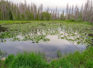
Lily Pad Lake
4.73.27 mi / 531 ft gainLily Pad Lake is a well known destination just outside of Silverthorne and in the Eagle's Nest Wilderness. The trail may be heavily trafficked on the weekends, but solitude can still be found in the early mornings or during the weekdays. The trail starts at the Lily Pad Lake Trailhead, just to t...Read more

