Littleton, Colorado
Looking for the best hiking in Littleton? We've got you covered with the top trails, trips, hiking, backpacking, camping and more around Littleton. The detailed guides, photos, and reviews are all submitted by the Outbound community.
Top Hiking Spots in and near Littleton
-
Golden, Colorado
Hike the North Table Mountain Loop
3.1 mi / 400 ft gainThe hike starts out from the North Table Mountain Park parking lot just east of Highway 93 on the North Table Loop Trail, with a half-mile fire road straight up the mountain. This fire road is by far the most strenuous part of the hike, and is essentially the sole elevation gain for the hike; onc...Read more -
Golden, Colorado
Hike Mount Galbraith
5.05.8 mi / 1247 ft gainStarting at roughly 6,000 ft. this hike will take you to the Mount Galbraith Loop Trail that circles the summit of the Mountain which peaks at 7,247 ft. Getting there is very simple, from State Highway 93, take Golden Gate Canyon Road west approximately 1.5 miles to the parking area and trailhea...Read more -
Evergreen, Colorado
Three Sisters
4.31.45 mi / 377 ft gainThe short 1.2 mile long trail, is a family-friendly, dog-friendly trail near Evergreen. The parking lot is incredibly easy to find and there is great signage to make sure you're going the right way. From the parking lot you can follow the Three Sisters trail signs until you reach the beginning of...Read more -
Evergreen, Colorado
Boulder The Eggs on the Hidden Fawn Trail
1.3 mi / 171 ft gainLooking for a place near Denver to perfect your bouldering skills? Or are you wanting to get the whole family out, but not looking for an extreme/technical hike? Which ever question best describes you, Alderfer/Three Sisters Park is the perfect place to go.This Jefferson County Open Space Park ha...Read more -
Evergreen, Colorado
Evergreen Mountain Loop
4.75.89 mi / 0 ft gainThe way up Evergreen Mountain is actually a few different trails stitched together throughout Alderfer/Three Sisters Park. The trail connects to both parking lots in the park, so if one is full you can just start from the other one, giving you lots of options for a quick day-hike. If you start ...Read more -
Evergreen, Colorado
Maxwell Falls
3.43.95 mi / 928 ft gainLocated just outside of Evergreen, this beginner hike is a great escape from the city for a few hours. There are three different options to hike to the falls: Maxwell Falls Lower Trail (4 miles), Upper Maxwell Falls Trail (1.1 miles), and Maxwell Falls Bluffs Cliffside Trail Loop (5 miles). On th...Read more -
Castle Rock, Colorado
Run the Challenge Hill
5.00.6 mi / 200 ft gainThe Basics: The Challenge Hill, or as I like to call it, the Mini-Incline, is a shrunken version of its big brother to the south in Manitou. However, don't let its relatively small 200 stair count fool you - this hill is a serious workout! Located in Philip S. Miller Park, just one minute off I-2...Read more -
Evergreen, Colorado
Hike the South Loop at Elk Meadow Park
3.04.4 miElk Meadow Park near Evergreen, CO spans 1,140 acres of open meadow and pine forests and has over 16 miles of managed trails by Jeffco Open Space. This park will give the visitor a diverse taste of ecosystems and terrain and is perfect for trail runners, families, or those seeking a quick excursi...Read more -
Conifer, Colorado
Upper Maxwell Falls Trail
1.11 mi / 135 ft gainUpper Maxwell Falls Trail is an out-and-back trail, which is the shortest and most direct route to Maxwell Falls located near Conifer, Colorado. If you're looking for a little longer trail, check out this Maxwell Falls adventure for a roughly 4-mile loop hike.Read more -
Golden, Colorado
Hike the Sawmill to Maverick Loop
4.32 mi / 450 ft gainFor this adventure, you'll be completing the Sawmill to Maverick loop. It is a short, but gentle trail that will take you through open meadows, to pine forests, and great views of Denver and Golden.Starting from the west parking area, cross the road and hit the Sawmill Trail. This trail starts ou...Read more -
Conifer, Colorado
Davis Ponds Trail
4.02.31 mi / 295 ft gainDavis Ponds Trail is a loop trail that takes you by a lake located near Conifer, Colorado.Read more -
Conifer, Colorado
Elk Falls Loop
3.512.76 mi / 1893 ft gainBegin on Staunton Ranch Trail for 3.3 miles. Switch to Bugling Elk Trail for the next 1.1 miles, then to Lion's Back Trail for the last mile to the overlook. From here, you can create the loop by backtracking to the Chimney Rock Trail, which then connects with the Elk Falls Trail. To head back to...Read more -
Golden, Colorado
Hike the Elk Range Trail
2.5This is an incredible and beautiful hike that is just off of Route 6 but feels a million miles away. Drive up Douglas Mountain Road for the west park access (and I do mean UP - it's a quick elevation gain), and you'll run right into the Centennial Cone Park entrance. There is a bathroom and a dec...Read more -
Franktown, Colorado
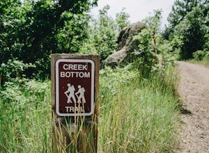
Hike the Creek Bottom Trail
5.04.1 miThe West Side of Castlewood Canyon is the more "rugged" side of the park, it has a dirt road, gravel parking lots, and only vault toilets. Luckily, this also means this is a less popular side of the park, making for less crowded trails and easier parking! Park at the first trailhead, for the Hom...Read more -
Franktown, Colorado
Hike the Rim Rock Trail
4.98 miThe West Side of Castlewood Canyon is the more "rugged" side of the park, it has a dirt road, gravel parking lots, and only vault toilets. Luckily, this also means this is a less popular side of the park, making for less crowded trails and easier parking! Park at the first trailhead, for the Hom...Read more -
Franktown, Colorado
Hike the Rim Rock / Creek Bottom Trail Loop
5.04.54 miThe West Side of Castlewood Canyon is the more "rugged" side of the park, it has a dirt road, gravel parking lots, and only vault toilets. Luckily, this also means this is a less popular side of the park, making for less crowded trails and easier parking! Park at the first trailhead, for the Hom...Read more

