Jefferson, Colorado
Looking for the best fitness in Jefferson? We've got you covered with the top trails, trips, hiking, backpacking, camping and more around Jefferson. The detailed guides, photos, and reviews are all submitted by the Outbound community.
Top Fitness Spots in and near Jefferson
-
Golden, Colorado
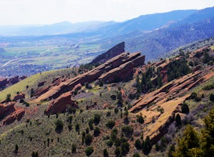
Matthews/Winters Park Loop
4.04.99 mi / 827 ft gainMatthews/Winters Park, which is part of the Jefferson County Open Space system, is proof that you do not have to go far from the city to enjoy the mountains. Nestled in the foothills between Golden and Morrison just off I-70 and C-470, Matthews/Winters is easy to access from Denver and any of the...Read more -
Littleton, Colorado
Hike to Carpenter Peak
4.56.2 mi / 1171 ft gainCarpenter Peak stands at 7,166 feet above sea level. While that altitude might not exactly take your breath away, the views from the top certainly will. Starting at the Visitor's Center, the trail to Carpenter's Peak begins as a relatively flat, well-traveled trail. A little less than a mile into...Read more -
Leadville, Colorado
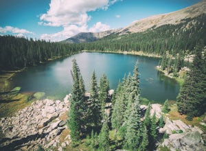
Savage Lakes Trail
5.03.97 mi / 1299 ft gainThe majority of this hike traverses through the beautiful forest that is part of the Holy Cross Wilderness. No significant views are to be had until you've climbed 1,300 ft over 2. miles and reach lower Savage Lake. The trail is easy enough to follow with no junctions along the way, and is adjace...Read more -
Golden, Colorado
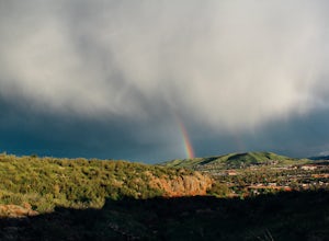
Hike South Table Mountain
4.03.3 mi / 1500 ft gainWant to see a rainbow? Possibly some coyotes or other Colorado wildlife?This hike is full of twists and turns, mostly involving the trail, but also in surprises along the way.Drive into downtown Golden (grab some food if you're hungry) and then park at the base of the Golden Summit trail. Startin...Read more -
Nederland, Colorado
Hike to the Lost Lakes via the Hessie Trail
4 mi / 1000 ft gainAccessed by Hessie Trailhead, Lost Lake is a relatively moderate 4 mile round-trip hike with about 1,000 feet of elevation. The core of the hike is uphill and on a gravel path, 2/3rds of the hike runs parallel to a rushing waterfall. After parking your car, head towards the Hessie Trailhead. Yo...Read more -
Nederland, Colorado
Snowshoe Lost Lake
5.02.7 mi / 791 ft gainDriving through the towns of Nederlands and Eldora alone is a beautiful experience. Once you come up to Hessie Trailhead, you'll already be in a daze because you'll be staring at Eldora Mountain and will see some ski runs in the distance.Getting to the trailhead early is best. Parking starts alon...Read more -
Buena Vista, Colorado
Summit La Plata Peak
5.09.25 mi / 4500 ft gainThe Northwest Ridge is the most easily accessible and popular route, and for good reasons. The trailhead is on the side of Hwy 82, otherwise known as Independence Pass, about 14.5 miles from the Hwy 24 junction, or about 10 miles from Twin Lakes to the east. The trailhead is hard to miss, and you...Read more -
Independence, Ohio
Hike Mountain Boy Ridge from the Top of Independence Pass
5.06 miThe trailhead is to the Independence Pass viewing deck is located at the Summit parking area, which is about 20 miles from Aspen and 24 miles west of Highway 24 on the Leadville side. At the parking area you will notice a paved walkway that takes you to the viewdeck, which is a easy five minute w...Read more -
Meredith, Colorado
Hike to Chapman Lake
1.6 miFrom downtown Basalt, drive up the Fryingpan River Road 28 miles and turn right on CR #504, also known as Elliot Way, just before Norrie Colony. Drive across the river and up the switchbacks for approximately 3 miles. Take the left fork, continue 1 mile and take the right fork approximately 1/2 m...Read more -
Basalt, Colorado
Hike to Eagle Lake, Colorado
5.05.5 mi / 1036 ft gainIf you find yourself back in the Lime Creek area just outside of Eagle, Colorado and south of Sylvan Lake State Park - you should make the time to get yourself up to Eagle Lake! The hike starts off of Brush Creek Road and follows a property line in the forest of Aspens and towering wildflowers fo...Read more -
Buena Vista, Colorado
Hike Huron Peak
5.06.5 miIf you have a 4WD vehicle, drive 2 miles from Winfield along a dirt road to the trailhead. If you don't have a suitable vehicle, you can park before the road gets rough and hike the rest of the road to the trailhead.Starting at 10560 feet of elevation, this 6.5 mile roundtrip hike begins its 3500...Read more -
Nederland, Colorado
Hike to Columbine Lake
5.07 mi / 1200 ft gainThe hike is about seven miles, give or take, however it feels longer. The elevation gain is little over 1000 feet. The drive here is about 45 minutes from both Granby and Winter Park, and is definitely worth it. You follow a trail dusted with wildflowers for the majority of the hike, and occasio...Read more -
Boulder, Colorado
Hike or Bike the Walker Ranch Loop
4.77.7 mi / 1740 ft gainWhen it comes to hiking trails in Boulder, the standard response usually consists of either Chautauqua Park or Mt. Sanitas, and while both offer excellent hiking options, they are both usually jam packed on the weekends. If you’re looking to stay close to the city, but want a little more seclusio...Read more -
Boulder, Colorado
Hike Bear Peak
4.87 mi / 2810 ft gainThe best advice I can give you? Wake up early to start this hike.Even though the Bear Peak hike will only take you about 4-5 hours round trip, it will still be advantageous to get off the mountain before afternoon and evening storms might pass through. This is a steep 7-mile out and back trail.St...Read more -
Boulder, Colorado
Hike South Boulder Peak
4.56.7 mi / 2900 ft gainStarting at the Mesa trailhead, continue a half a mile through a relatively even grade before arriving at the North Fork Shanahan trailhead, which will take you another half a mile on much steeper grade up to Fern Canyon where you will start a much harder portion of the hike; here, you'll head st...Read more -
Boulder, Colorado
Hike the Big Bluestem Trail Loop
4.04.35 mi / 841 ft gainThis is a great spot for an easy/moderate hike or trail run. The trail is accessible year round and can often be hiked in winter as well as other seasons. You start out at the Mesa Trailhead parking lot off of Hwy 170. There is a parking lot here but this is a starting spot for several hikes into...Read more

