Gypsum, Colorado
Looking for the best backpacking in Gypsum? We've got you covered with the top trails, trips, hiking, backpacking, camping and more around Gypsum. The detailed guides, photos, and reviews are all submitted by the Outbound community.
Top Backpacking Spots in and near Gypsum
-
Pitkin County, Colorado
Four Pass Loop in the Maroon Bells
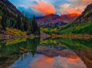
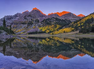
4.825.99 mi / 7566 ft gainUpdates will be posted here. The Four Pass Loop begins at Maroon Lake, famous for its iconic view of the Maroon Bells (Maroon Peak and North Maroon Peak), deemed the “most-photographed spot in Colorado.” After taking in this majestic view, continue to walk down the Maroon Lake Scenic Trail unti...Read more -
Aspen, Colorado
Snowmass Lake via Maroon-Snowmass Trail
4.316.53 mi / 5023 ft gainFor the adventurous backpacker looking to get backcountry in central Colorado, the stunning beauty of the Maroon Bells-Snowmass Wilderness cannot be beaten. While the Maroon Bells just outside of Aspen might be the most photographed mountains in North America, the beauty is definitely rivaled by ...Read more -
Aspen, Colorado
Explore the Maroon Bells & Snowmass Wilderness
5.0The beautiful and iconic Maroon Bells-Snowmass wilderness is home to some of the most amazing scenery and adventures to be had in all of Colorado. It is world-famous for the Maroon Bells, two challenging 14ers just outside of Aspen, Colorado. The third 14er, Pyramid Peak is also considered a clas...Read more -
Aspen, Colorado
Relax at Maroon Lake
4.9The Maroon Bells are known around the world for being some of the most iconic, beautiful mountains in all of the United States. Even if you haven't heard of them, there's a chance you've seen them. And if you've seen them in person, it's likely you were there with 800+ of your closest friends.If ...Read more -
Aspen, Colorado
Backpack to Snowmass Creek in the Maroon Bells-Snowmass Wilderness
13 miFor beginner backpackers or just those who can't take off 3-4 days to do the Four Pass Loop, there's still options near the iconic Maroon Bells. If you are planning to do an overnight at the Bells, you need to get there early or late - before 7:30 am or after 5 pm. The overnight lot fills quickl...Read more -
Aspen, Colorado
The Maroon Bells Traverse
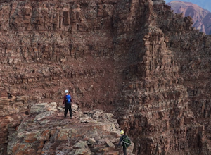
14 mi / 5000 ft gainI do not want to encourage those who are not capable mentally or physically to go on this hike, that is how accidents happen. Confidence is a must. This route is loose, long, chossy and complicated. The exposure and shear milage covered make for a heck of a day! That being said, I suggest you do ...Read more -
Aspen, Colorado
Crater Lake via Maroon-Snowmass Trail
4.63.77 mi / 722 ft gainThe crater lake trail begins at Maroon Lake and quickly breaks off from the scenic trail at .3 miles. Be sure to follow the signs to crater lake, which will be heading higher into the valley. The trail passes through a beautiful Aspen grove most of the way with wonderful views of 14ers, the Maroo...Read more -
Carbondale, Colorado
Backpack the Lead King Basin Trail
4.5 mi / 2000 ft gainWe began our hike at the beginning of the afternoon after about two-three hours driving up the 14 mile road. The first mile of the trail was mild, turning into an uphill adventure. Lots of switchbacks, winding paths, and some tree coverage. By mile 2, we were on a steep grade the rest of the way....Read more -
Aspen, Colorado
Hike Lost Man Loop
5.08.8 mi / 1290 ft gainThis 8.8 mile "loop" is not a true loop and the trail ends 4 miles apart along Independence Pass, so a car shuttle is recommended. I would recommend starting at the west trailhead (closer to Aspen) but will describe both trailheads so you can set up another car or shuttle at the other one.1) West...Read more -
Silverthorne, Colorado
Backpack to Upper Slate Lake
5.028 mi / 1386 ft gainStarting from the Rock Creek Trailhead parking lot, it is an up and down trek to Upper Slate Lake. The trail map states 10 miles each way, but accounting for switchbacks it ends up being closer to 14 long, hard miles.You will be among aspens and pines for the first half as you have a few moderate...Read more -
Leadville, Colorado
Ski Hut-to-Hut from Uncle Bud's to Skinner Hut
5.024.5 mi / 4700 ft gainThe trek starts just outside of Leadville near Turquoise Lake at 9800 ft. The first day you'll travel 6.5 miles and gain 1700 ft. to Uncle Bud's Hut, which sits around 11,400 ft. The second day you'll ski 7.1 miles to Skinner Hut and gain 2100 ft, mostly in the last 3 miles after having dropped...Read more -
Aspen, Colorado
Backpack Cathedral Lake
4.75.6 mi / 2000 ft gainCathedral Lake offers an excellent alternative to escape the crowds that swarm the Maroon Bells area, especially in the peak autumn season. The drive along Castle Creek Rd towards the abandoned ski town Ashcroft is lined with aspens showing off their golden hues. Parking at the trailhead is plent...Read more -
Independence, Ohio
Hike Lost Man Pass via Independence Lake
5.04.5 mi / 1200 ft gainPark at the pull out just west of independence pass. From there, begin on the Linkin's Lake Trail. The trail is generally easy to follow (although it can be muddy as it is a wet area) and climbs 900 feet in the 1.8 miles to independence lake. From Independence lake it is about 0.5 miles and 400 f...Read more -
Frisco, Colorado
Backpack the Colorado Trail: Copper Mountain to Hagerman Pass
39 miThe Colorado Trail (CT) runs for 483 miles from Denver to Durango, crossing through eight mountain ranges and passing through six wilderness areas. There are great resources on completing a thru-hike of the CT; this post is about Segments 8-9 of the CT from Copper Mountain to Tennessee Pass.These...Read more -
Leadville, Colorado
Overnight at the Emma and Marceline Yurts, Leadville
11 mi / 1200 ft gainDrive past the main downtown of Leadville and then head into the mountains south of town, following Mt. Sherman Road to the Yurt parking along a ridge before you come to the Black Cloud Mine. There are signs that say "Yurt Parking". Follow the road a little further down to a jeep road just before...Read more -
Frisco, Colorado
Backpack to the Gore Range's Wheeler and Lost Lakes
4.510 mi / 2200 ft gainThe range offers many remote lakes and peaks which hikers can access from various points of entry. Wheeler and Lost Lakes lie within the boundaries of the Eagle's Nest Wilderness Area.The Gore Trail begins on the north side of the CO-91 pedestrian bridge over I-70. You will follow the trail up al...Read more

