Evergreen, Colorado
Top Spots in and near Evergreen
-
Monument, Colorado
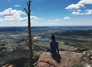
Mt. Herman & 715 Loop
4.06.16 mi / 1877 ft gainThe Basics: Mt. Herman is the most prominent peak overlooking Monument, CO and is easily spotted from I-25. The area between Monument and the mountain hosts a large network of meandering trails that are great for trail running and mountain biking. Our hike today starts at the uppermost parking lo...Read more -
Breckenridge, Colorado
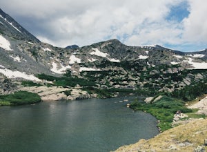
Hike McCullough Gulch to Upper Blue Reservoir
5.02.8 mi / 910 ft gainThe trail first takes you to Upper Blue Reservoir, about 1.4 miles in. Past this point, it can be somewhat tricky to find the trail, but for experienced hikers, the upper valley holds a number of lakes, a waterfall, and open tundra for exploring. Mountain goat sightings are also common in this ar...Read more -
Summit County, Colorado
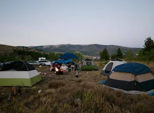
Camp at Blue River Campground
There are 24 sites at the Blue River Campground that have access to well maintained vault toilets, fire pits, and picnic tables. The campsites range in size, from single tent to multi-tent use (however no RV hookups).This campground is popular in the summer and can fill up every weekend, so I rec...Read more -
Breckenridge, Colorado
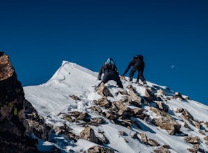
Winter Climb of North Star Mountain
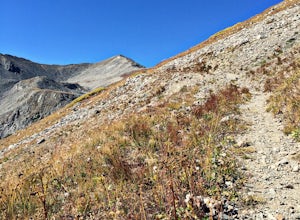
4.08 mi / 2400 ft gainFrom the west parking lot at the top of Hoosier Pass, take the 4x4 road as it climbs through a forest west of the pass. Before long, the trees thin and you'll stay on the road through treeline and reach a gate at just over 12,000 feet.Stay right at the gate and continue on this old mining road as...Read more -
Grand Lake, Colorado
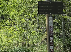
Doe Creek Trail
7.13 mi / 1617 ft gainDoe Creek Trail is a loop trail that takes you by a lake located near Granby, Colorado.Read more -
Summit County, Colorado
Hike to Crystal Peak
5.08.6 mi / 2482 ft gainOnce you turn off of Colorado hwy 9 onto dirt, your GPS will lead you to a gravel lot. At the end of that lot there's a pretty steep gravel road that heads NNW (GPS coords: 39°25'43.01"N 106° 4'11.30"W | Map Link if you want to plug that into your GPS for parking). From this lot you'll walk up t...Read more -
Frisco, Colorado
Ski to Janet's Cabin
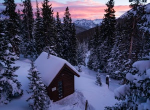
6 mi / 1900 ft gainJanet's Cabin is located on the eastern slope of the Continental Divide at 11,610 ft, near Copper Mountain ski resort. This hut is one of the rare huts with not only a sauna but indoor bathrooms (composting pits)! The cabin was built in 1990 and due to the location helicopters were required to b...Read more -
Frisco, Colorado
Backpack to the Gore Range's Wheeler and Lost Lakes
4.510 mi / 2200 ft gainThe range offers many remote lakes and peaks which hikers can access from various points of entry. Wheeler and Lost Lakes lie within the boundaries of the Eagle's Nest Wilderness Area.The Gore Trail begins on the north side of the CO-91 pedestrian bridge over I-70. You will follow the trail up al...Read more -
Woodland Park, Colorado
Lowell Gulch Upper and Lower Ridge Trail
4.04.45 mi / 719 ft gainLowell Gulch Upper and Lower Ridge Trail is a loop trail that takes you past scenic surroundings located near Woodland Park, Colorado.Read more -
Woodland Park, Colorado
Lovell Gulch Trail
5.22 mi / 814 ft gainLovell Gulch Trail is a loop trail that takes you by a river located near Woodland Park, Colorado.Read more -
Silverthorne, Colorado
Backpack to Upper Slate Lake
5.028 mi / 1386 ft gainStarting from the Rock Creek Trailhead parking lot, it is an up and down trek to Upper Slate Lake. The trail map states 10 miles each way, but accounting for switchbacks it ends up being closer to 14 long, hard miles.You will be among aspens and pines for the first half as you have a few moderate...Read more -
Frisco, Colorado
Backpack the Colorado Trail: Copper Mountain to Hagerman Pass
39 miThe Colorado Trail (CT) runs for 483 miles from Denver to Durango, crossing through eight mountain ranges and passing through six wilderness areas. There are great resources on completing a thru-hike of the CT; this post is about Segments 8-9 of the CT from Copper Mountain to Tennessee Pass.These...Read more -
1398 Longs Peak Road, Colorado
Storm Peak and Mount Lady Washington
4.512.57 mi / 5312 ft gainThis adventure began at the Longs Peak trailhead in southeastern Rocky Mountain National Park, Colorado. I followed the Longs Peak trail for 6 miles to the Boulderfield backcountry camping area. This is a fairly steep on-trail climb of 3,360 feet. After setting up camp at 12,760 feet, my partner...Read more -
Estes Park, Colorado
Longs Peak
5.013.3 mi / 5100 ft gainFor the most part, this hike is very straightforward, so I'll essentially skip over the first 5.5 or so miles of the hike, but, in case you don't know: Start (very early so you get a parking spot) from the trailhead right next to the parking lot (the road to it is paved - seriously this mountain...Read more -
Estes Park, Colorado
Peacock Pool
7.9 mi / 2438 ft gainThe peacock pool is a cool little tarn below the outlet to Chasm Lake. Please note that this adventure is best done in the winter/spring when snow is present to prevent erosion in the sensitive area. That is how the description will be written, assuming winter conditions. The approach is the sa...Read more -
Estes Park, Colorado
Boulderfield Campground via Longs Peak Trail
11.39 mi / 3337 ft gainBoulder Field is a high alpine backcountry site on Longs Peak, and is a popular camp for backpackers attempting to summit Longs Peak via the Keyhole route. At an impressive elevation of 12,760 feet, Boulder Field is a vast wasteland of rocks that sits 500 feet below the famous Keyhole feature, an...Read more

