Eldora, Colorado
Looking for the best photography in Eldora? We've got you covered with the top trails, trips, hiking, backpacking, camping and more around Eldora. The detailed guides, photos, and reviews are all submitted by the Outbound community.
Top Photography Spots in and near Eldora
-
Boulder, Colorado
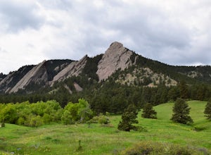
Hike the Chautauqua Trail to the Ski Jump Trail
5.01.55 miBeginning at the Chautauqua Trailhead, the Chautauqua Trail goes for 0.6 miles before connecting with the Bluebell-Baird Trail. From here it becomes a choose-your-own-adventure hike. For a short, simple hike you can do with people who aren't ready for lots of elevation gain, take a right and conn...Read more -
U.S. 40, Colorado
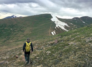
Parry Peak
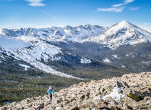
11.82 mi / 4209 ft gainThe trek to Parry Peak crosses three other peaks (Colorado Mines Peak, Mt. Flora, and Mt. Eva) along the Rocky Mountains. Begin your hike around sunrise as inclement weather often rolls in during the late afternoon. The trail is extremely rocky and steep. From the Berthoud Pass parking lot, fol...Read more -
Boulder, Colorado
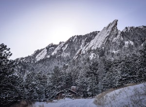
Hike the Enchanted Mesa Trail
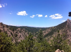
4.01.4 mi / 440 ft gainStart out on McClintock Trail for 0.7 miles (this particular stretch can get muddy), before switching over to Enchanted Mesa Trail. To add a scenic 0.4 miles to your hike, take the Quarry Loop by turning right at the stone cabin, then following the steps up to the quarry, where you can overlook t...Read more -
Boulder, Colorado
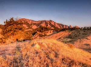
Catch a Boulder Sunrise from NCAR
A great place to watch the sunrise in Boulder is at NCAR, the National Center for Atmospheric Research. Park in the parking lot at the top of the hill, and if you're feeling up to it, you can walk south for about 10 minutes to an adjacent hill with beautiful views. Either way, you will want to ge...Read more -
Lyons, Colorado
Hike Meadow Mountain
4.07.7 mi / 2832 ft gainFrom the trailhead, follow the trail through the woods until you reach a meadow with a steep slope. Some portions of this slope reach an angle of 30 degrees and may feature slight avalanche danger in the winter. However, the trail is used enough that such conditions would make themselves known ...Read more -
Boulder, Colorado
Scramble Angel's Way
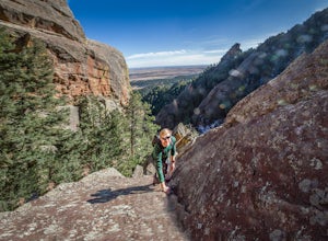
5 mi / 1000 ft gainAngel's Way is an amazing 8 pitch rock climb scramble (5.2) that is tucked away in Skunk Canyon, hidden from the crowds of Chautauqua. The best part of this scramble is you only need your climbing shoes and chalk-bag. It is similar to the 'Free Way' on the Second Flatiron. I would encourage ev...Read more -
Boulder, Colorado
Hike South Boulder Peak
4.56.7 mi / 2900 ft gainStarting at the Mesa trailhead, continue a half a mile through a relatively even grade before arriving at the North Fork Shanahan trailhead, which will take you another half a mile on much steeper grade up to Fern Canyon where you will start a much harder portion of the hike; here, you'll head st...Read more -
Boulder, Colorado
Hike Bear Peak
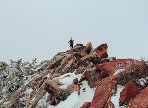
4.87 mi / 2810 ft gainThe best advice I can give you? Wake up early to start this hike.Even though the Bear Peak hike will only take you about 4-5 hours round trip, it will still be advantageous to get off the mountain before afternoon and evening storms might pass through. This is a steep 7-mile out and back trail.St...Read more -
Boulder, Colorado
Shanahan Ridge Trail
4.03.84 mi / 715 ft gainStarting on the edge of a neighborhood in South Boulder, this 3.8 mile loop begins its 869 foot elevation gain by meandering through a pine forest. You can 'choose your own adventure' by exploring the handful of trails that meet up with the Shanahan Ridge Trail, such as the South Mesa Trail, Shad...Read more -
Golden, Colorado
Hike the Elk Range Trail
2.5This is an incredible and beautiful hike that is just off of Route 6 but feels a million miles away. Drive up Douglas Mountain Road for the west park access (and I do mean UP - it's a quick elevation gain), and you'll run right into the Centennial Cone Park entrance. There is a bathroom and a dec...Read more -
Golden, Colorado
Hike the Sawmill to Maverick Loop
4.32 mi / 450 ft gainFor this adventure, you'll be completing the Sawmill to Maverick loop. It is a short, but gentle trail that will take you through open meadows, to pine forests, and great views of Denver and Golden.Starting from the west parking area, cross the road and hit the Sawmill Trail. This trail starts ou...Read more -
Boulder, Colorado
South Boulder Creek - Mesa Trail - Lower Big Bluestem Loop
4.04.46 mi / 453 ft gainThis 4 mile loop ascends only a slight amount in elevation, making for a pleasant loop in which opportunities for appreciation of the nature around you and broad vista photography are in plentiful supply. A great hike for those who may still be building their fitness, as so many trails in Boulder...Read more -
Allenspark, Colorado
Hike to Pear Lake
5.013 mi / 2112 ft gainPear lake is a beautiful alpine lake in the southern Wild Basin region of Rocky Mountain National Park. Once used as a reservoir, Pear Lake has been restored to its natural state and lies in scenic basin below some of the most isolated mountains in the park. The trail to Pear Lake passes through ...Read more -
Allenspark, Colorado
Hike to Finch Lake
3.08.96 miThere are several ways to reach finch lake but this will cover the route from the Finch Lake Trailhead in the wild basin area of Rocky Mountain National Park. You can also loop it with other trails in the area or begin at the Allenspark Trailhead, which is technically outside the park and a bit e...Read more -
Allenspark, Colorado
Backpack to Bluebird Lake
4.314 mi / 2500 ft gainStarting at the Wild Basin trailhead on the south side of Rocky Mountain National Park, hike through a wet forest towards upper and lower Copeland Falls, located 0.45 miles from the trailhead. From here, continue on the main trail along the North Fork of the Saint Vrain River to Calypso Cascades,...Read more -
Allenspark, Colorado
Hike to Thunder Lake
12 mi / 2275 ft gainStarting at the often-busy Wild Basin TH, the trail passes through dense forests as it follows the North Fork of the Saint Vrain River through the southernmost section of Rocky Mountain National Park. The trail passes alongside the small Copeland Falls before continuing west towards Calypso Casca...Read more

