Eldora, Colorado
Looking for the best chillin in Eldora? We've got you covered with the top trails, trips, hiking, backpacking, camping and more around Eldora. The detailed guides, photos, and reviews are all submitted by the Outbound community.
Top Chillin Spots in and near Eldora
-
Denver, Colorado
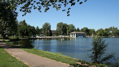
Washington Park Loop
2.34 mi / 72 ft gainWashington Park in located near Denver South High School is the perfect spot for a run, walk, or an afternoon picnic! This paved loop is just over 2 miles and offers up scenic views of both Grasmere Lake and Smith Lake. This is also a family-friendly destination with a playground for the kids and...Read more -
Silverthorne, Colorado
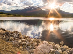
Hike to Old Dillon Reservoir
4.51.7 mi / 137 ft gainToday, Lake Dillon is one of the biggest attractions in the Dillon Valley, attracting boaters, anglers, and campers. However, the large reservoir we know today was not the first one in the area. The Old Dillon Reservoir was built in the 1930s to supply water to the original town of Dillon, which...Read more -
Silverthorne, Colorado
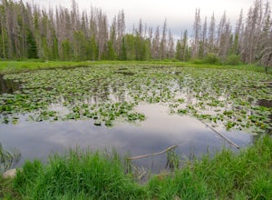
Lily Pad Lake
4.73.27 mi / 531 ft gainLily Pad Lake is a well known destination just outside of Silverthorne and in the Eagle's Nest Wilderness. The trail may be heavily trafficked on the weekends, but solitude can still be found in the early mornings or during the weekdays. The trail starts at the Lily Pad Lake Trailhead, just to t...Read more -
Frisco, Colorado
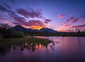
Sunset Shots at Lake Dillon
4.3To get to the southern end of the lake from Denver, head west on 70 until you reach 9. Take 9 for a few miles until you find the spot on the lake where you want to get started. On the south side of Lake Dillon, there was an abundance of old stumps lining the beach, which would occasionally drift ...Read more -
Loveland, Colorado
Hike the Valley Loop Trail in the Bobcat Ridge Natural Area
4.4 mi / 500 ft gainThe Valley Loop Trail in the Bobcat Ridge Natural Area begins at the main entrance of the Natural Area, just off W County Road 32 C near Masonville, west of Fort Collins and the Horsetooth Reservoir.To get there take West County Road 38 E west from Fort Collins over and around the Horsetooth Rese...Read more -
Loveland, Colorado
Hike the D.R. Trail in the Bobcat Ridge Natural Area
3.76.2 mi / 1050 ft gainD.R. Trail, named for David Rice Pulliam who donated the land to create the Bobcat Ridge Natural Area, is a 3.1 mile spur off the Valley Loop Trail that climbs roughly 1,000' into Mahoney Park before it intersects with the Powerline and Ginny Trails. To get to the start of the trail, take the Val...Read more -
Breckenridge, Colorado
Hike the Sawmill Trail to Fairy Forest
3.01.5 mi / 250 ft gainIf you brought the family to Breckenridge chances are you're probably not bringing the little ones on your next 14'er summit. Are you looking for an easy hike to let the kiddos experience some nature and run around a bit? Well then this short hike is perfect for you and the family. Plus, it's rig...Read more -
Walden, Colorado
Overnight at Nokhu Hut
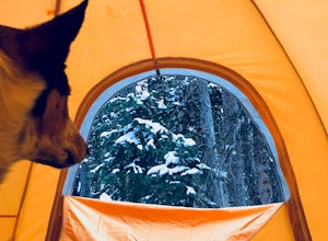
5.03 mi / 540 ft gainThe Nokhu Hut is part of the Never Summer Nordic Hut system, and makes for the perfect beginner Hut trip. The Hut has a stocked kitchen, wood shed, and small wood burning stove that keeps the tiny hut toasty warm.From the Hut, it is a short, easy hike to Lake Agnes - the trail often stays snowy u...Read more -
Breckenridge, Colorado
Camp at Boreas Pass
9 mi / 1500 ft gainBoreas pass is a high mountain pass in the Rocky Mountains that sits on the Continental Divide at 11,481'. Forest Service Road 33 goes over the pass and has numerous campsites all along its length, with several near the summit that feature breathtaking views of the Tenmile Range and the Breckenri...Read more -
Walden, Colorado
View Fall Color on Cameron Pass
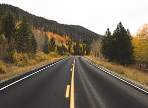
From the front range, drive west of Fort Collins, Colo. on Highway 14 towards Walden, Colo. When you enter Highway 14 from Fort Collins, look for Ted's Place. Ted's is a gas station and convenient store, stop here to hit the bathroom, fill up on gas, and grab some snacks. There will be very few f...Read more -
Fort Collins, Colorado
Hike the Coyote Ridge Trail
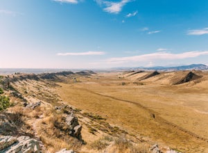
1.03 mi / 550 ft gainThe Coyote Ridge Natural Area is one of several Larimer County "gateway" preserves and Open Lands that lead into the Front Range of the Rocky Mountains, connecting the shrublands of the Great Plains to the Rocky Mountain themselves through a network of trails, parks, and preserves. The Coyote Rid...Read more -
Breckenridge, Colorado
Hike to & Stay at Francie's Cabin
5.01.09 mi / 1000 ft gainLocated at 11,360' and owned by the 10th Mountain Division Hut Association, Francies Cabin was built in memory of Frances Lockwood Bailey in 1994 and is located just a short distance (5 mile drive, 1.05 mile hike) from town of Breckenridge, Colorado. It has a summer and winter capacity of 20 peop...Read more -
Bellvue, Colorado
Winter camp at Zimmerman Lake
2.7 mi / 518 ft gainThis is a fairly popular snowshoeing and cross country skiing trail in the winter and offers a variety of additional trail options from the lake. Starting at the parking lot, the trailhead is easily accessed and begins the very gradual assent to Lake Zimmerman. Once at the lake, there are beautif...Read more -
Bellvue, Colorado
Hike to Comanche Lake in Pingree Park
3.58 mi / 700 ft gainYou start out hiking through the average Colorado forest for the first 4 miles of the 7-8 mile trip at about 6,500 feet. The trail is largely downhill for the first couple miles until it levels out and you are headed North. A little more than halfway, you come to Comanche Reservoir and hike up al...Read more -
Fort Collins, Colorado
Hike to Horsetooth Rock
4.55 mi / 1440 ft gainThe Horsetooth Mountain Park Open Space is located just 4 miles from Fort Collins. The 2,886 acre park offers 29 miles of hiking, biking, and horse back riding trails.Having taken both the multi use trail and the hiking only trail, I recommend the hiking only. This trail offers you the views and ...Read more -
Fort Collins, Colorado
Hike to Horsetooth Falls
4.52.22 mi / 101 ft gainHorsetooth Mountain Park is an outdoor trail haven just minutes from downtown Ft. Collins. The 2711 acre area has 29 miles of trails of varying length and difficulty for all levels of adventurers to explore. Horsetooth Falls is one of the shortest (yet stunning) trails in the area. This hike is i...Read more

