Eagle County, Colorado
Looking for the best backpacking in Eagle County? We've got you covered with the top trails, trips, hiking, backpacking, camping and more around Eagle County. The detailed guides, photos, and reviews are all submitted by the Outbound community.
Top Backpacking Spots in and near Eagle County
-
Snowmass, Colorado
Capitol Lake via Capitol Ditch
5.012.28 mi / 2575 ft gainThe route to Capitol Lake is fairly straightforward, but not without its minor hardships. The route begins at the end of Capitol Creek Road, 9 miles from the small "town" of Snowmass (NOT Snowmass Village - that's the high-class ski resort). The last few miles of this road provide the first min...Read more -
Aspen, Colorado
Backpack Cathedral Lake
4.75.6 mi / 2000 ft gainCathedral Lake offers an excellent alternative to escape the crowds that swarm the Maroon Bells area, especially in the peak autumn season. The drive along Castle Creek Rd towards the abandoned ski town Ashcroft is lined with aspens showing off their golden hues. Parking at the trailhead is plent...Read more -
Aspen, Colorado
Snowmass Lake via Maroon-Snowmass Trail
4.316.53 mi / 5023 ft gainFor the adventurous backpacker looking to get backcountry in central Colorado, the stunning beauty of the Maroon Bells-Snowmass Wilderness cannot be beaten. While the Maroon Bells just outside of Aspen might be the most photographed mountains in North America, the beauty is definitely rivaled by ...Read more -
Nederland, Colorado
Backpack to Caribou Lake
4.08.2 miThis is one of the most beautiful hikes I have ever done in Colorado. It is a great trip for photographers, fisherman or anyone who enjoys mountain views, forests filled with wildlife and peaceful meadows. Distances: Arapaho Pass: 3.2 miles, Caribou Lake: 4.2 miles, Caribou Pass: 6.4 miles, Meado...Read more -
Pitkin County, Colorado
Four Pass Loop in the Maroon Bells
4.825.99 mi / 7566 ft gainUpdates will be posted here. The Four Pass Loop begins at Maroon Lake, famous for its iconic view of the Maroon Bells (Maroon Peak and North Maroon Peak), deemed the “most-photographed spot in Colorado.” After taking in this majestic view, continue to walk down the Maroon Lake Scenic Trail unti...Read more -
Aspen, Colorado
Explore the Maroon Bells & Snowmass Wilderness
5.0The beautiful and iconic Maroon Bells-Snowmass wilderness is home to some of the most amazing scenery and adventures to be had in all of Colorado. It is world-famous for the Maroon Bells, two challenging 14ers just outside of Aspen, Colorado. The third 14er, Pyramid Peak is also considered a clas...Read more -
Aspen, Colorado
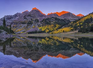
Relax at Maroon Lake
4.9The Maroon Bells are known around the world for being some of the most iconic, beautiful mountains in all of the United States. Even if you haven't heard of them, there's a chance you've seen them. And if you've seen them in person, it's likely you were there with 800+ of your closest friends.If ...Read more -
Aspen, Colorado
Backpack to Snowmass Creek in the Maroon Bells-Snowmass Wilderness
13 miFor beginner backpackers or just those who can't take off 3-4 days to do the Four Pass Loop, there's still options near the iconic Maroon Bells. If you are planning to do an overnight at the Bells, you need to get there early or late - before 7:30 am or after 5 pm. The overnight lot fills quickl...Read more -
Aspen, Colorado
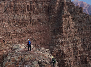
The Maroon Bells Traverse
14 mi / 5000 ft gainI do not want to encourage those who are not capable mentally or physically to go on this hike, that is how accidents happen. Confidence is a must. This route is loose, long, chossy and complicated. The exposure and shear milage covered make for a heck of a day! That being said, I suggest you do ...Read more -
Aspen, Colorado
Crater Lake via Maroon-Snowmass Trail
4.63.77 mi / 722 ft gainThe crater lake trail begins at Maroon Lake and quickly breaks off from the scenic trail at .3 miles. Be sure to follow the signs to crater lake, which will be heading higher into the valley. The trail passes through a beautiful Aspen grove most of the way with wonderful views of 14ers, the Maroo...Read more -
Granby, Colorado
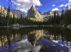
Mirror and Crater Lakes via Cascade Creek Trail
4.614.94 mi / 2421 ft gainStart at the Monarch Lake trailhead (where there is a $5 parking fee unless you have one of the national lands passes) and follow the cascade creek trail around the north side of the lake. After about 1.5 miles the trail splits with the Arapaho pass trail, follow the cascade trail to the left as ...Read more -
Nederland, Colorado
Hiking the Indian Peaks Wilderness' Lost Lake
4.34.5 mi / 1000 ft gainLost Lake of the Indian Peaks Wilderness area is a scenic short hike (about 3 hours) with a lot to see. The trailhead is tucked at the end of a road that passes through Eldora, a charming village of cabins and old abandoned buildings. You will pass by the lost "town" of Hessie on foot, which is w...Read more -
Nederland, Colorado
King Lake via Hessie Trailhead
5.011.32 mi / 2375 ft gainThe normal route from the east side is via the Hessie trailhead outside Nederland Colorado. From the west it is most often accessed via the short trail from Rollins pass, which is open in the summer. As noted above, it is also a lake and area ripe for creating your own adventure. The description ...Read more -
Nederland, Colorado
Hike to the Lost Lakes via the Hessie Trail
4 mi / 1000 ft gainAccessed by Hessie Trailhead, Lost Lake is a relatively moderate 4 mile round-trip hike with about 1,000 feet of elevation. The core of the hike is uphill and on a gravel path, 2/3rds of the hike runs parallel to a rushing waterfall. After parking your car, head towards the Hessie Trailhead. Yo...Read more -
Garfield County, United States
Hike the Devil's Causeway Loop
5.010.5 mi / 1550 ft gainCrossing the Devil's Causeway is a rite of passage for Colorado hikers. The dramatic exposure will terrify some and exhilarate others, but the loop offers much more than the short rocky expanse that's the draw for most people.The Approach: From the trailhead at Stillwater Reservoir, the East Fork...Read more -
Bailey, Colorado
Payne Creek Trail via Brookside McCurdy Trailhead
4.517.98 mi / 3773 ft gainDay 1: Park at the Payne Creek/Brookside Trailhead (8,040 ft.) right outside Bailey. You'll go on the trail for about a mile before the trail parts to Craig Meadows or Craig Park. If you start this in the nighttime, it's best to camp before you part ways on the trail as it's a little more spaciou...Read more

