Divide, Colorado
Top Spots in and near Divide
-
Cascade, Colorado
Photograph Rampart Range Road
4.720 miFrom the starting point near Balanced Rock in Garden of the Gods, Rampart Range Road turns to dirt and begins a steady climb into the foothills west of Colorado Springs. Though dirt, the road is well-graded and perfectly suitable for passenger cars in good weather. As the road climbs, you'll trav...Read more -
Colorado Springs, Colorado
Paddle Rampart Reservoir
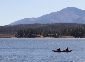
Rampart Reservoir is located off of Rampart Range Road and is boat accessible from Spring until Fall. It has a boat ramp for motorized as well as human powered boats. There are vault toilets nearby. It is a nice place to spend the day paddling at close to 9,000 ft elevation. Just be prepared for ...Read more -
Woodland Park, Colorado
Climb at Turkey Rocks
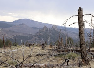
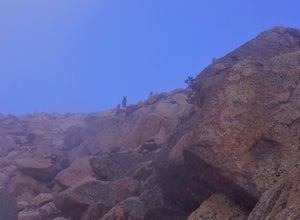
5.0Looking for a place to hone your crack climbing technique? Turkey Rocks is the place with some old school ethics and stiff grades. Turkey can be accessed from the town of Westcreek north of Woodland Park. From here, head west on Abbey Road and then south on West Creek Ave. About a mile down t...Read more -
Cascade, Colorado
Hike Barr Trail to Pikes Peak Summit
5.012 mi / 7400 ft gainBarr Trail is a 12 mile hike that travels the east face of Pikes Peak, from Manitou Springs (6700’) at the base, to the summit (14,115’). Because there are so many factors that can influence anyone’s experience of the trail (weather, fitness level, time of day, preparedness, etc.), and because ma...Read more -
Cascade, Colorado
Manitou Incline
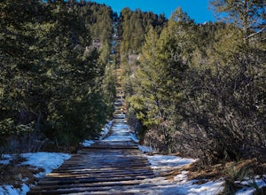
4.73.8 mi / 1949 ft gainIf you're ready for a fitness challenge like no other, look no further than the Manitou Incline. The trail climbs the remnants of an old cog railway bed, gaining 2000 feet of elevation in less than a mile. Busy all year round, the popular trail is used by everyone from Army Rangers and Olympic ho...Read more -
Manitou Springs, Colorado
Walk to Rainbow Falls
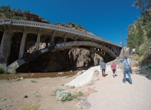
0.5 miThis waterfall was designated a historic site in 2016 due to its rich history dating back to the Native Americans and more recently the locals of Manitou Springs. The bridge itself that crosses over the falls was created in the early 20th century and was an architectural marvel during the time. ...Read more -
Manitou Springs, Colorado
Hike Red Mountain
2 mi / 750 ft gainThe hike can be started from where the Intemann trail meets Ruxton Ave close to Iron Spring. For parking, you can park at one of the few pay-for parking along the street or park in town and take the bus up to the incline. The hike starts up what seems to be a driveway until you reach a small gate...Read more -
Manitou Springs, Colorado
Manitou Springs' Mineral Springs
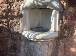
5.0Manitou Springs is home to eight mineral springs all fairly close to the main shopping strip of Manitou. The springs were originally utilized by the Native Americans. In the 19th century, they were utilized by visitors from all over the world due to their supposed health benefits. They all taste ...Read more -
Cripple Creek, Colorado
Drive Gold Camp Road
4.35 miGold Camp Road is a road that begins near Bear Creek Regional park. As you drive up the winding road, the road will turn to dirt. Continue driving down the dirt road, turn the corner and BAM, you're hit with some mountain views that will take your breath away. As you continue to drive Gold camp r...Read more -
Colorado Springs, Colorado
Hike Eagle's Peak (USAFA)
4.02.5 mi / 1100 ft gainThis is a short trail that goes very high in elevation. In about 1.25 miles you can go about 2000ish feet in elevation change. You need to wait till 9am to start the hike as it sits on the US Airforce Academy. It is definitely worth it. Bring shoes that can handle the rocky terrain.You take the f...Read more -
Colorado Springs, Colorado
Hike to Blodgett Peak
3.04.5 mi / 2325 ft gainGetting There Google Maps + "Blodgett Peak Open Space"= Easy Peasy. The parking lot only accommodates 11 cars with a one of those reserved for handicap. A port-a-potty is the only facility available at the trail head, so plan accordingly. The Hike Starting out at about 7,000 feet the first mile ...Read more -
Colorado Springs, Colorado
Siamese Twins Loop
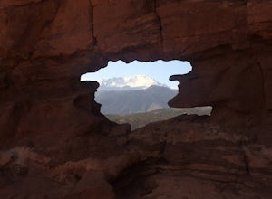
4.00.55 mi / 105 ft gainSiamese twins is about a half mile hike with little elevation gain that is a quick hike while driving the park. The hardest thing about this is getting a parking spot to tell you the truth. On a weekend or pretty much any summer day the five or so spots available at the trailhead are constantly...Read more -
Guffey, Colorado
Paradise Cove
4.5From Colorado Springs, follow RT 24 to the town of Florissant (34.5 miles). From Florissant, follow Teller County Road 1 south for about 9.2 miles, until a Y fork, and bear right, into County Road 11. Follow County Road 11 for 4.1 miles, until a T intersection, and make a right turn at the inters...Read more -
Colorado Springs, Colorado
Climb and Hike in the Garden of the Gods
4.7If you are new to the area a stop by the visitor center can helpful to get a map of the trails and roads in the area as well as obtaining a climbing permit (one is needed to climb and is free).Once you have entered the area there are multiple trails and pull outs that you can explore. Many of the...Read more -
Colorado Springs, Colorado
Scotsman Trail Loop
5.01.09 mi / 128 ft gainScotsman Trail Loop is a loop trail where you may see beautiful wildflowers located near Colorado Springs, Colorado.Read more -
Colorado Springs, Colorado
Hike the Upper Loop Trail
5.00.75 mi / 72 ft gainThis short spur trail is right off Perkins Central Garden Trail. Most people walk by it because the walkway changes from paved to dirt, but it is definitely a must-see if you're exploring the park. It climbs just a short amount before reaching the rocks you can climb on. Make sure you take a mome...Read more

