Denver, Colorado
Top Spots in and near Denver
-
Boulder, Colorado
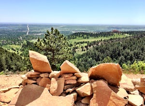
Woods Quarry via NCAR
4.23.28 mi / 755 ft gainYou can start from Chautauqua Park, but I prefer to start at NCAR, especially since there is ample parking and you can take a bathroom break inside before hitting the trail. From the intersection of Table Mesa Drive and Broadway in Boulder, drive west on Table Mesa to its end at the NCAR buildin...Read more -
Boulder, Colorado
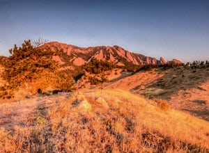
Catch a Boulder Sunrise from NCAR
A great place to watch the sunrise in Boulder is at NCAR, the National Center for Atmospheric Research. Park in the parking lot at the top of the hill, and if you're feeling up to it, you can walk south for about 10 minutes to an adjacent hill with beautiful views. Either way, you will want to ge...Read more -
Evergreen, Colorado
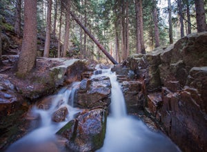
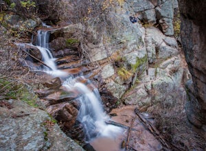
Maxwell Falls
3.43.95 mi / 928 ft gainLocated just outside of Evergreen, this beginner hike is a great escape from the city for a few hours. There are three different options to hike to the falls: Maxwell Falls Lower Trail (4 miles), Upper Maxwell Falls Trail (1.1 miles), and Maxwell Falls Bluffs Cliffside Trail Loop (5 miles). On th...Read more -
Littleton, Colorado
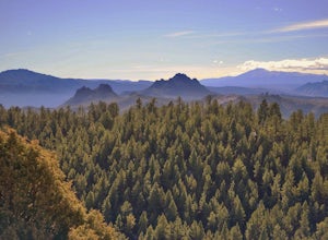
Hike the Eagle's View Trail
4.34.3 mi / 900 ft gainReynolds Park is part of the Jefferson County Open Space system. Located a few miles south of Conifer, off Hwy 285 on S. Foxton Road, it is a foothills park geared for families, groups, and the casual hiker. The network of trails on the west side of the road offers hikers and equestrians anything...Read more -
Evergreen, Colorado
Private and Tranquil Retreat at Beaver Brook Watershed
4.0Note: This is NOT the Beaver Brook Trail in Genesee Park/Lookout Mountain! If you enjoy the scenery and ambiance of Evergreen, but Evergreen Lake has become too crowded for your tastes, Beaver Brook Watershed (owned by the City of Golden) is an excellent alternative. It’s a small, secluded area a...Read more -
Boulder, Colorado
Hike the Enchanted Mesa Trail
4.01.4 mi / 440 ft gainStart out on McClintock Trail for 0.7 miles (this particular stretch can get muddy), before switching over to Enchanted Mesa Trail. To add a scenic 0.4 miles to your hike, take the Quarry Loop by turning right at the stone cabin, then following the steps up to the quarry, where you can overlook t...Read more -
Boulder, Colorado
Hike or Bike the Walker Ranch Loop
4.77.7 mi / 1740 ft gainWhen it comes to hiking trails in Boulder, the standard response usually consists of either Chautauqua Park or Mt. Sanitas, and while both offer excellent hiking options, they are both usually jam packed on the weekends. If you’re looking to stay close to the city, but want a little more seclusio...Read more -
Boulder, Colorado
Royal Arch Trail
4.43.32 mi / 1220 ft gainRoyal Arch Trail climbs up Boulder's famous Chautauqua Park to an archway formed by sandstone rocks that tower over thirty feet high. Start at the Chautauqua Trail Station by the Ranger Station, and continue up Bluebell Road for 0.7 miles. You will then arrive at a more forested area, where you ...Read more -
Boulder, Colorado
Hike to the 1st Flatiron
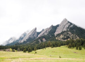
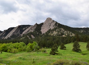
4.62.4 mi / 1422 ft gainStarting at the ever-popular and ever-populated Chautauqua Trailhead, take the main trail (a highway version of a dirt trail) straight towards the Flatirons. Continue going straight passed the Ski Jump trail to your right (0.2 mi.), then at a crossroads with the Bluebell-Baird trail (0.3 mi.) tur...Read more -
Boulder, Colorado
Green Mountain via Chautauqua Park
4.55.24 mi / 2467 ft gainStarting from the popular Chautauqua Park trailhead, head west on the main trail to the first branch off onto a smaller trail that will take you toward Baseline Road. Follow this trail until it eventually connects with Gregory Canyon Trailhead—you can park at this trailhead if you wish, but miss ...Read more -
Boulder, Colorado
Hike the Chautauqua Trail to the Ski Jump Trail
5.01.55 miBeginning at the Chautauqua Trailhead, the Chautauqua Trail goes for 0.6 miles before connecting with the Bluebell-Baird Trail. From here it becomes a choose-your-own-adventure hike. For a short, simple hike you can do with people who aren't ready for lots of elevation gain, take a right and conn...Read more -
Golden, Colorado
Hike Beaver Trail in Golden Gate Canyon State Park
2.3 mi / 1046 ft gainThis trail starts off at Slough Pond, a great fishing pond or picnic spot. The trail starts out tree-covered. After a few tenths of a mile you have the choice to go clockwise or counter-clockwise. If you go counter-clockwise you have about 3/4 of a mile of steep uphill hiking to do (the Park rate...Read more -
Conifer, Colorado
Upper Maxwell Falls Trail
1.11 mi / 135 ft gainUpper Maxwell Falls Trail is an out-and-back trail, which is the shortest and most direct route to Maxwell Falls located near Conifer, Colorado. If you're looking for a little longer trail, check out this Maxwell Falls adventure for a roughly 4-mile loop hike.Read more -
Boulder, Colorado
Green Mountain via Gregory Canyon and Ranger Trail
5.45 mi / 2313 ft gainGreen Mountain via Gregory Canyon and Ranger Trail is an out-and-back trail that provides a good opportunity to view wildlife located near Boulder, Colorado.Read more -
Boulder, Colorado
Hike the Saddle Rock Trail
5.02.6 mi / 1500 ft gainYou can either start the from the Gregory Canyon Trailhead or the main Chautauqua trail. At the Chautauqua trailhead you will need to pay for parking on Saturdays and Sundays and at the Gregory Canyon Trailhead you will need to pay for parking if your car is not registered in Boulder. If you sta...Read more -
Golden, Colorado
Hike the Blue Grouse Trail Loop
3.06 mi / 400 ft gainStart the hike at the Blue Grouse Trailhead located next to Kriley Pond. Travel along Blue Grouse Trail for 0.7 miles until you reach a fork in the trail at Mule Trail where you will take a right. Along the Mule Trail you will travel up a series of switch backs before the trail levels out and you...Read more

