Central City, Colorado
Looking for the best photography in Central City? We've got you covered with the top trails, trips, hiking, backpacking, camping and more around Central City. The detailed guides, photos, and reviews are all submitted by the Outbound community.
Top Photography Spots in and near Central City
-
Silver Plume, Colorado
Grays and Torreys Peaks
4.37.97 mi / 3458 ft gainAt about an hour's drive from Denver, Grays Peak (14,270 ft./4338m) and its sister mountain, Torreys Peak (14,267 ft./4337m), are two of the most popular 14ers in the state. Because of this, a wealth of information is available on the internet. Rather than go into all the details of the technical...Read more -
Silver Plume, Colorado
Torrey's Peak via Kelso Ridge
5.05.79 mi / 2982 ft gainThe start of this route up the Kelso Ridge is the same as doing the standard route of Gray's and Torrey's peaks. From the trailhead cross the large metal bridge and continue on the great trail as it slowly climbs away from the parking lot and trailhead. This first section is not steep, but prov...Read more -
Silver Plume, Colorado
Grays Peak Trail
4.57.25 mi / 2995 ft gainThe first challenge you'll face on your way to the summit of Gray's peak is Steven's Gulch Road. My Corolla rolled up to the start of what I’ve seen described as a “4x4 road that should probably not be attempted in a low clearance vehicle”. But what the heck, it was late, and I didn't feel like w...Read more -
Dillon, Colorado
Mount Bierstadt
4.67.18 mi / 2697 ft gainIf you’re ready for your first 14er, Mount Bierstadt holds a reputation for a great “starter” 14er. Of course, experienced climbers will enjoy this (relatively speaking) easy mountain as well. Besides the joy of the hike itself, Bierstadt is a stunning wildflower hike in July and August. Thanks t...Read more -
Idaho Springs, Colorado
Bierstadt, Evans, and The Sawtooth Loop
4.59.76 mi / 3438 ft gainStarting from the oddly poorly marked Guanella Pass Trailhead (Google maps directions to Guanella Campground and then drive about two miles past it to the south), the trail heads southeast toward Bierstadt, and much of your route to the first summit is visible from the parking lot. The trail to ...Read more -
Idaho Springs, Colorado
Watch the Sunrise at Guanella Pass
5.01 mi / 100 ft gainFrom Denver, take i70 to Georgetown and simply follow the signs through town to the top. This pass can also be accessed from the south via US Highway 285 at the town of Grant. Guanella Pass is closed in the winter, typically from about the last week in November through the last week of May. Watch...Read more -
Dillon, Colorado
Silver Dollar Lake Trail
5.03.93 mi / 945 ft gainGuanella Pass, which connects the charming and historic town of Georgetown in the north to the blink-and-you’ll-miss-it Grant to the south, is a recreational outdoorsman’s dream. Volumes could be written on what this 22-mile scenic byway has to offer. Silver Dollar Lake Trail is just one tiny po...Read more -
Boulder, Colorado
Catch a Boulder Sunrise from NCAR
A great place to watch the sunrise in Boulder is at NCAR, the National Center for Atmospheric Research. Park in the parking lot at the top of the hill, and if you're feeling up to it, you can walk south for about 10 minutes to an adjacent hill with beautiful views. Either way, you will want to ge...Read more -
Georgetown, Colorado
Hike to Square Top Lakes
4.3 mi / 1080 ft gainStarting from Guanella Pass, right across from the Bierstadt trailhead, Square Top Lakes is definitely a hidden gem. Most people here are attempting to do the 14er, but if you've already bagged that one (or are just looking for some high altitude hiking to get you ready for it), Square Top Lakes ...Read more -
Boulder, Colorado
Shanahan Ridge Trail
4.03.84 mi / 715 ft gainStarting on the edge of a neighborhood in South Boulder, this 3.8 mile loop begins its 869 foot elevation gain by meandering through a pine forest. You can 'choose your own adventure' by exploring the handful of trails that meet up with the Shanahan Ridge Trail, such as the South Mesa Trail, Shad...Read more -
Golden, Colorado
Matthews/Winters Park Loop
4.04.99 mi / 827 ft gainMatthews/Winters Park, which is part of the Jefferson County Open Space system, is proof that you do not have to go far from the city to enjoy the mountains. Nestled in the foothills between Golden and Morrison just off I-70 and C-470, Matthews/Winters is easy to access from Denver and any of the...Read more -
Boulder, Colorado
Scramble Angel's Way
5 mi / 1000 ft gainAngel's Way is an amazing 8 pitch rock climb scramble (5.2) that is tucked away in Skunk Canyon, hidden from the crowds of Chautauqua. The best part of this scramble is you only need your climbing shoes and chalk-bag. It is similar to the 'Free Way' on the Second Flatiron. I would encourage ev...Read more -
Parshall, Colorado
Ski or Snowshoe Jones Pass
4.06 mi / 1600 ft gainIts sister trail, Butler Gulch, is an all-time favorite hike (both summer and winter), and since they share a trailhead, I knew Jones Pass would be special as well.Jones Pass is not the type of trail I normally take, since it is actually a 4x4 road that is used for Jeeping in the summer and snowm...Read more -
Boulder, Colorado
Royal Arch Trail
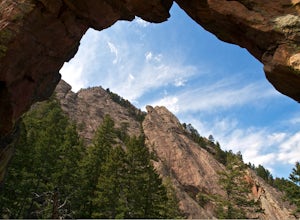
4.43.32 mi / 1220 ft gainRoyal Arch Trail climbs up Boulder's famous Chautauqua Park to an archway formed by sandstone rocks that tower over thirty feet high. Start at the Chautauqua Trail Station by the Ranger Station, and continue up Bluebell Road for 0.7 miles. You will then arrive at a more forested area, where you ...Read more -
Boulder, Colorado
Hike to the 1st Flatiron
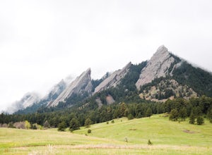
4.62.4 mi / 1422 ft gainStarting at the ever-popular and ever-populated Chautauqua Trailhead, take the main trail (a highway version of a dirt trail) straight towards the Flatirons. Continue going straight passed the Ski Jump trail to your right (0.2 mi.), then at a crossroads with the Bluebell-Baird trail (0.3 mi.) tur...Read more -
Boulder, Colorado
Green Mountain via Chautauqua Park
4.55.24 mi / 2467 ft gainStarting from the popular Chautauqua Park trailhead, head west on the main trail to the first branch off onto a smaller trail that will take you toward Baseline Road. Follow this trail until it eventually connects with Gregory Canyon Trailhead—you can park at this trailhead if you wish, but miss ...Read more

