Breckenridge, Colorado
Looking for the best photography in Breckenridge? We've got you covered with the top trails, trips, hiking, backpacking, camping and more around Breckenridge. The detailed guides, photos, and reviews are all submitted by the Outbound community.
Top Photography Spots in and near Breckenridge
-
Frisco, Colorado
Snowshoe the Mayflower Gulch
4.74 mi / 1000 ft gainTo begin, park in the large parking lot (it is usually plowed all winter except right after a large storm). The parking lot can be reached via highway 91, approximately 6 miles south of Copper Mountain and will be on the east (left if coming from the north) side of the road. Begin up the obvious ...Read more -
Frisco, Colorado
Frisco to Vail through Hike
5.013.55 mi / 3430 ft gainStarting at the Meadow Creek Trail head just off the turn off to Frisco this hike connects the stunning Eccles Pass and Gore Creek trails.Passing over Eccles Pass (11,917') and Red Buffalo Pass (11,742') this spectacular hike passes through dense forest, serene lakes and bubbling creeks.The Vail ...Read more -
Frisco, Colorado
Hike to Eccles Pass
10 mi / 3000 ft gainStarting at just over 9,000ft the Meadow Creek trail follows the path of the similarly named Meadow Creek. Through a canopy of aspens and pines the trail climbs at a steady, moderate rate. After a few water crossings the trees give way to an alpine meadow that offer a view of the final approach t...Read more -
Frisco, Colorado
Hike Red Buffalo Pass, Frisco to East Vail
13.2 mi / 3400 ft gainStarting at the Meadow Creek trailhead in Frisco, you'll find yourself ending up in East Vail at Gore Lake Trailhead. See all photos here. The trail in Meadow Creek starts to climb at a gradual pace for the 3-4 miles, after a mile or so, take a look back upon the views of Lake Dillion. You'll ar...Read more -
Frisco, Colorado
Sunset Shots at Lake Dillon
4.3To get to the southern end of the lake from Denver, head west on 70 until you reach 9. Take 9 for a few miles until you find the spot on the lake where you want to get started. On the south side of Lake Dillon, there was an abundance of old stumps lining the beach, which would occasionally drift ...Read more -
Breckenridge, Colorado
Winter Climb of North Star Mountain
4.08 mi / 2400 ft gainFrom the west parking lot at the top of Hoosier Pass, take the 4x4 road as it climbs through a forest west of the pass. Before long, the trees thin and you'll stay on the road through treeline and reach a gate at just over 12,000 feet.Stay right at the gate and continue on this old mining road as...Read more -
Silverthorne, Colorado
Hike to Old Dillon Reservoir
4.51.7 mi / 137 ft gainToday, Lake Dillon is one of the biggest attractions in the Dillon Valley, attracting boaters, anglers, and campers. However, the large reservoir we know today was not the first one in the area. The Old Dillon Reservoir was built in the 1930s to supply water to the original town of Dillon, which...Read more -
Silverthorne, Colorado
Lily Pad Lake
4.73.27 mi / 531 ft gainLily Pad Lake is a well known destination just outside of Silverthorne and in the Eagle's Nest Wilderness. The trail may be heavily trafficked on the weekends, but solitude can still be found in the early mornings or during the weekdays. The trail starts at the Lily Pad Lake Trailhead, just to t...Read more -
Leadville, Colorado
Backcountry Ski at Fremont Pass
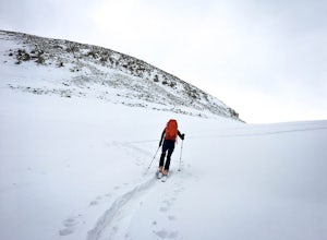
Starting at 11,319 feet of elevation, you can choose which direction to head into the backcountry. Park at the pull-off area at the bend in the road. From here, you can head into the woods to the right (there are usually tracks from other skiers to follow) or follow Trail Rd. to reach some peaks ...Read more -
Breckenridge, Colorado
Discover Ancient Trees on Windy Ridge
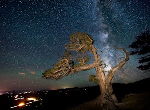
The Windy Ridge Bristlecone Pine Scenic Area is a remote stand of trees off a 4WD road near Alma, Colorado. This grove of bristlecone pines was given protected status in 1964 due to its uniquely shaped trees influenced by the winds blasting off nearby 14er, Mount Bross. The area sits at 11,700 ...Read more -
Dillon, Colorado
Off-Road to Glacier Mountain
5.07.4 mi / 2100 ft gainThe trail begins just past historical Main Street Montezuma. You will see a sign on your right for St. Johns road. This road is officially marked as 275 on a map. The original road lead to St. Johns but not much of the town remains.You will cross the Snake River almost immediately after you turn ...Read more -
Leadville, Colorado
Camp at Kite Lake
5.0Kite Lake is a beautiful little lake that is surrounded plenty of fourteeners. Just outside of Alma, Colorado, Kite lake can be accessed from Buckskin Street. Buckskin is a simple left turn after the only bar in Alma, or a right turn before the only bar in Alma... Do note, this road is not drivab...Read more -
Leadville, Colorado
Mt. Democrat (CLOSED)
4.84 mi / 2150 ft gainNOTE: As of March 2023, access to parts of this loop that are on private property (including Mt. Democrat & Mt. Lincoln) are closed to the public indefinitely. (Source) To begin this wonderful hike, drive from the town of Alma, Colorado and head up Buckskin Street for about 6 miles. I would ...Read more -
Leadville, Colorado
Mounts Democrat, Lincoln, Cameron and Bross (CLOSED)
4.08 mi / 3500 ft gainNOTE: As of March 2023, access to parts of this loop that are on private property (including Mt. Democrat & Mt. Lincoln) are closed to the public indefinitely. (Source) Find your way to the Kite Lake trailhead near Alma, Colorado. The road up to the trailhead is suitable for most vehicles, i...Read more -
Silverthorne, Colorado
South Willow Falls
4.66.17 miStart at the Willowbrook Trailhead. You’ll hit a “Y” in the trail pretty quickly - go left and you’ll soon be at the first log bridge. There are quite a few water crossings on the trail, but they are easy to maneuver. After hiking in the Willow Creek Open Space for a bit, you’ll enter Eagle’s Ne...Read more -
Dillon, Colorado
Sunset Views from Morgan Peak
8.42 mi / 2900 ft gainHow you get to Morgan Peak and the other 13ers in the area depends on if you have a 4-wheel drive with good clearance or not. If so, drive the rough Santa Fe road from the small town of Montezuma (just outside Keystone). The road is also known as Forest Service 264 and is a left at the stop sign ...Read more

