Bond, Colorado
Looking for the best camping in Bond? We've got you covered with the top trails, trips, hiking, backpacking, camping and more around Bond. The detailed guides, photos, and reviews are all submitted by the Outbound community.
Top Camping Spots in and near Bond
-
Coalmont, Colorado
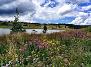
Camp at Dumont Lake, CO
4.5Dumont Lake is 22 miles southeast of Steamboat Springs, just minutes off of U.S. Highway 40 (Rabbit Ears Pass). As you turn off the highway and drive down the dirt road, you get great views of Rabbit Ears Peak.The campground is made up of 14 sites. Almost all of the sites have a view of the meado...Read more -
Summit County, Colorado
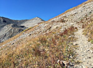
Hike to Crystal Peak
5.08.6 mi / 2482 ft gainOnce you turn off of Colorado hwy 9 onto dirt, your GPS will lead you to a gravel lot. At the end of that lot there's a pretty steep gravel road that heads NNW (GPS coords: 39°25'43.01"N 106° 4'11.30"W | Map Link if you want to plug that into your GPS for parking). From this lot you'll walk up t...Read more -
Turquoise Lake, Colorado
Escape to Turquoise Lake
5.0Turquoise Lake is an 'off the beaten path' gem only 3 hours from the Denver Metro Area. The area surrounding the lake is home to some spacious and tree-shaded campgrounds. If you plan ahead and book early, you'll have your pick of the best spots within close proximity to the lake. The campground ...Read more -
Parshall, Colorado
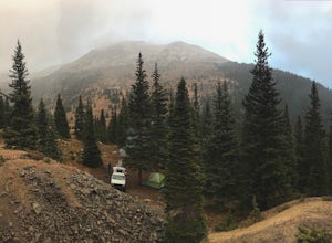
Camp at Jones Pass
4.5To locate these campsites all you have to do is type in Jones Pass Road into google maps or your iPhone and it will take you straight there. There are road signs once you get off I-70 that will help you the rest of the way that say Jones Pass. Once you hit the dirt road and pass the Jones Pass Tr...Read more -
Breckenridge, Colorado
Lower Crystal Lake via Crystal Creek Road
5.04.52 mi / 1624 ft gainTo get to the Crystal Lakes start at the Spruce Creek Trailhead. You can hike or drive to the Lower Crystal Lake along Crystal Creek Road. If you choose to drive, you will need a high clearance 4x4 vehicle as you follow along Crystal Creek Road. The road is steep, but when they get to the top it ...Read more -
Carbondale, Colorado
Camp at Prince Creek
3.0From Colorado State Highway 82, turn south onto Highway 133 (toward Carbondale). Continue south past the Carbondale Main Street roundabout. After two miles, turn East onto Prince Creek Road. Follow this four miles to where the pavement ends. After passing through a cattle gate, BLM land lines the...Read more -
Basalt, Colorado
Camp at Thomas Lake and Summit Mt. Sopris
5.013 mi / 4400 ft gainWith the Elk Mountain range behind it, It appears to be standing by itself, and has the resemblance of a grand volcano.From Hwy 133 out of Carbondale, turn down Prince Creek Road and drive 6 miles to the trailhead. The trail is a nice mixture of meadows and woods, with excellent views of the vall...Read more -
Aspen, Colorado
Camp on the Backside of Buttermilk Mountain
1.04 mi / 2000 ft gainPark at the Buttermilk Ski Area parking lot and begin your hike up the mountain at the bottom of the Summit Express chair lift. Follow the 4x4 dirt road the entire way up Buttermilk. There are other small hiking trails that you can follow too, and with the entire mountain being a ski area, it's s...Read more -
Leadville, Colorado
Camp at Kite Lake
5.0Kite Lake is a beautiful little lake that is surrounded plenty of fourteeners. Just outside of Alma, Colorado, Kite lake can be accessed from Buckskin Street. Buckskin is a simple left turn after the only bar in Alma, or a right turn before the only bar in Alma... Do note, this road is not drivab...Read more -
Breckenridge, Colorado
Camp at Boreas Pass
9 mi / 1500 ft gainBoreas pass is a high mountain pass in the Rocky Mountains that sits on the Continental Divide at 11,481'. Forest Service Road 33 goes over the pass and has numerous campsites all along its length, with several near the summit that feature breathtaking views of the Tenmile Range and the Breckenri...Read more -
Snowmass, Colorado
Capitol Lake via Capitol Ditch
5.012.28 mi / 2575 ft gainThe route to Capitol Lake is fairly straightforward, but not without its minor hardships. The route begins at the end of Capitol Creek Road, 9 miles from the small "town" of Snowmass (NOT Snowmass Village - that's the high-class ski resort). The last few miles of this road provide the first min...Read more -
Silver Plume, Colorado
Torrey's Peak via Kelso Ridge
5.05.79 mi / 2982 ft gainThe start of this route up the Kelso Ridge is the same as doing the standard route of Gray's and Torrey's peaks. From the trailhead cross the large metal bridge and continue on the great trail as it slowly climbs away from the parking lot and trailhead. This first section is not steep, but prov...Read more -
Aspen, Colorado
Camp at Silver Bell Campground
Escape the bustle of town and head out of Aspen on Maroon Creek Road. Follow the signs to Maroon-Bells Snowmass Wilderness Area. There is a $10 entrance fee (unless you are a national parks pass cardholder) plus an additional fee to camp. Continue down the road to Silver Bell Campground. With a t...Read more -
Grand Lake, Colorado
Camp at Stillwater Pass
4.6Some of my best nights in Colorado were spent in Stillwater Pass. There are numerous campsites with remade fire pits. I found this site when the Timber Creek Campground in Rocky Mountain National Park was full and I did not want to head back to Denver. There is a photo of a white plastic horse a...Read more -
Aspen, Colorado
Camp Difficult Campground, Aspen
This is a great backup campground if all of Maroon Bells campgrounds are full, which in all reality is highly likely. If you're looking to beat the crowds, this is a good number campground to consider. This campground is right off the highway, 5 miles away from the town of Aspen, easy to find, an...Read more -
Leadville, Colorado
Hike Mount Massive
4.8Starting from the Mt Massive Trailhead off of Halfmoon Creek Road (a half mile past the more popular Mt Elbert Trailhead), follow the excellent and easy trail into the woods. This trail is wide and abnormally flat for a 14er trail for the first three miles. During these first 3 miles the only rea...Read more

