Beaver Creek, Colorado
Top Spots in and near Beaver Creek
-
Gypsum, Colorado
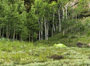
Explore Hardscrabble Mountain
Depending where you choose to access the Hardscrabble area from, this can be a fairly easy day hike or an overnight camping trip. If looking for a shorter day hike, access the Hardscrabble area by way of Hardscrabble Mountain Rd. From the town of Eagle, head South on Sylvan Lake Rd. In 5 miles, t...Read more -
Leadville, Colorado
Savage Lakes Trail
5.03.97 mi / 1299 ft gainThe majority of this hike traverses through the beautiful forest that is part of the Holy Cross Wilderness. No significant views are to be had until you've climbed 1,300 ft over 2. miles and reach lower Savage Lake. The trail is easy enough to follow with no junctions along the way, and is adjace...Read more -
Silverthorne, Colorado
Hike Cataract Lake and Falls
4.72.1 mi / 200 ft gainMy husband and I heard about this hike while we were at a marriage retreat in nearby Dillon. This is the perfect casual day hike for a couple, small groups, or families with children. While we were there in May, just before the aspens were fully leafed out, it was easy to see that this location w...Read more -
Silverthorne, Colorado
Backpack to Upper Slate Lake
5.028 mi / 1386 ft gainStarting from the Rock Creek Trailhead parking lot, it is an up and down trek to Upper Slate Lake. The trail map states 10 miles each way, but accounting for switchbacks it ends up being closer to 14 long, hard miles.You will be among aspens and pines for the first half as you have a few moderate...Read more -
Leadville, Colorado
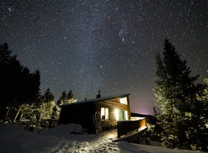
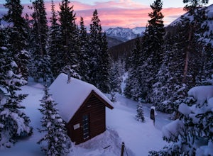
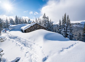
Ski or Snowshoe to Vance's Cabin
3.1 mi / 750 ft gainVance's Cabin is a private hut near Tennessee Pass booked by the 10th mountain division. The hut was completed in 1988 and sleeps 16; 6 beds upstairs in a loft and 10 bunk beds downstairs in a communal bunked area around the wood stove. It's a compact cabin compared to some of the other huts in...Read more -
Frisco, Colorado
Backpack the Colorado Trail: Copper Mountain to Hagerman Pass
39 miThe Colorado Trail (CT) runs for 483 miles from Denver to Durango, crossing through eight mountain ranges and passing through six wilderness areas. There are great resources on completing a thru-hike of the CT; this post is about Segments 8-9 of the CT from Copper Mountain to Tennessee Pass.These...Read more -
Frisco, Colorado
Backpack to the Gore Range's Wheeler and Lost Lakes
4.510 mi / 2200 ft gainThe range offers many remote lakes and peaks which hikers can access from various points of entry. Wheeler and Lost Lakes lie within the boundaries of the Eagle's Nest Wilderness Area.The Gore Trail begins on the north side of the CO-91 pedestrian bridge over I-70. You will follow the trail up al...Read more -
Frisco, Colorado
Ski to Janet's Cabin
6 mi / 1900 ft gainJanet's Cabin is located on the eastern slope of the Continental Divide at 11,610 ft, near Copper Mountain ski resort. This hut is one of the rare huts with not only a sauna but indoor bathrooms (composting pits)! The cabin was built in 1990 and due to the location helicopters were required to b...Read more -
Meredith, Colorado
Ski Betty Bear to Skinner Hut
20.2 mi / 3650 ft gainBetty Bear and Skinner Huts reside deep in the Colorado backcountry surrounded by thick forests and snowy peaks. Both of these huts offer an opportunity for off-grid leisure and crowd-free skiing. The huts come stocked with padded mattresses, wood stoves & fuel, propane burners, all cookware ...Read more -
Silverthorne, Colorado
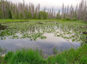
Lily Pad Lake
4.73.27 mi / 531 ft gainLily Pad Lake is a well known destination just outside of Silverthorne and in the Eagle's Nest Wilderness. The trail may be heavily trafficked on the weekends, but solitude can still be found in the early mornings or during the weekdays. The trail starts at the Lily Pad Lake Trailhead, just to t...Read more -
Frisco, Colorado
Mount Royal Trail
3.98 mi / 1391 ft gainMount Royal Trail is an out-and-back trail that takes you through a nice forest located near Frisco, Colorado.Read more -
Frisco, Colorado
Hike or Snowshoe to Rainbow Lakes
5.03 mi / 250 ft gainYou can do this hike two different ways: 1- Start from the Peaks Trail Trailhead for an out and back hike, distance is a little over 2 miles roundtrip. 2- Start along the Summit County Recreational Trail (as marked on this map), also out and back hike, total distance just over 3 miles, and provid...Read more -
Summit County, Colorado
Camp at Blue River Campground
There are 24 sites at the Blue River Campground that have access to well maintained vault toilets, fire pits, and picnic tables. The campsites range in size, from single tent to multi-tent use (however no RV hookups).This campground is popular in the summer and can fill up every weekend, so I rec...Read more -
Frisco, Colorado
Backcountry Ski or Snowboard at Mayflower Gulch
If you were driving down highway 91 towards Leadville and blinked at just the right moment, you'd drive right past this hidden gem of an area. Located just over 6 miles South of Copper Mountain ski resort on the East side of highway 91, the parking lot for the Mayflower Gulch trail head offers pl...Read more -
Frisco, Colorado
Hike to Mayflower Gulch
4.74 mi / 1000 ft gainGetting to the Mayflower Gulch is pretty easy, you can either hike an easy 2 mile forest road or drive all the way to end (you need decent clearance for the drive). At the end of the hike you are greeted with a stunning view of the Old Boston mining site. During the summer, wildflowers are abunda...Read more -
Frisco, Colorado
Snowshoe the Mayflower Gulch
4.74 mi / 1000 ft gainTo begin, park in the large parking lot (it is usually plowed all winter except right after a large storm). The parking lot can be reached via highway 91, approximately 6 miles south of Copper Mountain and will be on the east (left if coming from the north) side of the road. Begin up the obvious ...Read more

