Yucca Valley, California
Yucca Valley, California offers a plethora of unique experiences for visitors to explore. From hiking the best trails to exploring the scenic desert landscape, there is something for everyone. Must-visit attractions include the Oasis of Mara and the Joshua Tree National Park. For adventurers, the Integratron and Keys View are both excellent choices. With so many activities and attractions to choose from, Yucca Valley is the perfect destination for anyone looking to get out and explore.
Top Spots in and near Yucca Valley
-
Big Bear, California
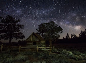
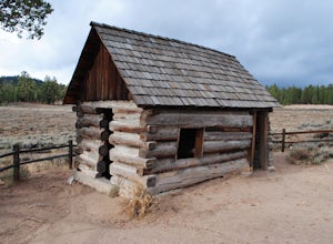
Explore Van Dusen Cabin
4.0This is a great day trip to spend in the mountains. from Highway 18 at the Big Bear Dam you turn left onto highway 38 around the north shore of Big Bear. Continue till you see the sign Van Dusen Rd and turn left. The paved road takes you through residential neighborhoods where the dirt road begin...Read more -
Big Bear Lake, California
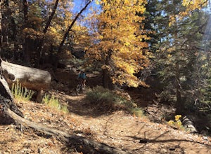
Knickerbocker Road & Pine Knot Trail
5.06.1 mi / 1007 ft gainPark at the free parking lot behind the village off Knickerbocker Rd between Village Drive and Pedder Road. Ride up Knickerbocker Rd towards the mountain. Look out for the fire service road 2N08 that veers left and uphill. The first 2 miles are challenging steep uphill, but beautiful nonetheless....Read more -
Big Bear, California
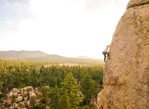
Rock Climb Holcomb Valley
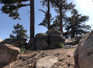
5.0Most of the drive to Holcomb Valley is done on regular paved roads until about the last hour when you get above Big Bear Lake and you start your journey on dirt roads. The road is extremely bumpy and has lots of pot holes but there are generally quite a few cars up there that don't have 4 wheel d...Read more -
Big Bear, California
Cougar Crest Trail
5.05.57 mi / 892 ft gainOn the north side of Big Bear Lake, just off the 38, you will find a turn off for the Cougar Crest Trail. The parking lot is well marked, and signs for the trailhead are easy to spot. Parking is not an issue if you come in later in the afternoon, but the hike can get crowded during peak hours. Fo...Read more -
Banning, California
Lake Fulmor Loop Trail
5.00.53 mi / 89 ft gainLake Fulmor is a small lake in the San Jacinto Wilderness near Idyllwild, CA. The trail loops around the lake offering spectacular views and is good for all skill levels. There are picnic tables, grills, and a small dock where you can peer out over the lake or cast a line. To fish in Lake Fulm...Read more -
Big Bear, California
Holcomb Valley Campground
This campground is awesome! With great views, plenty of space and clean bathrooms it'll have you in for a treat! Whether it be a multiple day trip or just one night this campground is awesome. Read below for information if you are looking for a trip in the mountains! Cost: This campground is a ...Read more -
Big Bear Lake, California
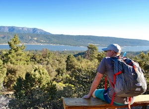
Grand View Point
6.9 mi / 1312 ft gainGrand View Point is accessed via Pine Knot Trail, a 6.5 mile out and back hiking trail located at the Aspen Glen Picnic Area, 1 mile from Big Bear Village. With its close proximity to town, Pine Knot Trail is popular in the summer with mountain bikers and the trailhead is often crowded in the win...Read more -
Fawnskin, California
Grays Peak Trail
1.06.95 mi / 1293 ft gainThis is a fairly easy mountain peak to climb. The trailhead is easily accessible right off of Hwy 38 by the town of Fawnskin. There is a large National Forest sign noting the parking area to Grays Peak Trail. Note that parking in this lot requires either a day pass or a California Adventure pa...Read more -
Angelus Oaks, California
San Bernardino Peak
3.015.82 mi / 4911 ft gainThe San Bernadino Peak Trail out of Angelus Oaks is a very challenging hike, which can either be done as a day hike or an overnight trip. Free permits are required for day hiking and overnights in the San Gorgonio Wilderness. These permits can be accessed via Sgwa.org/permits. If you choose to ...Read more -
Forest Falls, California
Summit Mt. San Bernardino from Angelus Oaks
16 mi / 4775 ft gainThe trailhead is somewhat 'interesting' to get to given the dirt roads are in questionable shape and some of the roads in Angelus Oaks are not easily identifiable but I didn't have any problems finding it by closely following Google Maps. Trailhead parking requires an Adventure Pass parking pe...Read more -
Mountain Center, California
Apache Peak Trail
9.4 mi / 2966 ft gainApache Peak Trail is an out-and-back trail where you may see wildflowers located near Mountain Center, California.Read more -
Fawnskin, California
Castle Rock Trail at Big Bear Lake
4.52.7 mi / 719 ft gainFollow the directions to the trail head, and park on the side of the road. You will see a sign that says Castle Rock Trail, and the path is directly behind that sign. The hike up to the peak is steep, sandy, and very rocky, so shoes with good traction is recommended. There are also lots of oak a...Read more -
Riverside County, California
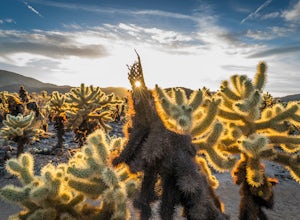
Photograph the Cholla Cactus Gardens
4.40.25 mi / 0 ft gainThe Cholla Cactus Garden is something everyone can appreciate and enjoy. The trail is in total about a 0.25 loop, but you are certainly free to wander around more. Plan on spending at least 30 minutes to an hour enjoying the scenery. If you are a photographer, you will be enthralled by the light...Read more -
Fawnskin, California
Pine Oak Lane Beach
Pine Oak Lane Beach, is located on the western side of Big Bear Lake. Whether you're seeking a tranquil escape or an action-packed day on the water, this scenic beach has something for everyone. Activities: At Pine Oak Lane Beach, you can enjoy a variety of recreational activities, including swi...Read more -
La Quinta, California
Hike to Lake Cahuilla
4.55.41 mi / 183 ft gainFrom Hwy. 111 take Washington (South) 3 miles to Avenue 52 (Turn Right). Take Avenue 52 a 1/2 mile to Avenida Bermudas (Turn Left). Follow Avenida Bermudas for 2 miles (becomes Calle Tecate). Cove Trailhead & Parking Lot located on the left across from Avenida Ramirez. You'll start heading ou...Read more -
La Quinta, California
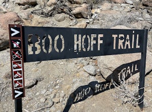
Boo Hoff Trail
12.7 mi / 2323 ft gainBoo Hoff Trail is a loop trail where you may see wildflowers located near La Quinta, California.Read more

