Whittier, California
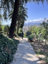
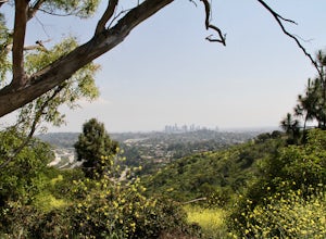
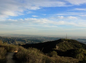
The Hellman Park Trail in Whittier, California is a top choice for outdoor adventures. This 4-mile round trip hike offers a moderate challenge with its steady incline and uneven terrain. Along the trail, you'll find scenic vistas of the city and the San Gabriel Mountains. Unique rock formations and native chaparral provide a backdrop for your hike. The trail also features a small stream and a variety of bird species. Near the location, the Whittier Narrows Recreation Area is a must-visit. It offers fishing, biking, and picnic areas along the San Gabriel River. The best Trails and Outdoor Activities are waiting for you in Whittier, California. Get your hiking boots ready and explore these natural attractions.
Top Spots in and near Whittier
-
Los Angeles, California
Micheltorena Stairs
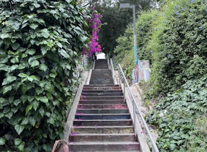
3.00.19 mi / 75 ft gainI preferred the steps, before anything was painted on them. Whoever thought it would be a great idea to do that was wrong. No upkeep and these stairs have been heavily vandalized. The steps are a series of stairways you will find throughout Silver Lake and neighboring areas. They facilitated peo...Read more -
Los Angeles, California
Landa St Stairs (Esther's Steps)
5.00.18 mi / 138 ft gainOne of the hidden gems of the neighborhood, a beloved local named Esther Aagaard Tapebland walked these steps everyday, for 50 years in Silver Lake. Fountain Ave becomes Landa St. Park on Griffith Park Ave and hike your way up the steep driveway. Amazing views of Hollywood, the Hollywood Sign, th...Read more -
Altadena, California
San Gabriel via Sam Merrill and Mount Lowe Trails
17.55 mi / 5614 ft gainSan Gabriel via Sam Merrill and Mount Lowe Trails is a loop trail where you may see beautiful wildflowers located near Altadena, California.Read more -
Altadena, California
Thalehaha Falls
1.71 mi / 679 ft gainThe trails starts in a foothill neighborhood of Altadena CA at the corner of Pleasantridge Dr. and Rubio Vista Rd. This is one of the better entries into the Angeles National Forest because it is one of the lesser known. Find a place to park on the street and head out on the trail into Rubio Cany...Read more -
Altadena, California
Echo Mountain and Inspiration Point Loop
4.110.16 mi / 3369 ft gainThe trail switchbacks up the mountain before reaching the first historic marker, in 3 miles. These are the remains of the Mount Lowe Railroad, which brought customers to Echo Mountain Resort, also in ruins, nearby. Explore the historic sites, then head up Castle Canyon Trail. A steep climb will ...Read more -
Los Angeles, California
Hoover Walk
4.0In 2009, the people that lived in the neighborhood, close to the stairs, wanted to find a way to fight the graffiti that was being put on the structures and stairs themselves. Artist Ricardo Mendoza was commissioned to paint a giant mural that would cover most of the concrete walls that surround ...Read more -
Los Angeles, California
Beacon Hill via Coolidge Trail
5.02.84 mi / 587 ft gainThe starting point for your run is at the Griffith Park Southern Railroad. From the parking lot walk east crossing Crystal Springs Drive and find the Coolidge Hiking Trail. Begin running up Coolidge Trail toward Upper Beacon Trail making sure to stay straight at the first intersection (0.2 miles)...Read more -
Seal Beach, California
Seal Beach
4.7Seal Beach is a small beach community between Long Beach and Huntington Beach. Right off PCH (Pacific Coast Highway), this sandy beach is a great place to chill on a hot summer day. The high winds coming off the water makes it an ideal place to kite board, surf, or simply fly a kite along the sho...Read more -
Glendale, California
Nibley Park
5.0Nibley Park is a small and secluded park with lots of trees and green area. There are a number of picnic tables and a restroom, that is ADA compliant. The playground is small but two separate play areas that are marked for their specific ages for young kids to have fun. There is also a half court...Read more -
Altadena, California
Millard Falls
3.01.27 mi / 289 ft gainTo get to the trail, park at the Millard Campground Trailhead parking lot, where you'll find plenty of parking. Follow the trail that leads away from the lot and past the Millard Campground. If necessary, you'll find bathrooms at the campground. Follow signs for Millard Falls as the trail veers r...Read more -
Los Angeles, California
Griffith Park Old Zoo Loop
4.02.52 mi / 666 ft gainThe Griffith Park Old Zoo Loop is a 2.52-mile moderately trafficked loop trail located in Griffith Park, Los Angeles. Due to its length and minimal elevation gain of ~670 feet, the hike is open to all skill levels. The trail is primarily used for walking, hiking, and trail running, The Griffith P...Read more -
Los Angeles, California
Mount Hollywood via the Fern Canyon Trail
5.05.02 mi / 1581 ft gainAt 1,625 feet Mt Hollywood is the second highest point in Griffith Park and provides picturesque views of the Hollywood Sign, Griffith Park Observatory, Downtown Los Angeles and the San Gabriel Mountains. The hike to the Mt Hollywood Summit begins on the northeast side of Griffith Park near the ...Read more -
Seal Beach, California
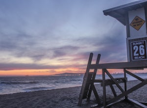
Sunset Beach
4.6Sunset Beach is located just 9 miles south of Long Beach and 6 miles North of Huntington Beach, CA on the famous Pacific Coast Highway 1. I accessed Sunset Beach from the South on I-405. I took exit 22 for Seal Beach. After the exit I turned a left/west on Seal Beach Blvd and drove for 2.6 miles ...Read more -
Glendale, California
Mt. Thom and Tongva Peak
6.06 mi / 1480 ft gainMount Thom and Tongva Peak are accessed by using the 6.2 mile out and back trail, Las Flores Motorway located in the north part of Glendale, CA. Roadside parking is not allowed near the trailhead, you will need to park in the nearby residential area along Sunshine Drive about 0.15 miles away from...Read more -
La Verne, California
Marshall Canyon Trail
4.05.99 mi / 722 ft gainFor this adventure you can choose to start in a multiple of places; for the easiest parking use Oak Mesa Park located next to Oak Mesa Elementary School. From the parking lot cross the soccer field towards the bridge on the north east end of the school. Once across the bridge follow Los Robles ea...Read more -
Los Angeles, California
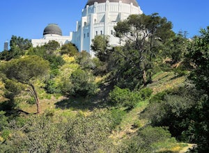
Ferndell to the West Observatory Loop Trail to Griffith Observatory
4.52.63 mi / 587 ft gainThe Ferndell to Griffith Observatory trail in Los Angeles, California is a moderate difficulty, 2.63-mile loop trail. The trail starts at Ferndell Nature Museum, a small museum with a garden and picnic area. The trail then ascends through a shaded canyon, with a small stream running alongside. ...Read more

