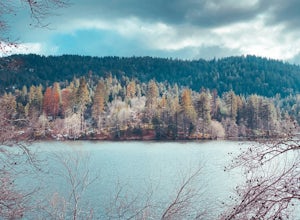
Valyermo, California
Valyermo, California, is a must-visit for outdoor adventures. The Big Rock Creek Trail is a top pick for hiking. This moderate difficulty trail offers scenic views of the San Gabriel Mountains and the Mojave Desert. The trail is lined with unique rock formations and crosses several streams, making it a fun challenge for hikers. Nearby, the Devil's Punchbowl Natural Area is another must-visit. This area boasts unique geological formations and a variety of trails for all skill levels. For a more relaxed outdoor activity, the Valyermo Ranch offers horseback riding with stunning views of the surrounding mountains. Make sure to check out these best trails and outdoor activities when in Valyermo, California.
Top Spots in and near Valyermo
-
Altadena, California
Eaton Canyon to Idlehour Trail Camp
4.510.99 mi / 3291 ft gainIdlehour is nestled deep in the Angeles National Forest, so it feels like you're in the heart of some untapped wilderness instead of six miles away from a bustling metropolis. The trail camp is accessible by foot through a variety of locations, but the most popular route is through Eaton Canyon, ...Read more -
Altadena, California
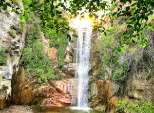
Millard Falls
3.01.27 mi / 289 ft gainTo get to the trail, park at the Millard Campground Trailhead parking lot, where you'll find plenty of parking. Follow the trail that leads away from the lot and past the Millard Campground. If necessary, you'll find bathrooms at the campground. Follow signs for Millard Falls as the trail veers r...Read more -
Altadena, California
San Gabriel via Sam Merrill and Mount Lowe Trails
17.55 mi / 5614 ft gainSan Gabriel via Sam Merrill and Mount Lowe Trails is a loop trail where you may see beautiful wildflowers located near Altadena, California.Read more -
Los Angeles County, California
Big Tujunga Canyon Lookouts
1.22 mi / 453 ft gainPark at the Condor Peak Trailhead, please note that this trail head is unmarked so keep your eyes peeled on the right side of the turnout for a small single track trail. The trail gradually climbs along the side of the canyon until reaching a 4 way intersection. To your left and to your right wil...Read more -
La Cañada Flintridge, California
Teepee Trail
5.02.55 mi / 1145 ft gainHidden in the small community of La Canada, California, the trailhead is pretty hidden! From the 210, take the exit for Highway 2/Angeles Crest Highway. Head north (towards the mountains) for about a mile. As the highway begins to curve, you will come across a small side-street, Harter Lane. Turn...Read more -
Palmdale, California
California Aqueduct Trail
7.67 mi / 213 ft gainCalifornia Aqueduct Trail is an out-and-back trail that takes you past scenic surroundings located near Palmdale, California.Read more -
Los Angeles County, California
Trail Canyon Falls
4.04.56 mi / 1017 ft gainTo get to the trail, take Big Tujunga Canyon Road until you see signs for Trail Canyon Road. The entry point is easy to miss, but keep an eye out for a stop sign and cars parked at the bottom of a dirt path. Drive up the dirt path for direct parking at the trailhead (4x4 is definitely recommended...Read more -
Lytle Creek, California
Old CC Spur Trail via Big Tree Cucamonga Rd
5.11 mi / 1138 ft gainOld CC Spur Trail via Big Tree Cucamonga Rd is an out-and-back trail that takes you by a waterfall located near Fontana, California.Read more -
Pasadena, California
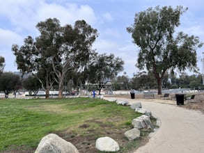
Central Arroyo Seco Community Recreation Loop
5.00.66 mi / 36 ft gainBeautiful views of the Rose Bowl and surrounding San Gabriel Mountains. A protected .75 mile loop, that offers an easy path, to stroll along. You’ll find convenient water filling stations, clean bathrooms, and a fitness area, along the path. Easy parking all around.Read more -
Santa Clarita, California
Hike the PCT and Foot Trail Loop through Vasquez Rocks
5.05.5 mi / 287 ft gainThe Pacific Crest Trail and foot trail hike is a 5-mile loop with a quick PCT branch-off that leads under the 14 freeway through a long, well-maintained (but very dark) tunnel. Pull into the well-marked parking lot and stop in the visitor center to take a look at the topographical park model and...Read more -
Pasadena, California
Arroyo Terrace Trail
5.01.54 mi / 194 ft gainArroyo Terrace Trail is a loop trail that takes you by a river located near Pasadena, California.Read more -
Agua Dulce, California
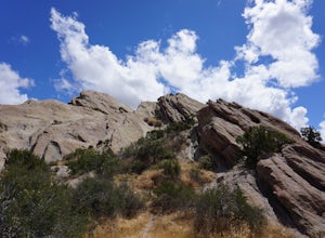
Vasquez Rocks
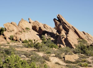
5.02.42 mi / 367 ft gainThis is a Natural Park Area located in Santa Clarita, within the Sierra Pelona Mountains. It features amazing diagonal rock formations, created because of the force between two tectonic plates pushing against each other. This place is a photographer's paradise, and every spot in this 900+ acre l...Read more -
Pasadena, California
Lower Arroyo Seco Loop
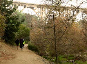
4.02.88 mi / 230 ft gainNestled next to the CA-134, this trail presents a relaxing atmosphere while only a 30 minute drive from Downtown Los Angeles and a 5 minute drive from Old Town Pasadena. From bird-watching to archery, this trail provides a peaceful atmosphere with no lapse in beauty. The trail which is around 1....Read more -
Hesperia, California
Cleghorn Beach and Day Use Area
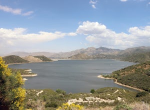
Nestled at the southwestern edge of Silverwood Lake lies Cleghorn Beach and Day Use Area, a perfect spot for a leisurely afternoon. This family-friendly beach boasts lifeguards on duty during the summer months and offers reservable picnic shelters for your convenience. Unlike other parts of the l...Read more -
Glendale, California
Beaudry Loop
5.79 mi / 1572 ft gainThe Beaudry Loop trail features a bench at the top with 360 degree views of the greater LA area. The trailhead is a little hidden on Beaudry Blvd. As Beaudry Blvd turns into Beaudry Terrace, you'll see cars parked at the paved trailhead. There is very little shade on the trail so bring ample sun...Read more -
Hesperia, California
Sawpit Beach
Sawpit Beach, is nestled within the Silverwood Lake State Recreation Area. The beach offers a peaceful respite along the southern shores of Silverwood Lake. With lifeguards on duty during the summer months, families can enjoy a worry-free day of swimming and relaxation. The sandy shores provide t...Read more

