Twin Peaks, California
Top Spots in and near Twin Peaks
-
Palm Springs, California
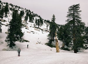
Winter Climb San Jacinto from the Tram
5.08 mi / 2400 ft gainIntermediate: No snow.Advanced: Lots of snow.Expert: Snow w/ high winds and low temps. GPX: https://www.gaiagps.com/datasu... San Jacinto, at 10,834 feet, is the second-highest peak in the Southern California. It's unique in that it has a rotating tram car (think slow motion disco floor) that r...Read more -
Palm Springs, California
Scramble Cornell Peak
3.5 mi / 1000 ft gainEntering Mt San Jacinto State Park via the Palm Springs Aerial Tram is one of the easiest ways to get into the wilderness area. Purchase your ticket and ride to the station where you'll be able to walk out the backdoor and onto the trail. In order to get to Cornell, your route finding skills wil...Read more -
Mountain Center, California
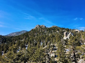
Tahquitz Peak via Devils Slide Trail
5.08.31 mi / 2238 ft gainTahquitz Peak via Devils Slide Trail is a moderately trafficked 8+ mile out and back trail located near Idyllwild, California. This trail is one of the most popular hikes in the San Jacinto area that features a fire lookout tower at the peak and amazing views of the valley below. At an elevation...Read more -
Mountain Center, California
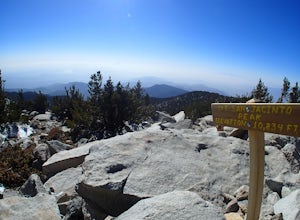
Mount San Jacinto via Devil's Slide
4.514.57 mi / 4475 ft gainMt. San Jacinto is the second tallest peak in Southern California at 10,834’. Although this route requires a fair amount of work, the effort is more than rewarded by the expansive views, forest, meadows, and dramatic topography. You will need an Adventure Pass ($5/day) to park at Humber Park, as...Read more -
Lake Forest, California
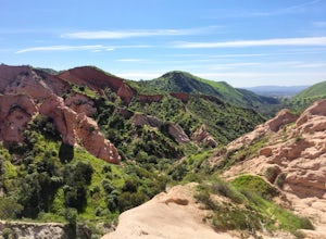
Hike Borrego Canyon to Red Rock Canyon Trails
4.64.2 mi / 500 ft gainJust south east of the city of Irvine, on the southern end of Orange County, is the scenic Whiting Ranch Wilderness Park. Don't let the newly developed shopping centers restaurants fool you, because just beyond the parking lot ($3 Daily Use Fee) of the Borrego Canyon Trailhead, you will find your...Read more -
Lancaster, California
Saddleback Butte State Park Loop
0.58 mi / 46 ft gainSaddleback Butte State Park is a state park in the Antelope Valley of the western Mojave Desert. It’s oftentimes looked over, but you’d be surprised what you can find there. Definitely a place to stop. It is located east of Lancaster. It can get hot so make sure to bring lots of water and wear su...Read more -
Lancaster, California
Little Butte Trail
4.02.09 mi / 213 ft gainLittle Butte Trail is an out-and-back trail that is moderately difficult located near Llano, California.Read more -
Hemet, California
Hike South Fork Trail
5.4 mi / 1056 ft gainBegin by following the unsigned but visible trail on the south side of the turnout. You climb steadily through bushes and past granite boulders. At half a mile, you pass over to the western slope of the hill where the trail bends southeast, providing your first look of the river valley far below....Read more -
Palm Springs, California
North Lykken Trail from W. Crescent Drive
1.67 mi / 906 ft gainNorth Lykken Trail from W. Crescent Drive is an out-and-back trail that takes you past scenic surroundings located near Palm Springs, California.Read more -
Palm Springs, California
Skyline Trail to Aerial Tramway Top Station
5.09.41 mi / 8238 ft gainSkyline Trail to Aerial Tramway Top Station is a point-to-point trail where you may see beautiful wildflowers located near Palm Springs, California.Read more -
Palm Springs, California
Museum Trail
1.52 mi / 860 ft gainThe Museum Trail is a very steep climb with a 1,000 feet elevation gain in just one mile but has some great views of downtown Palm Springs. The hike starts behind the Palm Springs Art Museum. This trail can also access the Cactus to Clouds Trail that goes all the way to the top of Mt. San Jacinto...Read more -
Landers, California
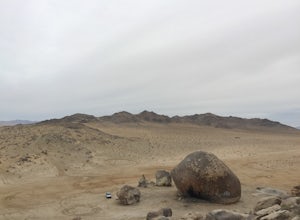
Explore Giant Rock
This is an adventure that my wife and me have been wanting to do for a while now. We finally decided to make the 30 minute journey out to Landers from Yucca Valley. There are quite a few points of interest along the way, but that is a story for another adventure.Giant Rock is 5.2 miles northwest ...Read more -
Whittier, California
Hellman Park Trail
3.04 mi / 850 ft gainThis trail is great if you're looking for a quick, but intense workout. The hike itself is only 4 miles out- and-back and can be easily completed within a couple of hours. However, be prepared for a steep and steady incline for the first 1.5 miles. The trail itself is pretty wide, and if you sho...Read more -
Los Angeles County, California
San Gabriel Peak
4.02.79 mi / 1040 ft gainAt 6,000 feet, San Gabriel Peak gives you one of the best views of the Los Angeles basin on the front range of the San Gabriel Mountains National Monument. As you pass through Muller Tunnel, the trail will be littered with rocks and boulders. A little over 100 feet in, the road will fork in thre...Read more -
Los Angeles County, California
Idlehour Trail
4.014.89 mi / 4665 ft gainIdlehour Trail located near Mount Wilson, California, is an out-and-back trail that is strenuous and can take 8-10 hours if done all at once. There are opportunities to camp off the trail, making this a backpacking trail in the Angeles National Forest as well. To access the Idlehour Campground ...Read more -
Palm Springs, California
South Lykken Trail to Simonetta Kennett Viewpoint
3.66.45 mi / 1654 ft gainThe South Lykken Trail is the south half of the 9.5-mile Carl Lykken Trail, which weaves along a series of mountain ridges above downtown Palm Springs. Dogs are not permitted on this trail. This section of the trail runs 3.2 miles one-way. You will gain just over 1600ft of elevation at the high...Read more

