Truckee, California
Looking for the best chillin in Truckee? We've got you covered with the top trails, trips, hiking, backpacking, camping and more around Truckee. The detailed guides, photos, and reviews are all submitted by the Outbound community.
Top Chillin Spots in and near Truckee
-
Calpine, California
Camp at Salmon Creek Campground
Salmon Creek Campground is a quiet campground in the Northern Sierra Buttes. Since it is right up the road from Sardine Lakes it seems to get overlooked a bit. We were able to reserve three campsites the same week of our trip. There were 11 to choose from! The campground is just passed the turn f...Read more -
South Lake Tahoe, California
Capture the Sunset at the Angora Ridge Fire Lookout
The Angora Ridge Fire lookout sits above the serene Fallen Leaf Lake with incredible views of Mt. Tallac and Desolation Wilderness. You can hike, bike or drive to the lookout. This is a great spot to photograph the sunset, as the sky will reflect off both Fallen Leaf Lake and Lake Tahoe. Bring a ...Read more -
Tahoma, California
Hike to Half Moon Lake in Desolation Wilderness
5.011 mi / 1600 ft gainThis hike starts at the Glen Alpine Trailhead near Fallen Leaf Lake. Because Desolation is a wilderness area, you are required to fill out a day-use permit which can be found at the trailhead. If you are backpacking make sure to obtain an overnight permit either online or at the Taylor Creek Visi...Read more -
South Lake Tahoe, California
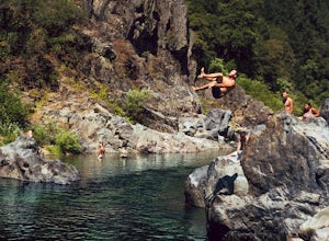
Cliff Jumping Paradise
4.5If you choose to go cliff jumping, be safe and know your limits ahead of time. Don't feel like the big jump is your only option, there are lower jumps, especially across from the beach (only about 15ft. high). Angora Lake in Lake Tahoe is a easy 1mi hike up, but well worth it at the top. It's a b...Read more -
Kyburz, California
Backpack to Smith Lake, Desolation Wilderness
5.05.6 mi / 1750 ft gainTo get to the Twin Lakes Trailhead from the Bay Area/Sacramento, head east on HWY 50 past Kyburz for 4 miles until you see the left-hand turnoff for Wrights Road. If coming westbound on HWY 50, this will be a right-hand turn 5 miles past Strawberry. Follow this paved road for 8 miles (watch for p...Read more -
Echo Lake, California
Hike Flagpole Peak from the bottom of Echo Summit
3.5 mi / 1900 ft gainFor this hike there are two places you can start from. One is at the Echo Lakes parking lot and the other is at the bottom of Echo Summit (where we started at). Parking at the gun tower at the bottom of Echo Summit you'll be looking right at the face of Flagpole. After parking just off the side o...Read more -
Echo Lake, California
Backpack to the "Waterfall Camp" in Desolation Wilderness
4.710.5 mi / 1522 ft gainAlthough this hike can be done as a day hike, it is an awesome place to camp. There is a lot to explore and you will want to spend as much there time as you can. The easiest way to start this hike is to start at the Echo Lakes. There is ample parking above the marina and you even have the option ...Read more -
Echo Lake, California
Hike to Jabu Lake in Desolation Wilderness
3.7Although this hike can be done as a day hike, there are incredible camping spots near the lake. The easiest way to start this hike is to start at the Echo Lakes. There is ample parking above the marina and you even have the option of taking a water taxi across the echo lakes to cut off around 2.5...Read more -
Echo Lake, California
Hike the Echo Lake Trail
4.05 mi / 688 ft gainThe Echo Lakes Trail goes through California's Desolation Wilderness and features incredible views. This trail is rated as moderate, and is best for excited beginners or intermediate hikers. This hike takes roughly 3.5-4 hours. Dogs are allowed on trail if kept on leash. The trail is best used fr...Read more -
Foresthill, California
Explore Sugar Pine Reservoir
4.3Just a few miles north of Foresthill, Sugar Pine is a lesser known reservoir found in Placer County that is surprisingly unpopulated for how much the park provides. A swim suit, some friends, and some good music can be all it takes to have a good time.There is a boat-launching station that is eas...Read more -
El Dorado County, California
Camp at Ice House Reservoir
4.01 mi / 1 ft gainDesolation Wilderness is just west of Lake Tahoe, a part of Eldorado National Forest. It's a very popular backpacking destination as the PCT and Tahoe Rim Trail both run through the area. There are what seems to be endless amounts of mountain lakes, creeks, and rivers that run through this area w...Read more -
Twin Bridges, California
Hike Pyramid Peak via Rocky Canyon
5.07.4 mi / 4100 ft gainPyramid Peak is the tallest peak in the Crystal Range and the Desolation Wilderness, just west of Lake Tahoe. On a clear day it can be seen from the Bay Area over 150 miles away. Named for its distinct shape, Pyramid a massive heap of glaciated granite slabs and talus, and the Rocky Canyon route ...Read more -
Frazier Creek Road, California
Frazier Falls
4.01.06 mi / 79 ft gainFrazier Falls is the ultimate family hike. Because the paved trail is only a mile long round trip, this trail is open to nearly anyone. Because of its relativly easy access and family friendly nature, this trail can get busy during the summer months. To reach Frazier Falls from the town of Gra...Read more -
Nevada City, California
Hike the Diggins Loop Trail
5.02.7 miCheck in and pay for your parking or present California State Parks Pass at the museum building in North Bloomfield. After paying for parking there are several different options to get onto the Diggins Loop trail. Access to the Diggins Loop trail can be found by the Park Headcounters by jumping...Read more -
Nevada City, California
Swim at Edwards Crossing on the South Yuba River
5.02.74 mi / 1302 ft gainThere are endless swimming holes on the South Yuba River the feature crystal clear water, massive granite boulders and pristine pocket beaches, particularly those lower in the foothills. Many are separated by sections of rapids, but can be reached via the growing trail system of the South Yuba Ri...Read more -
Colfax, California
Hike The Historical Stevens Trail
5.08 mi / 3376 ft gainBest known as one of the most popular hiking and biking trails to the North Fork American River, in part because of the easy access from Colfax. However, this is a remote trail, and hikers are advised to bring plenty of fluids as well as carry a whistle. The entire trail is primarily shaded, pa...Read more

