Trail of 100 Giants Trail, California
Looking for the best photography in Trail of 100 Giants Trail? We've got you covered with the top trails, trips, hiking, backpacking, camping and more around Trail of 100 Giants Trail. The detailed guides, photos, and reviews are all submitted by the Outbound community.
Top Photography Spots in and near Trail of 100 Giants Trail
-
Sequoia National Park, California
Backpack the High Sierra Trail
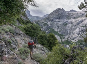
5.071 miThe High Sierra Trail begins at Crescent Meadow in Sequoia National Park, on the West side of the Sierra Nevada range, and ends at Whitney Portal on the East, traversing the highest and most beautiful part of the Sierras. From deep river canyons to high alpine peaks, lakes, and meadows, this hike...Read more -
Sequoia National Park, California
Hike Crescent Meadow
4.51.6 miCrescent Meadow is a collection of loops in the Giant Forest in Sequoia National Park. The trailhead is located just past the tunnel log east of General's Highway 198. The main loop is 1.6mi total. However you can take any of the loops to the General Sherman tree 3mi, Tharp's Log trail 0.5mi, or ...Read more -
Sequoia National Park, California
Drive through Tunnel Log
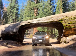
Tunnel log is a massive fallen sequoia across the middle of the road, which is a great photo opportunity for visitors of the national park. The mammoth tree fell over in 1937, but a year later, a car tunnel was carved in the middle of its trunk so vehicles could still pass through. Although the...Read more -
Sequoia National Park, California
Hike through the Giant Forest in Sequoia NP
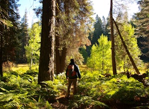
5.02 mi / 154 ft gainTake a drive to Sequoia National Park and take in the beautiful views of the second oldest national park. If you go in the winter or early spring time, be sure to check the weather beforehand and be prepared for the cold.If you are an avid traveler to national parks, I'd recommend that 2 weeks b...Read more -
Sequoia National Park, California
Hike the Congress Trail
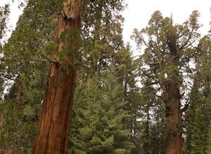
5.03.1 mi / 500 ft gainWhile the General Sherman Tree is the main attraction in this area, the Congress Trail allows you to get away from the majority of the crowd and explore the giant sequoias at your leisure. The vast majority of visitors only walk to and from the General Sherman Tree. The trail starts out from the ...Read more -
Sequoia National Park, California
Hike to Emerald Lake, Sequoia National Park
4.510.4 mi / 2200 ft gainBegin this hike at the Alta Peak Trailhead in the Sequoia National Park. The trail initially takes you east-southeast through a loosely forested area that is stark and arid. Around 1.5 miles in you'll cross a small creek, but this creek may dry up in the late spring/summer. Shortly after the cree...Read more -
Sequoia National Park, California
Hike to Pear Lake via the Lakes Trail
5.012.4 mi / 2300 ft gainThe Lakes Trail to Pear Lake can be done as either an overnight stay or a day hike. For overnight, you'll need to get a permit but there are beautiful camping spots available at both Emerald Lake and Pear Lake. As a day hike, plan to spend all day since you'll undoubtedly pause at each lake for...Read more -
Sequoia National Park, California
Mount Silliman, Sequoia NP
5.011.24 mi / 4449 ft gainThere is available parking at the campgrounds at the Lodgepole Visitor Center. Lodgepole's elevation starts at 6720 ft. Twin Lakes Trailhead starts right at the base, which you will be following to get to Mount Silliman. Along Twin Lakes Trail are several campgrounds for your journey, you can go...Read more -
Three Rivers, California
Hike Little Baldy
5.03.5 mi / 700 ft gainA short hike with impressive views of Sequoia National Park, the Little Baldy trail is the less touristy version of Moro Rock. When we hiked it on a beautiful Sunday morning in the summer, we had the entire summit to ourselves. Even if other hikers had been up there, it would have still felt em...Read more -
Inyo County, California
Summit of Mt. Whitney
5.020.85 mi / 6100 ft gainMt. Whitney is the highest peak in the contiguous United States. It stands over 14,500ft high at its peak (elevation gain of 6100') and it sure feels like it when you are up there. Getting There Located just West of Lone Pine, CA you take Whitney Portal Road West for 13 miles all the way to its...Read more -
Inyo County, California
Winter Summit Mt. Whitney
22 mi / 6500 ft gainDay 1: We arrived at the Lone Pine Visitors Center at the intersection of HWY 395 and HWY 136 just south of Lone Pine, CA. We issued ourselves our overnight permits to climb Mt. Whitney and picked up our Wag Bags. You can self issue yourself the free permit Nov. 2 through Apr 30. Climbing during ...Read more -
Inyo County, California
Meysan Lakes Trail
9.23 mi / 3724 ft gainMeysan Lakes Trail is located on the ever popular Whitney Portal Road. Park on the side of the road next to the Whitney Portal Campground. Start the hike by cutting through the campground, and passing some seasonal cabin style residences. Follow the Meysan Lakes Trail signs. The trail cuts throu...Read more -
Inyo County, California
Green & Camp Lakes via Meysan Lakes
5.08.16 mi / 3248 ft gainGreen Lake via Meysan Lakes Trail is hiked from mid-June to end of September most seasons. Once the snow starts to fall, the road to the trailhead will be closed. A permit is require for overnight. You can obtain the permits online or at the ranger station in Lone Pine. Book online if you plan on...Read more -
Kern County, California
Off-Road to McIver's Cabin
5.0A little over 2 hours north of LA on Highway 14, there is an abrupt turnoff for Horse Canyon Road, which is also SC65. Just a few hundred meters off the 14 there is a large map which you continue straight by and follow SC65 for about 7 miles, along relatively flat dirt roads. The trail does bec...Read more -
Lone Pine, California
Rock Climb the Candy Store
The Candy Store is a group of boulders and small spires with around 30 climbing routes ranging from 5.6 to 5.11. The majority are trad routes with a significant portion toprope and a couple of sport. The major features/boulders are: First BoulderThe GumdropLollipop BoulderRock Candy TowerSecond B...Read more

