Tahoe Vista, California
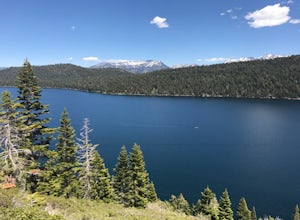
The Tahoe Rim Trail is a must-visit for those seeking scenic outdoor adventures in Tahoe Vista, California. This 165-mile trail offers panoramic views of the crystal-clear Lake Tahoe, the largest alpine lake in North America. The trail is moderately challenging, with some steep ascents and descents, but the breathtaking views of the Sierra Nevada Mountains and Carson Range make it worth the effort. You can also spot unique rock formations and a variety of flora and fauna along the trail. Another top outdoor activity in Tahoe Vista is kayaking on Lake Tahoe. Paddle along the calm, blue waters and enjoy the stunning mountain backdrop. For a more relaxed activity, try fishing in the Truckee River, which is teeming with trout. These are just a few of the best trails and outdoor activities available in and near Tahoe Vista.
Top Spots in and near Tahoe Vista
-
South Lake Tahoe, California
Photograph the Milky Way over Fallen Leaf Lake
Fallen Leaf has been my favorite spot in all of Tahoe since I can remember. The beautiful shoreline sits right up against the base of Mt. Tallac with almost zero light pollution. It is one of my favorite spots to go and shoot the stars. There are tons of spots to pick from depending on what you a...Read more -
South Lake Tahoe, California
Swim at Fallen Leaf Lake
4.0Lake Tahoe has so many beautiful and breath-taking places to visit, hike, camp, wander around, etc. and Fallen Leaf Lake is definitely one of them. It's free to visit and park too and it is an easy hike from the parking area to the lake. The lake is very tranquil and serene and for those who wa...Read more -
Reno, Nevada
Upper Chalk Creek Trail
4.01.44 mi / 121 ft gainUpper Chalk Creek Trail is an out-and-back trail located near Reno, Nevada.Read more -
South Lake Tahoe, California
Ski or Snowboard Heavenly
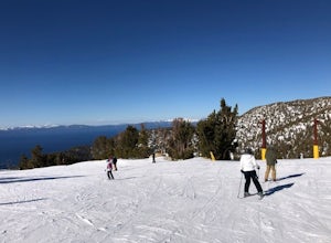
5.0One of the more beautiful resorts in Lake Tahoe to go snowboarding and skiing. Heavenly is situated in South Lake Tahoe on the border of California and Nevada. This ski resort has an amazing view of the lake while going down, as well as one of the largest total areas to ski in Lake Tahoe. This ...Read more -
South Lake Tahoe, California
Hike the Fallen Leaf Lake Trail
5.08.1 mi / 859 ft gainThe Fallen Leaf Lake Trail is located in South Lake Tahoe, California. It is important to note that there is no trail on the east side of the lake. The trail turns into a paved road when you reach the marina after passing the campground. Additionally, lots of small trails jut out from the main tr...Read more -
South Lake Tahoe, California
Hike Mount Tallac
4.99.5 mi / 3255 ft gainThe classic 9½ mile out-and-back day hike to Mount Tallac begins at the trailhead on the southwestern side of Lake Tahoe, between Emerald Bay and Camp Richardson. When driving to the trailhead, make a turn inland at Mt. Tallac Road and follow the well-signed route to the reasonably sized parking ...Read more -
Reno, Nevada
Oxbow Nature Study Area Nature Trail
4.00.77 mi / 23 ft gainOxbow Nature Study Area Nature Trail is a loop trail that takes you by a river located near Reno, Nevada.Read more -
Reno, Nevada
Rattle Snake Mountain
4.01.49 mi / 371 ft gainRattle Snake Mountain is an out-and-back trail that takes you past scenic surroundings located near Reno, Nevada.Read more -
Reno, Nevada
Peavine Peak Trail
3.08.89 mi / 2913 ft gainPeavine Peak Trail is a loop trail where you may see beautiful wildflowers located near Reno, Nevada.Read more -
Reno, Nevada
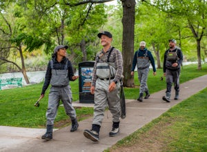
Fly Fish the Truckee River from Wingfield Park
At just 121 miles long from Lake Tahoe to Pyramid Lake, the Truckee River continues to produce the largest trout in the Lower 48. Fly fisherman commonly divide the river into two reaches – East & West, and there is excellent fishing to be found right in downtown Reno all along the Truckee and...Read more -
Reno, Nevada
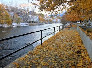
Truckee River Pathway: Downtown to Dorostkar Park
4.04.42 mi / 220 ft gainTruckee River Pathway: Downtown to Dorostkar Park is a point-to-point trail that takes you by a river located near Reno, Nevada.Read more -
Reno, Nevada
May Arboretum and Herman Pond Trail
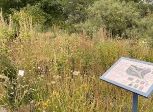
5.01.07 mi / 89 ft gainMay Arboretum and Herman Pond Trail is a loop trail where you may see beautiful wildflowers located near Reno, Nevada.Read more -
South Lake Tahoe, California
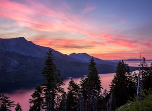
Capture the Sunset at the Angora Ridge Fire Lookout
The Angora Ridge Fire lookout sits above the serene Fallen Leaf Lake with incredible views of Mt. Tallac and Desolation Wilderness. You can hike, bike or drive to the lookout. This is a great spot to photograph the sunset, as the sky will reflect off both Fallen Leaf Lake and Lake Tahoe. Bring a ...Read more -
Reno, Nevada
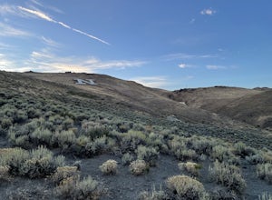
Miners Trail to The "N"
3.51.89 mi / 371 ft gainMiners Trail to The "N" is an out-and-back trail that provides a good opportunity to view wildlife located near Reno, Nevada.Read more -
Reno, Nevada
Hidden Valley County Park Loop
4.04.23 mi / 1207 ft gainThis is the hidden sight of Hidden Valley. Head south down Hidden Valley Drive from Mira Loma and turn right on Mia Vista Drive until you get to the parking lot for Hidden Valley Regional Park. Watch out for wild horses on all roads leading in and throughout your hike. There are hundreds of trail...Read more -
Reno, Nevada
Highland Loop Trail
2.37 mi / 453 ft gainHidden Valley Park is a large, 480-acre regional park in southeast Reno, of which 65 acres are developed that features an extensive trail network along with equestrian grounds, a dog park, playground, and numerous other features. The Highland Loop Trail is a great way to experience the park and ...Read more

