Tahoe Vista, California
Looking for the best hiking in Tahoe Vista? We've got you covered with the top trails, trips, hiking, backpacking, camping and more around Tahoe Vista. The detailed guides, photos, and reviews are all submitted by the Outbound community.
Top Hiking Spots in and near Tahoe Vista
-
Truckee, California
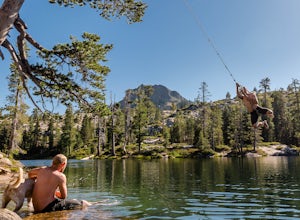
Swim at Long Lake near Truckee
3.71.5 mi / 100 ft gainThe story goes that twenty or so years ago, long before the advent of the Royal Gorge Cross-Country Ski Area, some local Truckee boys decided to put a couple rope swings up on Long Lake near Soda Springs, CA, and they remain there to this day.Long Lake sits amongst a cluster of both man-made and ...Read more -
Truckee, California
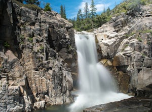
Backpack the Palisades Creek Trail
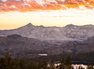
4.015 mi / 2200 ft gainAfter driving out to Kidd Lakes and parking at the trailhead, you take off through some easy forest hiking past Cascade Lakes and Long Lake. Pay attention to the cairns marking the trail as you traverse across a large granite section with Devils Peak to your West. The trail is easy to follow and ...Read more -
Reno, Nevada
Huffaker Park Lookout Trail
4.01.88 mi / 308 ft gainHuffaker Park Lookout Trail is a loop trail where you may see beautiful wildflowers located near Reno, Nevada.Read more -
El Dorado County, California
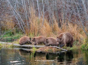
Photograph Black Bears at Taylor Creek, South Lake Tahoe
/ 30 ft gainLake Tahoe is a tourist attraction filled with spectacular views and a plethora of wildlife. However, one species in particular has made a lasting impression on both locals and tourists - black bears. The area around Lake Tahoe is prime bear habitat and cities in the vicinity are seeing a rising ...Read more -
Reno, Nevada
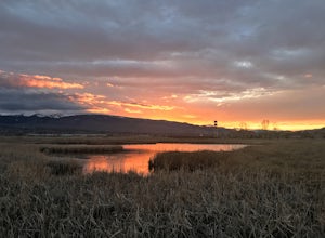
Damonte Ranch Wetland Loop
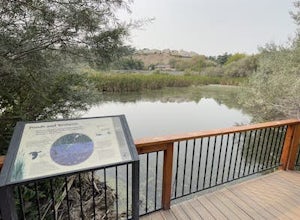
5.03.07 mi / 85 ft gainDamonte Ranch Wetland Loop is a loop trail that takes you by a lake located near Sparks, Nevada.Read more -
Reno, Nevada
Upper Chalk Creek Trail
4.01.44 mi / 121 ft gainUpper Chalk Creek Trail is an out-and-back trail located near Reno, Nevada.Read more -
South Lake Tahoe, California
Hike the Fallen Leaf Lake Trail
5.08.1 mi / 859 ft gainThe Fallen Leaf Lake Trail is located in South Lake Tahoe, California. It is important to note that there is no trail on the east side of the lake. The trail turns into a paved road when you reach the marina after passing the campground. Additionally, lots of small trails jut out from the main tr...Read more -
South Lake Tahoe, California
Hike Mount Tallac
4.99.5 mi / 3255 ft gainThe classic 9½ mile out-and-back day hike to Mount Tallac begins at the trailhead on the southwestern side of Lake Tahoe, between Emerald Bay and Camp Richardson. When driving to the trailhead, make a turn inland at Mt. Tallac Road and follow the well-signed route to the reasonably sized parking ...Read more -
Reno, Nevada
Oxbow Nature Study Area Nature Trail
4.00.77 mi / 23 ft gainOxbow Nature Study Area Nature Trail is a loop trail that takes you by a river located near Reno, Nevada.Read more -
Reno, Nevada
Rattle Snake Mountain
4.01.49 mi / 371 ft gainRattle Snake Mountain is an out-and-back trail that takes you past scenic surroundings located near Reno, Nevada.Read more -
Reno, Nevada
Peavine Peak Trail
3.08.89 mi / 2913 ft gainPeavine Peak Trail is a loop trail where you may see beautiful wildflowers located near Reno, Nevada.Read more -
Reno, Nevada
May Arboretum and Herman Pond Trail
5.01.07 mi / 89 ft gainMay Arboretum and Herman Pond Trail is a loop trail where you may see beautiful wildflowers located near Reno, Nevada.Read more -
South Lake Tahoe, California
Capture the Sunset at the Angora Ridge Fire Lookout
The Angora Ridge Fire lookout sits above the serene Fallen Leaf Lake with incredible views of Mt. Tallac and Desolation Wilderness. You can hike, bike or drive to the lookout. This is a great spot to photograph the sunset, as the sky will reflect off both Fallen Leaf Lake and Lake Tahoe. Bring a ...Read more -
Reno, Nevada
Miners Trail to The "N"
3.51.89 mi / 371 ft gainMiners Trail to The "N" is an out-and-back trail that provides a good opportunity to view wildlife located near Reno, Nevada.Read more -
Reno, Nevada
Hidden Valley County Park Loop
4.04.23 mi / 1207 ft gainThis is the hidden sight of Hidden Valley. Head south down Hidden Valley Drive from Mira Loma and turn right on Mia Vista Drive until you get to the parking lot for Hidden Valley Regional Park. Watch out for wild horses on all roads leading in and throughout your hike. There are hundreds of trail...Read more -
Reno, Nevada
Highland Loop Trail
2.37 mi / 453 ft gainHidden Valley Park is a large, 480-acre regional park in southeast Reno, of which 65 acres are developed that features an extensive trail network along with equestrian grounds, a dog park, playground, and numerous other features. The Highland Loop Trail is a great way to experience the park and ...Read more

