South Gate, California
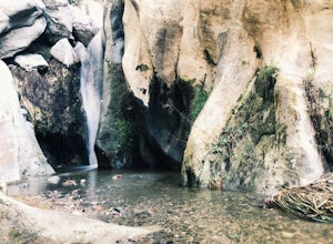
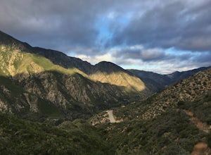
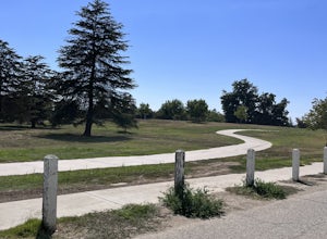
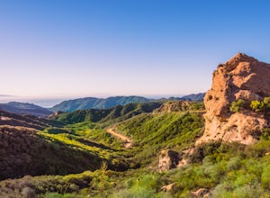
South Gate, California, is a must-visit for the best trails and outdoor activities. One of the top trails is the South Gate Park Bike Trail, a paved, easy-to-navigate path perfect for biking or a leisurely walk. It's surrounded by lush greenery and offers scenic views of the park. For those into fishing or boating, the nearby Lynwood Park Lake is a popular spot. Its calm waters are home to a variety of fish, making it an ideal location for a relaxing day out. If you're looking for a bit more adventure, the Hollydale Park offers a more challenging terrain for mountain biking. With its unique rock formations and clear streams, it's a great place for outdoor adventures. All these attractions are conveniently located in and near South Gate, making it a top destination for those who enjoy the outdoors.
Top Spots in and near South Gate
-
Los Angeles, California
Canyonback Nike Loop
4.06.02 mi / 1693 ft gainCanyonback Nike Loop is a loop trail that takes you by a river located near Encino, California.Read more -
Los Angeles County, California
Idlehour Trail
4.014.89 mi / 4665 ft gainIdlehour Trail located near Mount Wilson, California, is an out-and-back trail that is strenuous and can take 8-10 hours if done all at once. There are opportunities to camp off the trail, making this a backpacking trail in the Angeles National Forest as well. To access the Idlehour Campground ...Read more -
Los Angeles County, California
San Gabriel Peak
4.02.79 mi / 1040 ft gainAt 6,000 feet, San Gabriel Peak gives you one of the best views of the Los Angeles basin on the front range of the San Gabriel Mountains National Monument. As you pass through Muller Tunnel, the trail will be littered with rocks and boulders. A little over 100 feet in, the road will fork in thre...Read more -
Los Angeles, California
Parker Mesa Overlook via Paseo Miramar
4.25.32 mi / 1099 ft gainThis 5.4-mile out-and back trail takes off from the end of the residential area of Paseo Miramar. Once you hike a little less than a quarter mile in, you'll connect with Los Liones Canyon Trail. Continue on Paseo Miramar Trail, which in another 2.5 miles, will connect you with the Parker Mesa Ove...Read more -
Los Angeles, California
Los Liones Trail
5.04.41 mi / 1115 ft gainLos Liones Trail is an out-and-back trail that is moderately difficult located near Pacific Palisades, California.Read more -
Malibu, California
Ratner Beach
4.5Unlike most beaches in Los Angeles, this tiny little stretch of beach is usually empty, and is a little gem! It is the perfect place to get an unobstructed view of the sunset, and the sticks in the ground make for a picturesque sunset picture! Just be warned, this beach is right on PCH, so expect...Read more -
Azusa, California
Fish Canyon Falls
2.04.08 mi / 801 ft gainThis trail is currently closed! Learn more on the U.S. Forest Service website. Follow Encanto Parkway towards the hills until you come to a junction with a sign labeled "trail" that points towards a parking lot to your right. Parking is free, though on weekends it may be difficult to find a spot...Read more -
Los Angeles County, California
Mt. Disappointment via Billy Riley Trail
3.5 mi / 1132 ft gainFrom the 210 Freeway in La Cañada, take California Highway 2 north 14 miles up into the San Gabriel Mountains. Make sure you have your National Forest Pass (sold at REI or Ranger Station) or your Interagency Pass because they have started checking parked vehicles. At the Red Box Picnic area, make...Read more -
Los Angeles County, California
Switzer Falls
3.43.66 mi / 728 ft gainJust off the Angeles Crest highway, you’ll find one of LA’s best waterfalls, Switzer Falls. There is a parking lot just next to the trailhead. If you go on the weekend and run into a crowd, there’s parking near the highway, adding a little distance to your trek. Once you’ve walked through the Sw...Read more -
Los Angeles County, California
Bear Canyon via Switzer Falls Trailhead
6.67 mi / 1273 ft gainParking: Parking is available at the Switzer Falls Picnic Area, or in the two overflow lots on the hill. You will need an Adventure Pass to leave your car parked here. Make sure to follow posted signs - there are some parking spots that do not allow overnight parking. Amenities: Bear Canyon has...Read more -
Altadena, California
Gabrieleno Trail: Switzer Falls to Hahamonga Watershed
5.010.14 mi / 814 ft gainGabrieleno Trail: Switzer Falls to Hahamonga Watershed is a point-to-point trail that takes you by a waterfall located near La Canada Flintridge, California.Read more -
Los Angeles, California
Santa Ynez Falls
3.52.25 mi / 243 ft gainThe Santa Ynez Canyon Trail is located 10 minutes away from the beach providing you the opportunity to do this hike early in the morning and spend the rest of the day hanging out at the beach. To get to the trailhead, take Vereda de la Montura Road until you reach the private residential area (th...Read more -
Los Angeles County, California
Big Tujunga Canyon Lookouts
1.22 mi / 453 ft gainPark at the Condor Peak Trailhead, please note that this trail head is unmarked so keep your eyes peeled on the right side of the turnout for a small single track trail. The trail gradually climbs along the side of the canyon until reaching a 4 way intersection. To your left and to your right wil...Read more -
Los Angeles, California
Sepulveda Basin: Upstream Of Balboa
4.03.7 mi / 75 ft gainSepulveda Basin: Upstream Of Balboa is a loop trail that takes you by a river located near Encino, California.Read more -
Topanga, California
Eagle Rock in Topanga State Park
4.45.99 mi / 1106 ft gainEagle Rock is located in Topanga State Park in the Santa Monica Mountains, and it is a unique formation that provides an amazing panoramic view of Santa Monica. On a clear day, the Catalina Islands and Palos Verdes Peninsula are visible. You can park on along the street of Entrada Rd. or pay $10 ...Read more -
Topanga, California
Parker Mesa Overlook via Trippet Ranch
4.06.75 mi / 1181 ft gainThis is a 6.8 mile round-trip hike that starts at Trippet Ranch in Topanga Canyon. Even though the range in elevation is 400 feet from peak to trough, the up and down trail totals to approximately 1800 feet elevation gain making this a beginner to intermediate adventure. The trail itself is pre...Read more

