Sonoma, California
One of the top outdoor adventures in Sonoma, California is hiking the Sonoma Overlook Trail. This 3-mile round trip trail offers scenic views of the Sonoma Valley and the San Francisco Bay. The trail is moderate in difficulty, making it a must-visit for both beginners and advanced hikers. As you traverse the trail, you'll come across a variety of plant species and wildlife. Another notable feature is the rock formation near the trailhead, a testament to the area's geological history. For those who enjoy water activities, the Russian River is nearby, offering opportunities for kayaking and fishing. The best Trails and Outdoor Activities in Sonoma are a testament to the area's natural beauty and diverse ecosystem.
Top Spots in and near Sonoma
-
San Francisco, California
Bayview Hill Loop
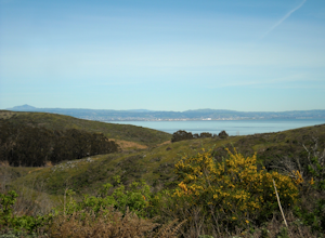
4.01.24 mi / 184 ft gainBayview Hill Loop is a loop trail that starts with a paved uphill climb and views of the bay facing toward the East Bay located in the Bayview neighborhood of San Francisco, California.Read more -
San Francisco, California
Fort Funston Trail
4.71.81 mi / 253 ft gainFort Funston is an SF gem I discovered when looking for a dog friendly hike near the city. Located west of Lake Merced, you'll find a gorgeous Northern California beach oasis where you and your dog can run wild and free :). Parking is located at the top of the park where you'll descend a steep se...Read more -
San Francisco, California
Lake Merced Loop
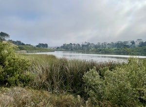
4.74.53 mi / 180 ft gainLake Merced Loop is a loop trail in the southwestern part of San Francisco. This trail is used for running and walking. You'll see plenty of people getting exercise or taking their dog for a stroll. There are also benches and tables around the loop. The lake itself is fresh water and is used for...Read more -
San Francisco, California
San Francisco Crosstown Trail
5.016.71 mi / 1975 ft gainThe San Francisco Crosstown Trail runs point-to-point from Candlestick Point to Land End. The SF Crosstown Trail officially opened in 2014. It connects park trails to neighborhoods and communities. In it's in entirety it's almost 17 miles long with 5 Sections available for those looking to bre...Read more -
Walnut Creek, California
Camp at Juniper Campground in Mount Diablo SP
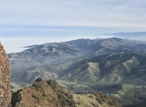
Mount Diablo's summit in Mount Diablo State Park rises to 3,848ft, with Juniper Campground in Mount Diablo SP is at approximately 3,000ft in elevation. Juniper Campground overlooks the valley below and some of the San Francisco Bay. Reservations for Juniper Campground can be made at Reserveamer...Read more -
Walnut Creek, California
Juniper to the Summit Loop Trail and Meridian Ridge
6.56 mi / 2037 ft gainJuniper to the Summit Loop Trail and Meridian Ridge is a loop trail that is strenuous located near Diablo, California.Read more -
Daly City, California
San Bruno Mountain
4.03.63 mi / 781 ft gainSan Bruno Mountain is a fun, mellow hike that climbs easily on a well-graded path to the ridge line, and then drops back to the trailhead. Along the way, the trail runs along a creek, ascends through chaparral, and provides excellent views of downtown San Francisco, the East Bay hills, and the Sa...Read more -
Danville, California
Summit Mount Diablo via Rock City Trail
5.07.8 mi / 2299 ft gainAlthough steep in sections, this trail is a wonderful workout and hikers are more than rewarded for their efforts. The Rock City Trail is a direct route to the summit of Mount Diablo, and the park is an ecological treasure dear to the hearts of Bay Area residents. The best views are on clear days...Read more -
Danville, California
Hike in Mount Diablo's Madrone Canyon
2.8 mi / 550 ft gainThis hike starts at the Rock City area of Mount Diablo State Park. Begin at the Madrone Canyon Trail, hiking southeast towards the Devils Slide trail. Along this section of the hike, the trail dips into a wooded canyon and follows the path of a small creek. To best experience the beauty of the cr...Read more -
Daly City, California
Mussel Rock Loop
4.01.95 mi / 322 ft gainMussel rock, a three-story, 50 million year old rock that has been carried some 500 miles northwest from Southern California, is where the San Andreas fault meets the Pacific Ocean. It's also an excellent spot to drink some wine and catch a sunset. From San Francisco, take Highway 1 south towar...Read more -
Castro Valley, California
Lake Chabot Regional Park Loop
4.08.65 mi / 1263 ft gainLooking for a fun day on a lake, but don't want to drive too far? We recommend heading out to the East Bay where you can combine a nice hike with an afternoon of fishing. This moderately challenging hike remains scenic throughout the 8.5 mile trek around the lake, and offers many opportunities fo...Read more -
Pacifica, California
Milagra Overlook Trail
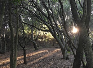
5.02.51 mi / 558 ft gainFound this hike with some friends after spending some time googling in my car when we were in the area looking for a quick hike with a view! Dog friendly Free parking (but quite limited) Ocean views Known to have gorgeous wildflower blooms (we were not there during this)Porta-potty type toilet...Read more -
Pacifica, California
Fish at Pacifica Pier
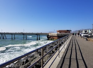
5.0This is a great place for fishing or just taking a walk to watch the sunset. It's a great place to walk or jog, or even bring a pup! There are lot of people fishing throughout the pier. A short walk away is Sharp Park Beach, where you can relax and bring a picnic to watch the sunset.Read more -
Pacifica, California
Picnic at Sharp Park Beach
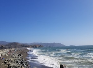
4.0A medium size beach with darker sand with big rocks and a paved path for walkers and joggers. The beach is a great place to bring a picnic and watch the sunset. It is located next to Pacifica Pier, which is popular for fishing.Read more -
Cazadero, California
Bouldering at Fort Ross
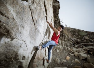
3.0The main boulder is right there on the water. You literally have to watch out for the waves coming up on the shore otherwise they might wipe out your camp. But it's an awesome spot with even more awesome routes. There's also a traverse along the back wall if you're looking for something a little ...Read more -
San Bruno, California
Sweeney Ridge via Sneath Lane
4.53.88 mi / 646 ft gainStarting from the parking lot on Sneath Lane Trail, you’ll head through the gate and continue on the path up Sweeney Ridge. This is a 5.7 mile out-and-back trek. There is a 600 ft. elevation gain, which comes mainly in the first 1.5 miles of the trail. Your legs and lungs may hurt a bit, but if t...Read more


