Sonoma County, California
Looking for the best hiking in Sonoma County? We've got you covered with the top trails, trips, hiking, backpacking, camping and more around Sonoma County. The detailed guides, photos, and reviews are all submitted by the Outbound community.
Top Hiking Spots in and near Sonoma County
-
Sebastopol, California
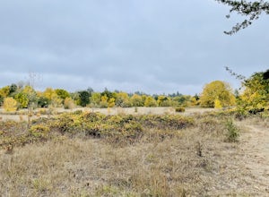
Thistle - Creek Loop
5.01.45 mi / 69 ft gainThe Thistle - Creek Loop is a loop trail at Ragle Ranch. This trail is used for hiking and running and offers some cover/shade as well as great views of foliage especially in the fall months. This trail is located near Sebastopol, California.Read more -
Larkfield-Wikiup, California
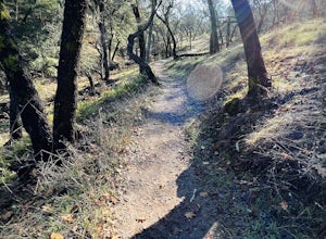
Creekside Trail to Canyon Trail to Ridge Trail Loop
4.04.46 mi / 850 ft gainCreekside Trail to Canyon Trail to Ridge Trail Loop is a loop trail that takes you through a nice forest located near Santa Rosa, California.Read more -
Novato, California
Mount Burdell Open Space Loop
4.87 mi / 1234 ft gainStart at the wide gravel parking lot. You will find the start of the San Andreas Fire Road on the south side leading up the mountain. The San Andreas Fire Road heads up the southern slope before joining the Middle Burdell Fire Road and then very quickly the Deer Camp Fire Road. Keep your eyes p...Read more -
Calistoga, California
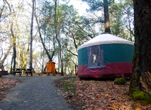
Camp at Bothe-Napa Valley SP
4.5Looking for a romantic getaway but you’d prefer to spend your nights around a campfire? This adventure is for you. This beautiful Napa Valley campground has it all – 10 miles of hiking trails, 1,900 acres to explore, and…new yurts! Yurts are basically cool circular tents that allow you enjoy the ...Read more -
Novato, California
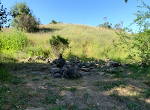
North Levee Trail
3.78 mi / 157 ft gainNorth Levee Trail is a loop trail where you may see wildflowers located near Novato, California.Read more -
Napa, California
Alston Park Loop Trail
2.76 mi / 184 ft gainAlston Park Loop Trail, located in Napa, California, is a 2.76-mile loop trail that offers a moderate level of difficulty for hikers. The trail is primarily used for hiking, walking, and running and is accessible year-round. The trail is well-maintained and clearly marked, making it suitable for ...Read more -
Calistoga, California
Hike the Oat Hill Mine Trail
5.08.3 miThe incline on this trail begins pretty much right away and is fairly gradual for the entire hike, some of it is quite rocky, making this an easy to moderate level hike. However, with some shade (probably wouldn't attempt it on a hot summer day) and the sweeping views of the valley that get bette...Read more -
Calistoga, California
Hike Bald Hill in Robert Louis Stevenson State Park
3.2 mi / 1200 ft gainBald Hill is the first serious peak/summit that can be reached via the Oat Hill Mine Trail as it breaks from the more popular loop and heads into the heart of Robert Louis Stevenson State Park. To get there you can either begin at the less frequently used trailhead at Picket and Rosedale Roads he...Read more -
Napa, California
Westwood Hills Park Loop
4.02.12 mi / 476 ft gainThis park can get a little crowded on weekends, so best to go early if possible. In terms of parking, there's a lot at the trailhead, but also plenty of available street parking. The loop can be broken up in a various ways as there are several offshoots from the main trailhead/trail leaving fro...Read more -
Nicasio, California
Hike and Fish at Nicasio Reservoir
5.03 mi / 300 ft gainNicasio is a quaint town just inland of the more popular coastal town of Point Reyes. It's most known for it's wine country, rolling hills, and the home of Skywalker Ranch, George Lucas's getaway home. Most visitors of this area either pass right on through for Point Reyes or use it's scenic road...Read more -
Novato, California
Schwindt, Indian Valley, and Waterfall Trail Loop
3.51 mi / 594 ft gainSchwindt, Indian Valley, and Waterfall Trail Loop is a loop trail that takes you by a waterfall located near Novato, California.Read more -
Occidental, California
LandPaths Grove of Old Trees
5.00.7 mi / 92 ft gainThe Grove of Old trees is a privately-owned preserve in Western Sonoma County that is open to the public year round. It is not large, only about 33 acres, but it makes a wonderful spot to go on a walk and to soak in the beauty of the redwoods. To get there from downtown Occidental, drive West up...Read more -
Saint Helena, California
Hike the Lake Hennessey Loop
5.06.4 mi / 900 ft gainThe "lollipop" hike starts at the "Ranch House" parking lot off of Chiles Pope Valley Road - alternatively, you can access from Conn Valley Road for a shortened 5.6-mile loop. You turn off Chiles Pope Valley Road onto Moore Creek Trail, drive past a private house (you can see it on the map) and t...Read more -
Inverness, California
Tomales Point Trail
4.79.47 mi / 1165 ft gainThis hike will take you through the Tule Elk Preserve in Point Reyes Nation Seashore, and offers fantastic views of Bodega and Tomales Bay, as well as the Pacific Ocean. Start at the Tomales Point Trailhead near the Historic Pierce Point Ranch. Follow the trail for roughly three miles. This trai...Read more -
Inverness, California
Marshall Beach Trail
5.02.41 mi / 305 ft gainMarshall Beach Trail is an out-and-back trail that provides a good opportunity to see wildlife located near Inverness, California.Read more -
Novato, California
Buck Gulch Falls Trail
5.01.26 mi / 203 ft gainBuck Gulch Falls (also known as Fairway Falls) is an easy, scenic hike that takes you through a beautiful forest on your way to a 15-foot waterfall. This little neighborhood treasure is tucked away in Novato, CA at the end of Fairway Drive and there is ample parking near the trailhead. If you v...Read more

