Soda Springs, California
Soda Springs, California, is a great place to explore. From must-visit parks to unique and memorable experiences, there's something for everyone. Take a hike and explore the area's trails, or take a kayak out on the lake. Head to the nearby ski resort for a day of skiing and snowboarding. For a more leisurely activity, take a drive to explore the area's roads and overlooks. No matter what type of activity you're looking for, Soda Springs has something for everyone. So come explore the best in and near the area!
Top Spots in and near Soda Springs
-
Truckee, California
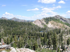
The Five Lakes Hike
4.0The Five Lakes Trail is located in the Granite Chief Wilderness in between Alpine Meadows and Squaw Valley ski resorts and is easily accessible at the intersection of Alpine Meadows and Deer Park roads. The 5-mile moderate trail ascends approximately 900-1000 ft. along granite canyons and pine f...Read more -
Truckee, California
Ski Outer Outer Limits at Alpine Meadows
Starting off of Lakeview chair at Alpine Meadows, head to the far right towards the sign for Outer Limits run. Traverse across the run and past the Ski Area Boundary signs on the far side. Continue through the trees where you will find a series of clearings generally full of untracked powder. The...Read more -
Olympic Valley, California
Hike the Shirley Canyon Cascades Trail
3.6 mi / 2109 ft gainThis trail has lots of elevation over a short distance, be warned! The Shirley Canyon Cascades Trail is close to Olympic Valley in the North Lake Tahoe region. Dogs are allowed on this trail if kept on leash.Read more -
Olympic Valley, California
Hike the Thunder Mountain Trail
5.03.2 mi / 2000 ft gainThe Thunder Mountain Trail is the perfect hike to explore the Squaw Valley Alpine Meadows. Squaw may be famed for its mountain ski runs in the winter, but when the snow melts in the summer, beautiful alpine meadows line the mountain and the ski runs turn into hiking trails! The Thunder Mountain T...Read more -
Placer County, California
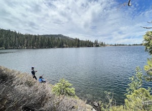
Paddle Lake Valley Reservoir
A perfect adventure spot off Highway 80, Lake Valley Reservoir offers paddlers prime parking and a paved boat launch to push off on a mountain lake with an island for picnicking. Lake speed is 10 mph so fishing boats with outboards are allowed but they have to take it slow. Post launch, head le...Read more -
Truckee, California
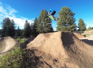
Ride the Truckee Bike Park
5.01 mi / 50 ft gainTruckee bike park is a great destination for all ages of bike riders. There are several different features including a pump track, dual slalom course, dirt jumps, strider track and more! This park is kid friendly but be sure to pack a helmet and pads especially for first-timers. More experienced ...Read more -
Olympic Valley, California
Hike to Lake Estelle and Five Lakes
6 mi / 1000 ft gainThis hike starts at Alpine Meadows Base Camp and finishes on Alpine Meadows Road. The end point is less than a half mile from the base, and an easy walk up a slight hill. Park at base camp and head on the trail to the far right of all of the lifts. Proceed up the trail for half a mile (this is th...Read more -
Nevada City, California
Bowman Road and Meadow Lake Road to Henness Pass
3.035.45 mi / 4895 ft gainBowman Road and Meadow Lake Road to Henness Pass is a point-to-point trail that takes you by a lake located near Alta, California.Read more -
Nevada City, California
Emerald Pools
4.00.68 mi / 49 ft gainEmerald Pools is an out-and-back trail that takes you by a river located near Emigrant Gap, California.Read more -
Tahoe City, California
Ride Twin Peaks in Lake Tahoe's Backcountry
This trip is best done in two days with an approach day and then a descent day. Get started at the base of the Sherwood Chair on the backside of the Alpine ski area. Head up, outside of the ski area boundary toward the high ridge.Once on the ridge, you follow it south for a few miles until reachi...Read more -
Nevada City, California
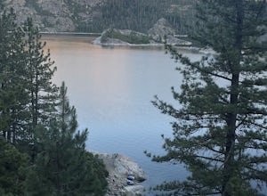
Backpack to Lower Rock Lake
3 mi / 713 ft gainThis adventure begins at the Lindsey Lake Campground parking lot (6,200 feet) where you leave your vehicle, takes you three miles up a trail rife with amazing photo opportunities and seasonal wildlife, and ends on the shore of Lower Rock Lake. Here you will find a dispersed camping site owned by ...Read more -
Tahoe City, California
Purple Trail and Burton Creek Loop
3.76 mi / 492 ft gainBurton Creek State Park is a moderate hike. It is a secluded peaceful hike that offers amazing views of the lake. This is a popular spot for mountain bikers, but is also ideal for hiking. Much of the trail is through the forest and there are many maps and signs pointing out the trails. The hike ...Read more -
Tahoe City, California
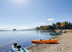
Paddle Commons Beach
5.0Commons Beach is a small beach and park on the northwest side of the lake. It is located very close to the CA-89 exit, so is ideal for road trip stops. There is a park for kids, and a grassy area near the beach. The beach itself is on the smaller side, but is relatively uncrowded. This area of th...Read more -
Tahoe City, California
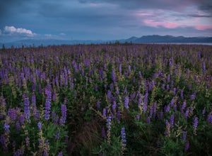
Photograph the Lupine at Lake Forest Beach
A quick walk through Lake Forest Beach in Tahoe City, California provides unparalleled opportunities to photograph expansive fields of lupine. These brilliant purple wildflowers cover the lowland shore of this public beach each summer, typically starting in mid-July through mid-August. In drought...Read more -
Carnelian Bay, California
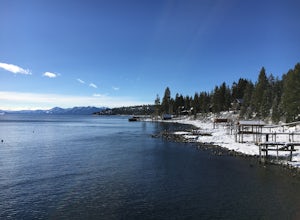
Explore Carnelian Bay
5.0Located on the northwest side of Lake Tahoe, Carnelian Bay is a fun place to spend the afternoon. However, there is no sand at Carnelian Bay as the ground is all large rocks. It's a great place to go swimming or SUPing in the summer, and it has a pier that you can jump off. It is usually less cr...Read more -
Homewood, California
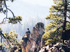
Eagle Rock
4.00.84 mi / 105 ft gainStarting at an outcrop off Highway 89 in Tahoe Pines, hikers make their way up the trail through a gradually sloping forest. Climbing rocks and logs, it is strenuous at times but only takes about 15-20 minutes to accomplish. Once at the top, the elevation is 6,286 feet and consists of an absolute...Read more

