Santa Paula, California
The best Trails and Outdoor Activities in Santa Paula, California offer a variety of top outdoor adventures. The Santa Paula Canyon Trail is a must-visit, known for its scenic beauty. It's a moderate difficulty hike with a stunning waterfall and natural rock slide at the end. This trail also features the Punch Bowls, unique rock formations that are a highlight of the hike. For a more relaxed activity, the Santa Paula Creek offers excellent fishing spots. The creek is home to a variety of fish species and is a popular spot for locals and visitors alike. Nearby, the Los Padres National Forest offers numerous trails for hiking and mountain biking. Its diverse landscape includes towering mountains, deep canyons, and vast wilderness areas, making it a top choice for outdoor activities. For a unique attraction, the Aviation Museum of Santa Paula gives a glimpse into the history of flight with its outdoor displays. It's a must-visit for any history buff. These are just a few examples of the best
Top Spots in and near Santa Paula
-
Ventura, California
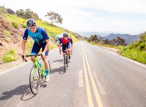
Bike the Lake Casitas Loop
1.048.9 mi / 3635 ft gainThe Lake Casitas Loop s a fantastic cycling trail leading from Ventura, California through Ventura Canyon, around Lake Casitas and up over Casitas Pass, down through Rincon Canyon to the ocean and south on Rincon Trail back to Ventura. It covers almost all of the ecological zones and topographica...Read more -
Ventura County, California
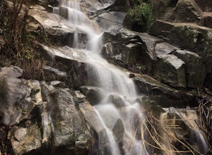
Sycamore Canyon Falls
3.3 mi / 545 ft gain...When arriving in the Santa Monica Mountains Recreational Area, take the drive and park at Sycamore Canyon parking lot. Parking is free and also offers restrooms and some history about the park. Follow the trailhead South until you come to the Satwiwa Culture Center on your left and a dome-like...Read more -
Newbury Park, California
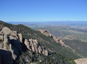
Boney Peak
4.012.04 mi / 3025 ft gainThe hike begins at the parking lot for Rancho Sierra Vista in Newbury Park, CA just outside LA. Pull into the parking lot and walk on the dirt road until you see the trail for Boney Peak. It is easy to find because the peak can be seen from the beginning of the trail. The trail is generally an in...Read more -
Ventura, California
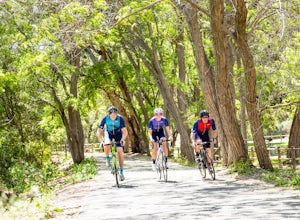
Bike the Ventura River and Ojai Bike Trails
32.6 mi / 1030 ft gainThe Ventura River and Ojai Valley Trail, effectively the same trail, is a gorgeous 32 mile trail that runs from Seaside Park in Ventura to downtown Ojai. It runs along and across the Ventura River and through the Ventura Canyon, with views up and down numerous side canyons and ravines. The trail ...Read more -
Ventura, California
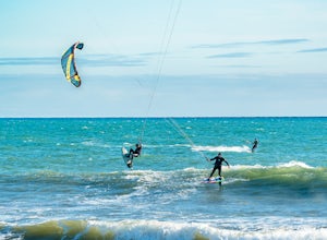
Kiteboard Surfer's Point
Surfer's Point aka Ventura Point is a well-known kite boarding/surfing (and surfing) spot due to its (when conditions are right) great wave quality, favorable wind direction (sideshore with occasional side-off), friendly locals, rider capacity, and a nearby point break with. When conditions are e...Read more -
Ojai, California
Piedra Blanca Formations
5.05.41 mi / 860 ft gainThese white sandstone formations, splitting out of the forest, are a worthwhile sight as you climb up to gain a great vantage point of the valley. Spend some time exploring the rocks - the nooks & crannies are full of surprises. You can turn this into an overnighter by staying at the campgrou...Read more -
Ojai, California
Willett Hot Springs via Sespe River Trail
20.08 mi / 2598 ft gainPark at the Lions Camp parking lot. Adventure Passes aren't technically "required" but it never hurts to have one. You can stop at the Forest Service in Ojai (1190 E. Ojai Ave) or stop at the Wheeler Gorge Station on your way up to buy one for $5 for a night. The trail begins at the far side of t...Read more -
Ojai, California
Climb at Wheeler Gorge
Grab a dozen quick draws, your 60m rope, and head up Highway 33 out of Ojai for 7 miles (One of the routes here describes the crag perfectly, a Riparian Daydream). Drive through one tunnel, and continue on for another mile or two until you reach two tunnels in quick succession. The crag is in bet...Read more -
Emma Wood State Beach, California
Surf Emma Wood State Beach
3.0Park your car along the famous Pacific Coast Highway and watch the waves roll in. Go out surfing, kiteboarding, swimming, or kayaking. Emma Wood State Beach is a fairly exposed beach and reef break that has reliable surf. Summer offers the most-favored conditions for surfing. Both breaks get cro...Read more -
Malibu, California
Hike Point Mugu Peak
4.52 mi / 1250 ft gainPoint Mugu State Park offers some amazing rolling mountains, sweeping meadows of tall grass, and beautiful coastal views. I suggest going in the spring. I recently went, and the wildflowers were blooming everywhere. There are campgrounds available in different parts of the park that you can make ...Read more -
Malibu, California
Hike Mugu Peak Loop via Chumash Trail
5.06.5 mi / 1255 ft gainFrom the parking lot at the trailhead, follow the steep trail going up the mountain. This part is quite challenging, so I recommend stretching out your legs before starting the hike. Once you reach the top, you will see your first junction. Go right if you want to go straight for the peak, and th...Read more -
Malibu, California
Grotto Trail
2.64 mi / 492 ft gainWho doesn't enjoy a hike that offers water, scenic views, boulder hopping and a subterranean cave? I know I do! The Grotto Trail begins at Circle X Ranch, which looks a bit like a small cowboy western store, and is approximately 6 miles from the Highway 1 (PCH). The parking is a tad tight, fittin...Read more -
12869 Yerba Buena Road, California
Mishe Mokwa Trail to Sandstone Peak
5.07.06 mi / 1755 ft gainTake Yerba Buena road to the trailhead. It is less zigzagged and shorter distance from PCH. Parking is easy provided that you start early in the morning. If the lot is full, you can always park on the side of the road. Bathroom is available at Sandstone Peak Trailhead parking lot, just 0.8 miles ...Read more -
Malibu, California
Sandstone Peak
4.83.03 mi / 971 ft gainIf you live in Los Angeles, Sandstone Peak is a must! The hike to the summit can be done on a 2 mile hike up and back on Sandstone Peak Trail, or a 6.5 mile hike up and back on Backbone Trail. The shorter trail is more popular, yet both are equally rewarding. You won't believe the views from the...Read more -
Malibu, California
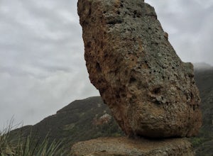
Balanced Rock via Sandstone Trailhead
5.04.36 mi / 1125 ft gain...From the PCH, make a left turn on Yerba Buena road (turn right if you're coming South) for about 6 miles until you get to the dirt parking area. If the lot is full, there's extra parking on the side of the road. FYI, Balanced Rock can also be accessed by starting at the Mishe Mokwa trailhead,...Read more -
Westlake Village, California
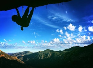
Climb at Echo Cliffs
1.3 miThe hike to the crag is about 1.3 miles one way and takes roughly 45 minutes. The approach starts at the Backbone / Mishe Mokwa trail head off Yerba Buena Rd. After walking a couple minutes you'll see a sign pointing left for the backbone trail or straight for Mishe Mokwa. Continue straight and ...Read more

