Santa Monica, California
Looking for the best fitness in Santa Monica? We've got you covered with the top trails, trips, hiking, backpacking, camping and more around Santa Monica. The detailed guides, photos, and reviews are all submitted by the Outbound community.
Top Fitness Spots in and near Santa Monica
-
Los Angeles, United States
Verdugo Crest Trail
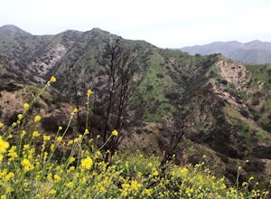
4.06.71 mi / 2510 ft gainThe Verdugo Crest Trail is a 6.6 mile loop near Glendale, California. The trail features lovely wildflowers in the spring and beautiful views year-round. The trail is steep, so make sure you are wearing sturdy running or walking shoes. Dogs are allowed on the trail but must be kept on leash. Va...Read more -
Burbank, California
Old Youth Camp Loop
2.59 mi / 732 ft gainThe Old Youth Camp Loop is a 2.6-mile loop with over 700 feet of elevation gain that can be ran, hiked, or even mountain biked if you prefer. While not completely empty the area receives very little visitors and is a great place to enjoy a little more solitude than near by hiking locations. The l...Read more -
Agoura Hills, California
Ladyface Peak
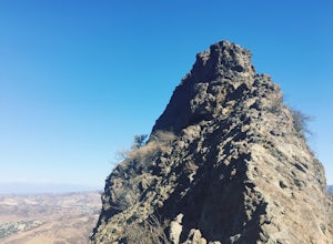
4.52.05 mi / 971 ft gainLadyface is a volcanic ridge that juts up over Agoura Hills. It is a short but steep hike up the ridgeline, and it offers amazing views to either side. Sections of the trail are steep and sandy so it can be challenging to maintain your footing. Trekking poles are optional and can help with the de...Read more -
Los Angeles, California
City View and Walnut Forest Trails Loop
4.02.59 mi / 568 ft gainThe City View and Walnut Forest Trails in Ernest E. Debs Regional Park are just outside of downtown Los Angeles, and are perfect for all abilities. The trails are most commonly used by dog walkers, trail runners, mountain bikers and families. The top of the hike features a unique pond. Dogs are a...Read more -
Malibu, California
Hike the Backbone East from Latigo Canyon
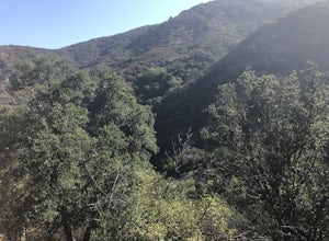
3.8 mi / 780 ft gainStarting in a dusty, generally empty parking lot, at about 2,000' ASL, you'll go immediately due north, up a few more feet before you drop down into another canyon covered in live oaks (and poison oak), thistles, ferns, and wildflowers. There's only one trail. It's windy, it's not hilly, it just ...Read more -
Glendale, California
Beaudry Loop
5.79 mi / 1572 ft gainThe Beaudry Loop trail features a bench at the top with 360 degree views of the greater LA area. The trailhead is a little hidden on Beaudry Blvd. As Beaudry Blvd turns into Beaudry Terrace, you'll see cars parked at the paved trailhead. There is very little shade on the trail so bring ample sun...Read more -
Pasadena, California
Central Arroyo Seco Community Recreation Loop
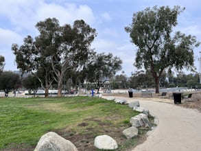
5.00.66 mi / 36 ft gainBeautiful views of the Rose Bowl and surrounding San Gabriel Mountains. A protected .75 mile loop, that offers an easy path, to stroll along. You’ll find convenient water filling stations, clean bathrooms, and a fitness area, along the path. Easy parking all around.Read more -
Stevenson Ranch, California
Hike the Towsley Canyon Loop
4.75.1 mi / 1340 ft gainThe Towsley Canyon Loop can be done in either a clockwise or counter-clockwise loop. The clockwise path starts with a gradual ascent through Wiley Canyon and steep descent into the Towsley Gorge while a counter-clockwise route starts with a steep climb out of Towsley Canyon and a gradual descent ...Read more -
Whittier, California
Sycamore Canyon Trail in Turnbull Canyon
2.03.47 mi / 627 ft gainThe Sycamore Canyon Park Trailhead can be found at the end of the dirt parking lot off Workman Mill Road. The entrance is off a small road which is pretty easy to miss, but there is a sign off the main road. Soon after you start on the trail, the path opens up onto a larger dirt road for vehicle ...Read more -
Malibu, California
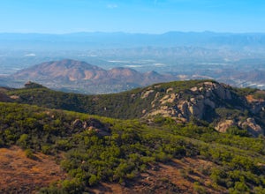
Sandstone Peak
4.83.03 mi / 971 ft gainIf you live in Los Angeles, Sandstone Peak is a must! The hike to the summit can be done on a 2 mile hike up and back on Sandstone Peak Trail, or a 6.5 mile hike up and back on Backbone Trail. The shorter trail is more popular, yet both are equally rewarding. You won't believe the views from the...Read more -
Malibu, California
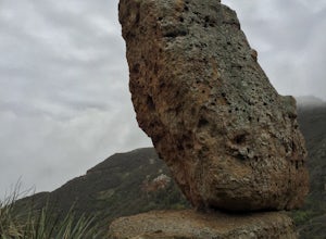
Balanced Rock via Sandstone Trailhead
5.04.36 mi / 1125 ft gain...From the PCH, make a left turn on Yerba Buena road (turn right if you're coming South) for about 6 miles until you get to the dirt parking area. If the lot is full, there's extra parking on the side of the road. FYI, Balanced Rock can also be accessed by starting at the Mishe Mokwa trailhead,...Read more -
Whittier, California
Hellman Park Trail
3.04 mi / 850 ft gainThis trail is great if you're looking for a quick, but intense workout. The hike itself is only 4 miles out- and-back and can be easily completed within a couple of hours. However, be prepared for a steep and steady incline for the first 1.5 miles. The trail itself is pretty wide, and if you sho...Read more -
Long Beach, California
Red Car Greenbelt
5.00.63 mi / 0 ft gainThe Greenbelt used to be the right-of-way for the long lost Pacific Electric Red Car, an amazing system of public transportation that connected Long Beach, LA, Orange Coutny, and even San Bernardino. The pathways are landscaped with plants typical of the area and plenty of native flowers for the...Read more -
Long Beach, California
Colorado Lagoon
5.00.95 mi / 30 ft gainThe Colorado Lagoon is a wetland that is being restored. To make this 1 mile walk into a loop, you have to walk along sidewalks near the park. This is a very kid-friendly destination. This trail crosses over the lagoon on a boardwalk. It also accesses a sandy swimming beach with restrooms, picnic...Read more -
Los Angeles County, California
Mt. Disappointment via Billy Riley Trail
3.5 mi / 1132 ft gainFrom the 210 Freeway in La Cañada, take California Highway 2 north 14 miles up into the San Gabriel Mountains. Make sure you have your National Forest Pass (sold at REI or Ranger Station) or your Interagency Pass because they have started checking parked vehicles. At the Red Box Picnic area, make...Read more -
Huntington Beach, California
Bolsa Chica Ecological Reserve Trail
4.72.97 mi / 30 ft gainThe Bolsa Chica Ecological Reserve Trail is great for birding and wildlife viewing. If you want a longer hike, you can extend the mileage by heading down the riverbed trail. The trail is open year-round. Dogs are not allowed in Bolsa Chica. Bolsa Chica State Beach is easily accessible from Oran...Read more

