San Mateo County, California
Looking for the best hiking in San Mateo County? We've got you covered with the top trails, trips, hiking, backpacking, camping and more around San Mateo County. The detailed guides, photos, and reviews are all submitted by the Outbound community.
Top Hiking Spots in and near San Mateo County
-
Boulder Creek, California
Hike the Ocean View Summit Loop
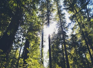
4.06 mi / 600 ft gainThis hike begins at the Big Basin park headquarters. If you're up for 6 miles through giant redwoods and along serene creeks, and with an ocean view, then this is the hike for you. Ocean view summit loop starts on the Gazos Creek Road bridge, next turn right on to the Middle Ridge Fire Road, whic...Read more -
Boulder Creek, California
Big Basin's Sunset Trail Camp
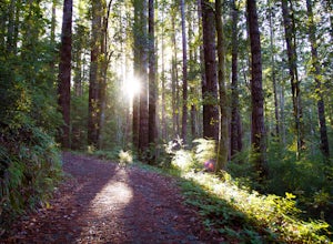
4.89.46 mi / 2146 ft gainThis trail and campsite is currently closed (learn more). Looking for a more authentic hiking and camping weekend, without having to drive hours away to find it? Then the Sunset Trail Camp within Big Basin Redwoods SP is your ticket. To access this site, you'll need to hike the famous Skyline-to...Read more -
Boulder Creek, California
Hike to Sempervirens Falls
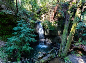
4.02.1 mi / 100 ft gainThe hike to Sempervirens Falls is an easy 2.1 mile out-and-back hike on the Sequoia Trail. You'll travel through the redwood forest and some of the campgrounds located in Big Basin State Park. The hike is pleasant but on occasion, you'll be too close to the road to feel like you're deep in the wi...Read more -
Rancho San Antonio Open Space Preserve, California
Hike Deer Hollow Farm Trail
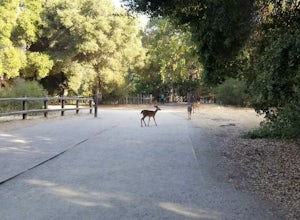
4.02.7 mi / 259 ft gainRancho San Antonio Open Space Preserve has many beginner to intermediate hiking trails. Deer Hollow Farm Trail Loop is a hiking trail for beginners, families, or anyone wanting to go on a short hike with nice views of the bay. The trail passes by a farm and deer can often be seen wandering aroun...Read more -
Half Moon Bay, California
Hike Along the Half Moon Bay Coastal Trail
4.65 mi / 104 ft gainStart at the visitor center along Kelly Avenue. Take note that the day parking fee is $10 in 2016 for each vehicle. You will then be able to enjoy both the Coastside Trail and Francis Beach (plus other beaches) with access to the amenities such as coin-operated showers and a semi-private beach.Th...Read more -
Los Gatos, California
Hike the Saratoga Gap Trail
4.64.7 miThe Saratoga Gap Trail is relatively lightly trafficked trail that is good year round, although waterfalls peak in late winter and spring. Overall, this 4.7 mile partial loop hike is moderate, with about 1000 feet in elevation change. Trailhead elevation is about 3090 feet. The featured hike desc...Read more -
Saratoga, California
Backpack Castle Rock State Park
4.7Castle Rock Trail Camp has a different policy than other backcountry camps in the area (i.e. campsites along Skyline to the Sea). This campground is open all year and is available on a first come, first served basis. If you can, grab a spot a Frog Flat Camp. To get to the camp, park your car at t...Read more -
Saratoga, California
Hike the Seven Springs Trail Loop
2.8 mi / 500 ft gainThe Seven Springs loop is only one great option of several in the preserve. Starting from the Prospect Rd parking lot the loop is 2.8 miles of rolling hills in and out of the shade. Most of the trail is at least 2 person width so easy to walk with a friend or furry companion. There have been larg...Read more -
Belmont, California
Hike San Mateo's Sugarloaf Mountain
5.01.5 mi / 500 ft gainSugarloaf is tucked away in Laurelwood Park which is located in a residential neighborhood right off of Hwy 92 in San Mateo, making this a great hiking & trail running option for Peninsula residents.I always park on Glendora Dr. and follow the paved path down towards the playground. At the bo...Read more -
Sanborn County Park, California
Hike Sanborn County Park via the San Andreas Trail
4.04.2 mi / 1282 ft gainThis is a moderately rated 4.2 mile trail that winds through the redwoods west of Saratoga. It features a dirt trail with tall trees and a creek. The hike is very tranquil and there is lot s of greenery. There are big rocks in the creek that can you can sit on. People often meditate here as i...Read more -
San Mateo County, California
Run Sawyer Camp Trail
5.012 mi / 300 ft gainThe Sawyer Camp Trail is a popular paved trail that stretches alongside the Crystal Springs Reservoir all the way to Hillcrest Blvd. The sixth mile crosses over the San Andreas Dam with nice views of San Andreas Lake.There are markers every half mile which makes timing and tracking your run easy....Read more -
Half Moon Bay, California
Catch the Sunset at Maverick's Beach
5.01 miMaverick's beach is most well-known for the Maverick surf competition and the gnarly waves which surface here in the winter months. For the rest of the year, the beach is still a site to see. With huge waves crashing ¼ mile off shore and bluffs towering 100 feet above you, it’s a picturesque plac...Read more -
Davenport, California
Hike around Greyhound Beach and Climb Greyhound Rock
0.7 mi / 0 ft gainThe trailhead is at the Greyhound Rock State Marine Conservation Area which is directly off Highway 1. There is a large paved parking lot with a good amount of trees so finding a shady parking spot isn't that difficult (if that's important to you). The parking lot is located on the beach cliffs ...Read more -
Moss Beach, California
Pillar Point Bluff Loop
4.71.84 mi / 154 ft gainSitting on a 140 acre bluff top, the Pillar Point Bluffs are a simple, easy hike with breathtaking views throughout. The bluffs are 22 miles from San Francisco – a 30 minute drive depending on the traffic. There is a small 10 car or so parking lot off of Airport Blvd, but there are two additional...Read more -
Moss Beach, California
Cypress Tree Tunnels at Moss Beach
4.50.79 mi / 105 ft gainThe Cypress Tree Tunnels are a quick jaunt from San Francisco (22 miles) and make for a great half-day trip. Getting here depends on traffic, but 30 minutes from the center of the city is doable. Parking is relatively easy. You can either park at the south end of the area at the Cypress Cove entr...Read more -
Moss Beach, California
Fitzgerald Marine Reserve
5.00.89 mi / 46 ft gainLocated beside a residential neighborhood, Fitzgerald Marine Reserve offers a rare glimpse of life in the northern California intertidal zones. There are parking spaces and restrooms available, as well as ranger-led guided tours. Be sure to check the tide charts and go during low tide (preferab...Read more

