San Martin, California
Top Spots in and near San Martin
-
Davenport, California
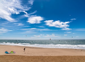
Kitesurf Waddell Beach
4.0Just north of Santa Cruz at the far west end of Big Basin State Park, Waddell Beach offers one of California's top spots for kiteboarding. Each spring and summer, you'll find consistent northwesterly afternoon sea breezes. With the added bonus of consistent waves from wind and ground swell, Wad...Read more -
Pacific Grove, California
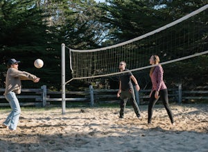
Play Volleyball at Asilomar Conference Grounds
Asilomar translates to “refuge by the sea,” a phrase that accurately depicts the Asilomar Conference Grounds. The area started as a YWCA women’s empowerment camp in 1913 and has since transitioned into a well-preserved state beach. It is located in the beautiful Monterey Peninsula. If you find y...Read more -
Pacific Grove, California
Catch Sunset on Asilomar State Beach
Asilomar, or “refuge by the sea” definitely lives up to its name. The beach is expansive and less-populated than other nearby destinations. With large sandbars and rocky outcroppings, it is a great place to enjoy sunset. This beach is also known for its premium surf, so expect a show from the lo...Read more -
Pacific Grove, California
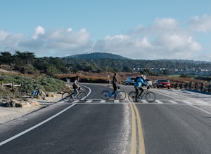
Bike at Asilomar State Beach
At Asilomar State Beach, adventure is accessible in many forms. I had the opportunity to rent a bike from Adventures by the Sea. Rentals start at $25, and while you are not permitted to ride along the boardwalk that leads you to the beach, you may walk your bike through the exquisite sand dunes A...Read more -
Pacific Grove, California
Exploring Asilomar's Ancient Sand Dunes
4.0Asilomar State Beach covers 107 acres of land. It is home to a delicate ecosystem that has been sustained through the years after it was almost destroyed. The intricate dunes at Asilomar are what have survived after the over-grazing back in the early 1900's that damaged about 480 acres of dunes. ...Read more -
Pacific Grove, California
Spanish Bay Trail
5.02.8 mi / 78 ft gainSpanish Bay Trail is an out and back trail that takes you past scenic views located near Monterey, California.Read more -
Palo Alto, California
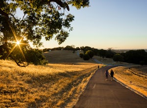
Hike the Arastradero Preserve Loop
3.04.5 mi / 600 ft gainGetting There: From Hwy 280, take the Page Mill Road exit and head West on Page Mill Road, away from Downtown Palo Alto (if you're taking 101, exit on Oregon Expressway). Then turn right on Arastradero Road. There will be a small sign indicating the dirt parking lot on the eastern side of the str...Read more -
Fremont, California
Lake Elizabeth Loop
3.02.1 mi / 69 ft gainLake Elizabeth is located in central Fremont. It offers a nice break from the city streets and can be enjoyed by walkers, joggers, and bikers alike. It is a park for all ages. Other attractions include volleyball nets, multiple playgrounds, and aqua adventure park, geese, and peddle boats. ...Read more -
Stanford, California
Sunset Picnic at Kite Hill
4.0Kite Hill is nothing more than what the name describes. A simple ascent less than 100 feet in elevation. But that 100 feet is all you need to feel like you discovered a little escape from the buzz below.To get there, you can park directly at the base of Kite Hill along Peter Coutts Rd and simply ...Read more -
Stanford, California
Stanford Dish Loop
4.43.67 mi / 472 ft gainIf you live in the Palo Alto area and are looking for a place to hike or run, The Dish is a close, and great way to get that exercise. Located right on the corner of Stanford Ave and Junipero Serra, you'll see that small gated entrance right when you drive on by. As far as parking goes, you're le...Read more -
Livermore, California
Hike the East Shore Trail Loop
3.7 mi / 1040 ft gainThis hike is best done during the spring, fall, or winter when moderate temperatures make the hike more comfortable. Be warned that this hike has a large elevation change despite being less than 4 miles. Starting at the Arroyo Road Staging Area, take the East Shore Trail east, heading towards a s...Read more -
La Honda, California
Hike the Brook Trail Loop
7.1 mi / 1500 ft gainThe Brook Trail Loop is a beautiful hike, starting off in Sam McDonald County Park and later entering into Pescadero Creek County Park. This adventure can be done in any season, with the trails almost entirely shaded for even the hottest summer days. Starting off from the Heritage Grove trailhead...Read more -
Del Monte Forest, California
Relax at Spanish Bay
Spanish Bay is a beach with a view point at the southern tip. You can see waves crashing into rocks and the many different shades of blue. This is a great spot for anyone exploring 17 Mile Drive, as it is scenic and perfect for picnics. There is a golf course nearby that offers some of the mos...Read more -
Pescadero, California
Pick Berries at Swanton's Berry Farm
Take a spectacularly scenic drive or bike ride out to this quaint coastal berry farm. Look out onto the shimmering ocean while you pick the ripest and sweetest berries yourself. Head inside their shop to enjoy pre-made jams, pies, chocolate covered strawberries, and so much more. While you're ins...Read more -
La Honda, California
Sam McDonald Park Loop
5.012.19 mi / 2192 ft gainThe Pescadero Creek Park Complex is a great place to escape for a day or overnight hike in the heart of the Bay Area. You will need to get a permit to stay overnight - these can be attained on a first-come, first-serve basis from the ranger station. Most of the campsites here are also available f...Read more -
Portola Valley, California
Hike the Windy Hill Loop
4.37.2 mi / 1400 ft gainThis 7.2-mile loop starts by heading out of the parking lot and onto the Spring Ridge Trail. Head Southeast On Spring Ridge Trail until you connect with Hamms Gulch Trail. When you jump on Hamms Gulch, head southwest for ~3.4 miles as you circle the far end of the OSP. At this point, you will con...Read more

