San Jose, California
Looking for the best hiking in San Jose? We've got you covered with the top trails, trips, hiking, backpacking, camping and more around San Jose. The detailed guides, photos, and reviews are all submitted by the Outbound community.
Top Hiking Spots in and near San Jose
-
Loma Mar, California
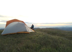
Camp Under the Redwoods at Memorial Park
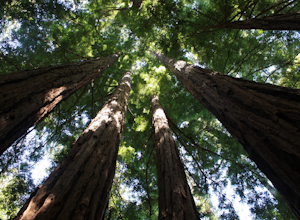
With old growth redwoods and a creek swimming area, Memorial Park is a perfect escape from the hustle and bustle of the Bay Area. Memorial Park is only a few miles east of the town of Pescadero. To get here, you can either approach from Highway 1 and drive up Pescadero Creek Road or take Highway ...Read more -
Pleasanton, California
Courdet Trail and Schuhart Trail
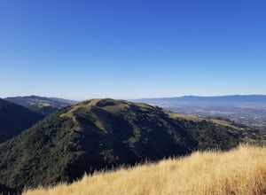
5.24 mi / 1122 ft gainThis is a 5+ mile out and back trail through the hills in the South Bay. The beginning of the hike has a steeper incline and then becomes more gradual later on. There is a beautiful views of the South Bay that are enjoyable in the day, but are fantastic in the evening. Some areas of the trail hav...Read more -
Redwood City, California
Hike or Bike the Old Growth Redwood Loop at El Corte de Madera
4.48.8 mi / 1900 ft gainThis hike starts at the middle parking lot of the El Corte de Madera Open Space Preserve. The middle lot is located roughly a mile south on Skyline Boulevard from the Skeggs Point Vista. From the parking lot, take the Methuselah Trail for 0.3 miles until you reach the Timberview Trail. Take this ...Read more -
Redwood City, California
Hike the Crystal Springs Trail Loop
5.6 mi / 1300 ft gainThis is a great hike for any season of the year, with rushing streams during the winter, wildflowers in the spring, and cool, shaded canyons during the summer. Starting from near the Zwierlein Picnic area, take the Crystal Springs to the left into the redwood forest. Stay straight at the next tra...Read more -
Gilroy, California
Redfern Pond via Hunting Hollow
5.07 mi / 1263 ft gainHenry W. Coe State Park, northern California's largest, provides outdoor enthusiasts with over 89,000 acres of land to explore, as well as 22,000 acres of designated wilderness area. With all of this space, the outdoor adventures are seemingly endless. We recommend a multi-day backpacking trip to...Read more -
Redwood City, California
Hike the Pulgas Ridge Open Space Preserve Loop
3.75.5 mi / 1000 ft gainGetting there: exit Highway 280 at Edgewood Road, travel .75 miles east, turn left on Crestview Drive, then immediately left again on Edmonds Road.Once parked, there are several different path options through the park. All of them connect in a large loop, and return to the parking lot. The Cordil...Read more -
Santa Cruz, California
Hike Natural Bridges to Lighthouse Field
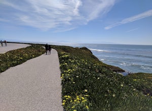
3.54.8 mi / 121 ft gainThis is a paved trail that can be used for hiking, jogging, or walking. It offers over 2 miles of beautiful California coast. Walk through flowers, see the jagged cliffs, and of course the lighthouse at the end! This walk can be done from either direction. Start at Natural Bridges and head We...Read more -
Pescadero, California
Camp at Butano State Park
Butano State Park definitely flies under the radar. But for those who love quick escapes, small crowds, fun hikes, and beautiful redwoods, it's a favorite. The park features miles of hiking trails, 21 drive-in campsites and 18 walk-in campsites. Restrooms with running water are provided. Drinking...Read more -
Pescadero, California
Hike the Little Butano Creek Trail
1.5 miThis short hike follows Little Butano Creek through a lush redwood forest. The trail crosses the creek multiple times as you walk over redwood pine needles and through pockets of ferns. Dogs can join on this trail, but must be on leash.Read more -
Davenport, California
Hike around Greyhound Beach and Climb Greyhound Rock
0.7 mi / 0 ft gainThe trailhead is at the Greyhound Rock State Marine Conservation Area which is directly off Highway 1. There is a large paved parking lot with a good amount of trees so finding a shady parking spot isn't that difficult (if that's important to you). The parking lot is located on the beach cliffs ...Read more -
Redwood City, California
Hike the Methuselah and El Corte De Madera Creek Loop
6.2 mi / 1800 ft gainThis loop hike will provide people with the opportunity to experience the tranquility of the lower canyons of the preserve, which tend to be more isolated than the heavier-trafficked trails that are closer to the main highway. Be warned that this hike is fairly strenuous because of the large amou...Read more -
Pescadero, California
Año Nuevo and Goat Trail Loop
4.03.76 mi / 761 ft gainThis steep and winding trail takes you to the top of a ridge where you can see the Pacific coastline and the redwoods piercing through the forest canopy. To do this trail connect the Ano Nuevo Trail, Olmo Fire Road, Goat Trail and the Six Bridges Trail. If you don't have all day to do the Canyon ...Read more -
Pescadero, California
Hike the Canyon Rim Route in Butano State Park
5.011.7 miLocated deep within the Santa Cruz Mountains, Butano State Park boasts a large redwood canyon with many miles of hiking trails as well as campsites. This state park is one of the quietest and least visited parks on the peninsula making a perfect place to escape the hustle of the Bay Area Butano S...Read more -
Redwood City, California
Hike Purisima Creek Redwoods OSP
4.67 miThere are two places to park for this specific loop- the main parking area on Highway 35 (Skyline Boulevard) and a smaller parking lot on the western end of the park. I would recommend parking at whichever is closest. Find directions to both on Openspace.org. From the main parking lot, the trail ...Read more -
Redwood City, California
Hike Whittemore Gulch at Purisima Creek Redwoods OSP
4.09.3 mi / 2109 ft gainThis trail starts out going downhill towards the ocean for the first half, which makes for a tough end to the hike as you trek back up the ridge. However, there are nice ocean and hilltop views that are worth the climb. On this trail, you'll pass 60+ banana slugs if conditions are right. They ar...Read more -
Half Moon Bay, California
Purisima Creek Trail and Craig Britton Trail Loop
4.06.95 mi / 1411 ft gainThis hike is perfect for any time of year, always staying cool because it is near the coast, and there are multiple creeks that flow year-round. Even on foggy days, the fog condenses on trees to make it seem like it is "raining." Be warned that this hike has a lot of elevation change and is stre...Read more


