San Francisco, California
Looking for the best photography in San Francisco? We've got you covered with the top trails, trips, hiking, backpacking, camping and more around San Francisco. The detailed guides, photos, and reviews are all submitted by the Outbound community.
Top Photography Spots in and near San Francisco
-
Bolinas, California
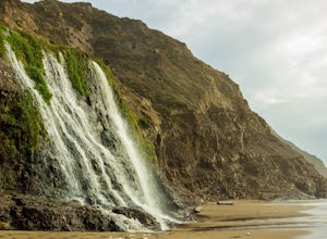
Alamere Falls via Palomarin Trailhead
4.513.54 mi / 1614 ft gainAlamere Falls is the tallest waterfall in the bay area. It is known as a tide fall because it empties directly into the Pacific Ocean. This is extremely unique because there are only 34 tide falls in the world and two in California, the other being McWay Falls in Big Sur. Enjoy stunning views of...Read more -
Bolinas, California
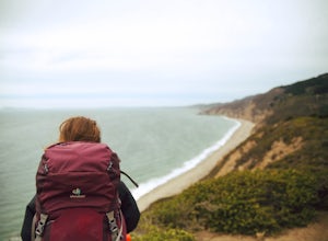
Point Reyes' Wildcat Camp via Coast Trail
5.011.19 mi / 1926 ft gainIn order to make this trip possible, go to recreation.gov and make a reservation for Wildcat Camp (available year-round). On your way to the trailhead, make sure to stop by the Bear Valley Visitor Center to grab your camping permit. For more information, visit: http://www.nps.gov/pore/planyourvis...Read more -
Bolinas, California
Glen Camp Loop via the Palomarin Trailhead
4.715.72 mi / 3091 ft gainDay 1 Before heading to the trailhead, make sure to stop by the Bear Valley Visitor Center to pick up your permit. To stay overnight in Point Reyes, you must stay at one of the trail camps. Camping anywhere else in the park is not allowed. Permits for the trail camps can be booked up to 6 mo...Read more -
Bolinas, California
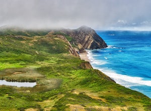
Backpack to Coast Camp in Point Reyes via Palomarin Trailhead
20.5 mi / 2705 ft gainSpanning from just north of the small town of Bolinas (about an hour north of San Francisco) across Inverness ridge and to the top of Tomales Point, Point Reyes National Seashore is as stunning park featuring breathtaking ocean views and solitude among the grassy hillsides and forested ridges. Th...Read more -
Redwood City, California
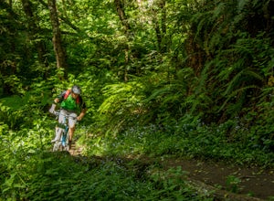
Mountain Bike at Purisima Creek
This beautiful mountain bike ride can be started at the Purisima Creek Road Trailhead or on Skyline Boulevard. There are many trails in the Purisisma Creek Redwoods, but Whittemore Gulch is by far the most beautiful and fun single track to descend on. If you are starting from Skyline Boulevard, i...Read more -
Half Moon Bay, California
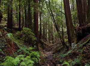
Purisima Creek Trail and Craig Britton Trail Loop
4.06.95 mi / 1411 ft gainThis hike is perfect for any time of year, always staying cool because it is near the coast, and there are multiple creeks that flow year-round. Even on foggy days, the fog condenses on trees to make it seem like it is "raining." Be warned that this hike has a lot of elevation change and is stre...Read more -
Half Moon Bay, California
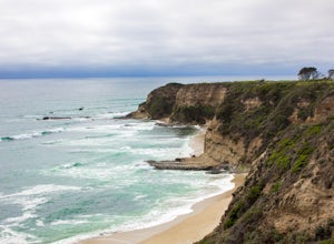
Bike the Cowell-Purisima Coastal Trail
4.0This trail begins at the Cowell State Beach parking lot and is only open on the weekends. From the lot, take the short Cowell Ranch Access trail to a scenic overlook. There are steps down to the secluded pocket beach just above the main trail. The trail playfully meanders along the cliffside with...Read more -
San Geronimo, California
Roys Redwood Preserve Loop
5.02.37 mi / 430 ft gainRoy's Redwoods Preserve is an easily missed pocket of Redwoods off Nicasio Valley Road in Marin County. Don't miss it: heading North on Sir Francis Drake Blvd turn right onto Nicasio Valley Rd--the gate for this little park is about a half mile up on the right. From the main entrance you enter a ...Read more -
Redwood City, California
Hike the Crystal Springs Trail Loop
5.6 mi / 1300 ft gainThis is a great hike for any season of the year, with rushing streams during the winter, wildflowers in the spring, and cool, shaded canyons during the summer. Starting from near the Zwierlein Picnic area, take the Crystal Springs to the left into the redwood forest. Stay straight at the next tra...Read more -
Novato, California
Buck Gulch Falls Trail
5.01.26 mi / 203 ft gainBuck Gulch Falls (also known as Fairway Falls) is an easy, scenic hike that takes you through a beautiful forest on your way to a 15-foot waterfall. This little neighborhood treasure is tucked away in Novato, CA at the end of Fairway Drive and there is ample parking near the trailhead. If you v...Read more -
Redwood City, California
Hike the Methuselah and El Corte De Madera Creek Loop
6.2 mi / 1800 ft gainThis loop hike will provide people with the opportunity to experience the tranquility of the lower canyons of the preserve, which tend to be more isolated than the heavier-trafficked trails that are closer to the main highway. Be warned that this hike is fairly strenuous because of the large amou...Read more -
Redwood City, California
Hike or Bike the Old Growth Redwood Loop at El Corte de Madera
4.48.8 mi / 1900 ft gainThis hike starts at the middle parking lot of the El Corte de Madera Open Space Preserve. The middle lot is located roughly a mile south on Skyline Boulevard from the Skeggs Point Vista. From the parking lot, take the Methuselah Trail for 0.3 miles until you reach the Timberview Trail. Take this ...Read more -
Woodside, California
Hike through Wunderlich County Park
5.04.5 mi / 1400 ft gainLocated in the iconic Silicon Valley town of Woodside, Wunderlich County Park offers a number of hiking trails as well as some horseback riding trails through the wilderness. Once in the parking lot, you will see a number of stables, riding ring, as well as a beautiful historic stable that was o...Read more -
Half Moon Bay, California
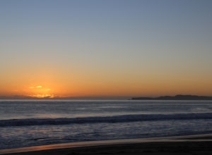
Watch the Sunset at Martin's Beach
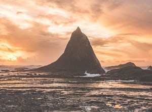
4.5Martin's Beach is a beach about 7 miles south of Half Moon Bay. It features a large, very cool looking rock formation right off the coast. This beach is accessible via Martin's Beach Road, which is a small turn off on your right when southbound on Highway 1, though sometimes the road is only open...Read more -
Walnut Creek, California
Run the Mt. Diablo Foothill Loop
5.06.2 mi / 875 ft gainContinue by car down Castle Rock Road until it dead ends at the beginning of the trail. Parking is usually easy to find. If full, there is another overflow lot about 500 ft back the way you came in.You'll walk a good half mile down the trail before getting the main gate. As you're walking, you'll...Read more -
Point Reyes Station, California
Bear Valley to Coast Camp Loop
5.016.18 mi / 2818 ft gainPermit and Trail Camp Info To stay overnight in Point Reyes, you must stay at one of the Trail Camps. Camping anywhere else in the park is not allowed. Permits for the Trail Camps can be booked up to 6 months in advance. If you are looking to go on a weekend, then you'll want to start loo...Read more

