Ross, California
Looking for the best hiking in Ross? We've got you covered with the top trails, trips, hiking, backpacking, camping and more around Ross. The detailed guides, photos, and reviews are all submitted by the Outbound community.
Top Hiking Spots in and near Ross
-
Mill Valley, California
Kirby Cove
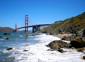
4.72 miThis scenic hike is a 1.8 mile out-and-back trail located near Sausalito, CA. From the trail and beach, you'll get scenic of the Golden Gate, San Francisco's skyline, and glimpses of the East Bay. The best news, there's rarely any crowd. Consider packing a blanket and a small picnic. With panora...Read more -
Lagunitas, California
Bolinas Ridge Loop
10.27 mi / 1568 ft gainNestled in the Samuel P. Taylor State Park this ten miler was a perfect escape from the chaos of the city. Hikers are able to pay a $10.00 park entry fee that includes plenty of parking spaces and restrooms before you hit the trail. The hike starts along the Cross Marin Trail, a path popular to ...Read more -
Bolinas, California
Alamere Falls via Palomarin Trailhead
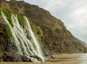
4.513.54 mi / 1614 ft gainAlamere Falls is the tallest waterfall in the bay area. It is known as a tide fall because it empties directly into the Pacific Ocean. This is extremely unique because there are only 34 tide falls in the world and two in California, the other being McWay Falls in Big Sur. Enjoy stunning views of...Read more -
Bolinas, California
Point Reyes' Wildcat Camp via Coast Trail
5.011.19 mi / 1926 ft gainIn order to make this trip possible, go to recreation.gov and make a reservation for Wildcat Camp (available year-round). On your way to the trailhead, make sure to stop by the Bear Valley Visitor Center to grab your camping permit. For more information, visit: http://www.nps.gov/pore/planyourvis...Read more -
Bolinas, California
Bass Lake via Palomarin Trailhead
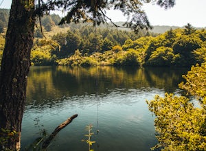
4.26.11 miFollow the Coast Trail from Palomarin Trailhead to Bass Lake. It's a fairly easy ~2.5-3 miles to the Lake. As soon as you pass the lake, on the left you will see a narrow unmarked dirt trail. Take this trail and you'll get to a nice clearing with easy lake access (this will be a great spot for lu...Read more -
Bolinas, California
Glen Camp Loop via the Palomarin Trailhead
4.715.72 mi / 3091 ft gainDay 1 Before heading to the trailhead, make sure to stop by the Bear Valley Visitor Center to pick up your permit. To stay overnight in Point Reyes, you must stay at one of the trail camps. Camping anywhere else in the park is not allowed. Permits for the trail camps can be booked up to 6 mo...Read more -
Bolinas, California
Backpack to Coast Camp in Point Reyes via Palomarin Trailhead
20.5 mi / 2705 ft gainSpanning from just north of the small town of Bolinas (about an hour north of San Francisco) across Inverness ridge and to the top of Tomales Point, Point Reyes National Seashore is as stunning park featuring breathtaking ocean views and solitude among the grassy hillsides and forested ridges. Th...Read more -
Novato, California
North Levee Trail
3.78 mi / 157 ft gainNorth Levee Trail is a loop trail where you may see wildflowers located near Novato, California.Read more -
Richmond, California
Explore Point Pinole Shoreline
5.0Point Pinole Regional Shoreline is a 2,315-acre parkland that juts out into the San Pablo Bay. Only a brief car ride from San Francisco, this is a great spot for a Sunday stroll, picnic or simply to find a quiet space.There are several short trails to choose from that wind through eucalyptus grov...Read more -
San Francisco, California
Batteries to Bluffs Trail
4.82.33 mi / 417 ft gainThe Batteries to Bluffs Trail in the Presidio is a true gem of San Francisco. It has everything you could want in a hike: a sea-side path along the ocean, relatively easy parking, gorgeous views of the Golden Gate Bridge, and a secluded beach that's perfect for picnics, sunbathing, and enjoying t...Read more -
Novato, California
Mount Burdell Open Space Loop
4.87 mi / 1234 ft gainStart at the wide gravel parking lot. You will find the start of the San Andreas Fire Road on the south side leading up the mountain. The San Andreas Fire Road heads up the southern slope before joining the Middle Burdell Fire Road and then very quickly the Deer Camp Fire Road. Keep your eyes p...Read more -
San Francisco, California
Mile Rock Beach
4.71.64 miThis rocky, secluded beach is tucked in along the Land’s End Coastal Trail in the Golden Gate National Recreation Area. Located 100 or so steps down from the main trail, you’ll find this mysterious little beach that will make you feel like you’re in an old pirate movie. There are a lot of logs an...Read more -
San Francisco, California
Lands End Trail
4.73.26 mi / 500 ft gainThe Lands End Trail is a 3.26 mile out-and-back hike located in the northwest corner of San Francisco along the city's rugged coastline. Offering spectacular views of the Golden Gate Bridge, Marin Headlands, and the Pacific Ocean, the hike is one of the most popular trails in San Francisco for ...Read more -
Richmond, California
Hike the Wildcat Canyon Loop
4.010.5 mi / 2300 ft gainStarting off on Wildcat Creek Trail, the trail is wide and rolling. After about 4 miles make a left on Jewel Trail, then onto Sylvan Trail. Another left puts you on Wildcat Peak Trail. Be sure to check your map, as many trails intersect here. Wildcat Peak Trail runs into Nimitz Way, at which poin...Read more -
San Francisco, California
Presidio Bay Area Ridge Trail
5.02.73 mi / 203 ft gainPresidio Bay Area Ridge Trail is a point-to-point trail where you may see wildflowers located near San Francisco, California.Read more -
San Francisco, California
Presidio Ecology Trail
5.01.82 mi / 427 ft gainPresidio Ecology Trail is a loop trail through the Presidio located near San Francisco, California. This loop can be started at the Upper Ecology Trail off of Arguello Blvd near Pacific or down at the Lower Ecology Trail near the Inn at the Presidio. This trail is dog friendly on-leash.Read more


