Pioneertown, California
Looking for the best hiking in Pioneertown? We've got you covered with the top trails, trips, hiking, backpacking, camping and more around Pioneertown. The detailed guides, photos, and reviews are all submitted by the Outbound community.
Top Hiking Spots in and near Pioneertown
-
Palm Springs, California
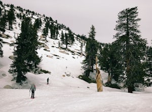
Winter Climb San Jacinto from the Tram
5.08 mi / 2400 ft gainIntermediate: No snow.Advanced: Lots of snow.Expert: Snow w/ high winds and low temps. GPX: https://www.gaiagps.com/datasu... San Jacinto, at 10,834 feet, is the second-highest peak in the Southern California. It's unique in that it has a rotating tram car (think slow motion disco floor) that r...Read more -
Palm Springs, California
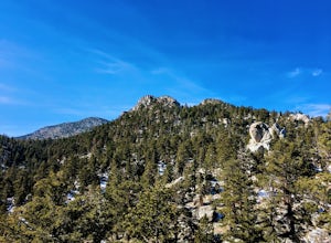
Scramble Cornell Peak
3.5 mi / 1000 ft gainEntering Mt San Jacinto State Park via the Palm Springs Aerial Tram is one of the easiest ways to get into the wilderness area. Purchase your ticket and ride to the station where you'll be able to walk out the backdoor and onto the trail. In order to get to Cornell, your route finding skills wil...Read more -
Palm Springs, California
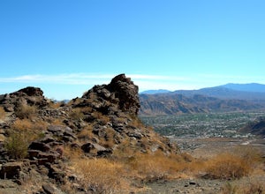
Museum Trail
1.52 mi / 860 ft gainThe Museum Trail is a very steep climb with a 1,000 feet elevation gain in just one mile but has some great views of downtown Palm Springs. The hike starts behind the Palm Springs Art Museum. This trail can also access the Cactus to Clouds Trail that goes all the way to the top of Mt. San Jacinto...Read more -
Palm Springs, California
Skyline Trail to Aerial Tramway Top Station
5.09.41 mi / 8238 ft gainSkyline Trail to Aerial Tramway Top Station is a point-to-point trail where you may see beautiful wildflowers located near Palm Springs, California.Read more -
Twentynine Palms, California
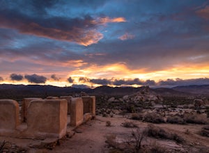
Ryan Ranch
0.75 mi / 56 ft gainIf you're in Joshua Tree, this is a great spot for sunset. A short, maybe 1/2 mile hike to the old ranch from the parking lot. We stayed at Ryan Campground and just walked in from there, about the same distance. Make sure to bring your camera, especially if there are spotty clouds in the sky a...Read more -
Forest Falls, California
Vivian Creek Trail to San Gorgonio Peak
17.83 mi / 5627 ft gainVivian Creek Trail to San Gorgonio Peak is an out-and-back trail that takes you by a waterfall located near Forest Falls, California.Read more -
Big Bear, California
Alpine Pedal Path
5.05.08 mi / 292 ft gainAlpine Pedal Path is an out-and-back trail that takes you by a lake located near Big Bear Lake, California.Read more -
Riverside County, California
Hike Ryan Mountain
4.82.86 mi / 1056 ft gainOne of the most prominent peaks in Joshua Tree National Park in Ryan Mountain. It's centrally located rising to a total of 5,456 feet above the valley floor. The trail to the peak is a moderate hike with a little over 1,000 feet elevation gain with panoramic views of Lost Horse Valley, Queen Vall...Read more -
Riverside County, California
Winter Hike to Ryan Mountain
2.86 mi / 1056 ft gainHike starts at the base of Ryan Mountain. The trail runs along side the mountain, offering great views overlooking Joshua Tree. Once you hit the summit, you'll get great panormaic views of the national park as the top of Ryan Mountain is at an elevation of 5457ft. The trail is open during all se...Read more -
Desert Hot Springs, California
Inspiration Peak in Joshua Tree
1.81 mi / 425 ft gainMost automobile-bound visitors to Joshua Tree make their way to Keys View, and why wouldn't they? It has some of the best views in the park and with it, some of the biggest, loudest crowds. Most don't realize that a short hike away is even *better* views and, if you're lucky, solitude, on top of ...Read more -
Big Bear, California
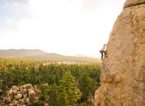
Rock Climb Holcomb Valley
5.0Most of the drive to Holcomb Valley is done on regular paved roads until about the last hour when you get above Big Bear Lake and you start your journey on dirt roads. The road is extremely bumpy and has lots of pot holes but there are generally quite a few cars up there that don't have 4 wheel d...Read more -
Riverside County, California
Hike to Lost Horse Mine
4.09 mi / 545 ft gainTo get to the trailhead, take Key's View Road from Park Blvd for around 2.5 miles and turn left onto a dirt road. The trailhead is at the end of this road. From here, you have the option to do the 6.1 mile loop or the 4 mile roundtrip out and back. This trail takes you through a beautiful desert ...Read more -
Palm Springs, California
South Carl Lykken Trail - North Section
3.42 mi / 1076 ft gainSouth Carl Lykken Trail - North Section is an out-and-back trail that takes you by a waterfall located near Palm Springs, California.Read more -
Palm Springs, California
South Lykken Trail to Simonetta Kennett Viewpoint
3.66.45 mi / 1654 ft gainThe South Lykken Trail is the south half of the 9.5-mile Carl Lykken Trail, which weaves along a series of mountain ridges above downtown Palm Springs. Dogs are not permitted on this trail. This section of the trail runs 3.2 miles one-way. You will gain just over 1600ft of elevation at the high...Read more -
Big Bear, California
Holcomb Valley Campground
This campground is awesome! With great views, plenty of space and clean bathrooms it'll have you in for a treat! Whether it be a multiple day trip or just one night this campground is awesome. Read below for information if you are looking for a trip in the mountains! Cost: This campground is a ...Read more -
Big Bear, California
Cougar Crest Trail
5.05.57 mi / 892 ft gainOn the north side of Big Bear Lake, just off the 38, you will find a turn off for the Cougar Crest Trail. The parking lot is well marked, and signs for the trailhead are easy to spot. Parking is not an issue if you come in later in the afternoon, but the hike can get crowded during peak hours. Fo...Read more

