Oxnard, California
Oxnard, California is home to some of the best trails and outdoor activities. A must-visit is the Channel Islands Harbor, a scenic waterfront featuring boating, kayaking, and paddleboarding. For hikers, the Santa Clara River Trail is a top choice. This 8-mile trail offers views of unique rock formations, the flowing Santa Clara River, and abundant birdlife. It's an easy to moderate hike, making it suitable for families. If you're a fan of birdwatching, McGrath State Beach is a top spot, housing over 245 bird species. For beach lovers, Silver Strand Beach is a gem with its pristine sand and clear waters. Enjoy swimming, surfing, or a relaxing beach walk. Oxnard is indeed a hub for outdoor adventures.
Top Spots in and near Oxnard
-
Topanga, California
Red Rock Canyon to Calabasas Peak
4.04.53 mi / 1004 ft gainWhen you get to the parking lot be sure to pay the $5 parking fee. You will need to place this in the provided envelope and drop it in the iron ranger. Start the hike by following the fire road behind the gate. About a couple of yards in, you will see a trail on your left which leads to a ghoul...Read more -
Ventura, California
Prisoner's Cove to Scorpion Anchorage
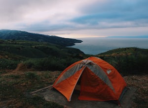
5.013.19 mi / 2474 ft gainTo get to Santa Cruz Island you will need to book a ferry with Island Packers. On their website, you can only book roundtrip tickets in and out of the same location so for this trip you will need to call and book a ferry into Prisoner's Harbor and out of Scorpion Anchorage. You can call them at (...Read more -
Ventura, California
Chinese Harbor via Prisoners Harbor
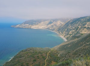
14.11 mi / 2703 ft gainThe hike to Chinese Harbor is a 14-mile out-and-back hike from Prisoners Harbor on Santa Cruz Island or a much more manageable 8-mile out-and-back hike from Del Norte backcountry campground. If you are spending the day on the island courtesy of Island Packers, a trek to Chinese Harbor might be di...Read more -
Maricopa, California
Camp and Boulder at Pine Mountain
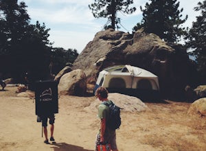
Pine Mountain is closed intermittently for the winter season due to snowfall, usually from November through February. Outside of those months, take the Highway 33 north out of Ojai, heading north for about an hour and a half. You’ll see a large turnout as well as a sign reading “Pine Mt Road” on ...Read more -
Montecito, California
Saddle Rock Loop
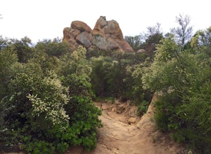
4.03.37 mi / 984 ft gainBegin at the trailhead in the parking area on E. Valley Road. You'll gain some elevation (don't forget your water). You'll know when you arrive at Saddle Rock--you can't miss this conspicuous rock formation. Enjoy the sights from here. If you plan carefully and hike up on a clear day, you may eve...Read more -
Montecito, California
Cold Spring Trail Loop
5.02.67 mi / 883 ft gainCold Spring Trail Loop is a loop trail that takes you by a river located near Santa Barbara, California.Read more -
Montecito, California
Tangerine Falls
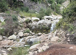
4.51.15 mi / 886 ft gainThis waterfall can be fairly dry during the year, so keep your eyes out for a recent rainstorm to get things going. When you start the hike on East Folk Trail, at 0.25 miles, cross over the creek and join West Fork Trail. A little over another half mile, West Fork starts to head uphill, but you c...Read more -
Montecito, California
West Fork of Cold Spring Trail
3.45 mi / 1135 ft gainIf you love the mountains above Santa Barbara but hate the crowds, stick to the canyon trails on the east side. The trails running up Cold Spring canyon offer a variety of experiences without all the noise. To find the West Fork of Cold Spring Trail, take the Olive Mill Rd. exit from the 101 fre...Read more -
Los Angeles, California
Hike up Chatsworth Park North
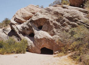
1 miFrom the parking lot, make your way through the park until you reach the bottom of a hill filled with huge rocks and boulders. It is very hard to miss.From here, you can pick any trail you wish. They will all lead up to the top. There's a lot of rock scrambling involved, as well as boulder hoppin...Read more -
Los Angeles, California
Stoney Point Park Loop
4.00.73 mi / 141 ft gainOnce you've parked along Topanga Canyon Blvd, make your way down the street and start the trail off near the steel gate, close to the horse stables. As you make your way in, you will notice some rock climbers practicing on the lower elevation rocks. Make your way around this rocky park, counter-...Read more -
Topanga, California
Top of Topanga Overlook
1 mi / 1613 ft gainThe Top of Topanga Overlook is where you can simply park your car, and sit in one of the benches to view the San Fernando Valley. But there is one hiking trail in that area which lets you get better vantage points, as well as a quick workout. Once you get to the overlook, park your car and safel...Read more -
Topanga, California
The Labyrinth at Tuna Canyon Park
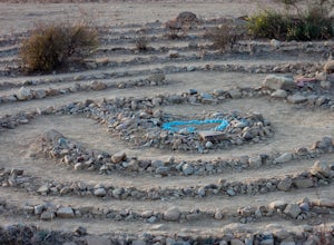
1.45 mi / 299 ft gainThis is a simple but steep 2.4 mile round-trip hike to a clearing on a mountaintop in Topanga/Malibu, about an hour's drive west of downtown LA. At the end of the hike you'll reach a clearing with incredible views. On a cloudy or foggy day, it feels like you're floating above the clouds; on a cle...Read more -
Los Angeles, California
Stoney Point via North End
4.01.42 mi / 240 ft gainStoney Point via North End is an out-and-back trail where you may see local wildlife located near Chatsworth, California.Read more -
Maricopa, California
Bear Trap Campground via Gene Marshall/Piedra Blanca Trail
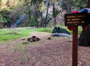
9.59 mi / 2211 ft gainThere's no better feeling then camping out and having a whole site to you and your friends...wouldn't you agree?!?! ...Deep in the Sespe Wilderness in Ojai, California sits a tucked away, well-managed campsite called "Bear Trap Campground". This campsite can be reached at any point of the year a...Read more -
Topanga, California
Eagle Rock in Topanga State Park
4.45.99 mi / 1106 ft gainEagle Rock is located in Topanga State Park in the Santa Monica Mountains, and it is a unique formation that provides an amazing panoramic view of Santa Monica. On a clear day, the Catalina Islands and Palos Verdes Peninsula are visible. You can park on along the street of Entrada Rd. or pay $10 ...Read more -
Topanga, California
Parker Mesa Overlook via Trippet Ranch
4.06.75 mi / 1181 ft gainThis is a 6.8 mile round-trip hike that starts at Trippet Ranch in Topanga Canyon. Even though the range in elevation is 400 feet from peak to trough, the up and down trail totals to approximately 1800 feet elevation gain making this a beginner to intermediate adventure. The trail itself is pre...Read more

