O'Brien, California
The best trails and outdoor activities in O'Brien, California offer a variety of scenic adventures. One of the top attractions is the Boulder Creek Falls trail. This 5.5-mile hike is moderately difficult with a stunning waterfall as the payoff. The trail winds through lush forest, past unique rock formations, and along the banks of Boulder Creek. Another must-visit is the Bailey Cove Trail. This easy 3.1-mile loop is ideal for bird watching and offers views of Shasta Lake. For those interested in fishing, the nearby Sacramento River is a top spot for rainbow trout. O'Brien also offers opportunities for rafting and kayaking. Whether you're a hiker, angler, or just someone seeking outdoor adventures, O'Brien, California has something for you.
Top Spots in and near O'Brien
-
Dunsmuir, California
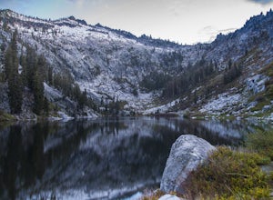
Heart Lake Trail From Castle Lake
5.02.46 mi / 719 ft gainHeart Lake Trail From Castle Lake is an out-and-back trail where you may see beautiful wildflowers located near Dunsmuir, California.Read more -
Dunsmuir, California
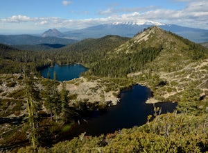
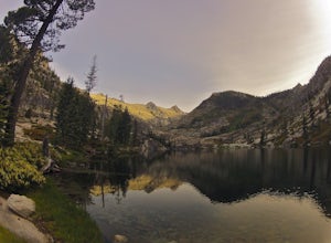
Hike to Heart Lake in the Klamath Mountains
4.52.2 mi / 600 ft gainScenes like this are rarely so accessible. Heart Lake is nestled in a bowl below Castle Peak, on the edge of the Castle Crags Wilderness just west of I-5 and the city of Mt. Shasta. The parking lot and trailhead are both located on the shore of Castle Lake, a much larger lake that is stunning in ...Read more -
Trinity Center, California
Backpack Stuart Fork to Emerald and Sapphire Lake
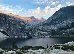
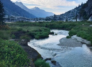
25 mi / 4448 ft gainThe Stuart Fork to Emerald and Sapphire Lakes trail features many beautiful lakes, meadows, and an area that resembles a jungle. Dogs are able to use this trail. This trail can be done as a day hike, an overnight, or a three-day backpacking trip. If you choose to make it a three day, the meadows ...Read more -
Trinity Center, California
Stuart Fork Trail to Emerald and Sapphire Lakes
5.027.06 mi / 4213 ft gainThe trail begins just past the Trinity Alps Resort, a private collection of cabins near Weaverville, CA. Hikers wanting an early start can spend the night at the Bridge Camp Campground, located next to the trailhead. The path starts out wide and level, following an old road to the wilderness bou...Read more -
Trinity Center, California
Stuart Fork to Alpine Lake
16 mi / 4265 ft gainNestled in the heights of the Trinity Alps, this hike to Alpine Lake is not for the faint of heart. Before embarking on this adventure call the Weaverville Ranger station to check snow levels as well as the flow of the Stuart Fork River. If you are too early in the summer season the snowpack wi...Read more -
Trinity Center, California
Stoddard Lake
5.07.01 mi / 1325 ft gainThe trail is a bit rocky, so wear sturdy hiking boots or trail runners. While your elevation gain is only 800 total, you will travel upwards of 1,982ft in elevation given the ups and downs of the trail. At mile 1.75, there is a spring that feeds into a large meadow. At mile 3, there is another sp...Read more -
Douglas City, California
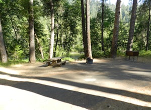
Camp at Steel Bridge Campground
Steel Bridge is located along the Trinity River. About three miles east of Douglas City on State Highway 299, turn north onto Steel Bridge Road and go about 2 miles to the campground.This campground is open from Mid-May until winter weather forces closure. The campground is home to 12 camping s...Read more -
McCloud, California
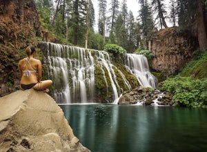
Middle McCloud Falls
4.82.49 mi / 243 ft gainJust 4 hours north of San Francisco, McCloud Falls offers a quick hike and swimming hole for those looking for something less crowded than Burney Falls. McCloud Falls has 3 tiers, but the middle section offers the best views by far. Getting Here To get here, park at the Fowlers Campground which...Read more -
McCloud, California
McCloud Middle Falls Short Trail
3.00.79 mi / 85 ft gainMcCloud Middle Falls Short Trail is located near McCloud, California. This route makes for an abbreviated version of the longer Middle McCloud Falls adventure which is 2.5 miles roundtrip. The parking area has an established parking lot and a vault toilet. The shorter trail with minimal elevati...Read more -
Douglas City, California
Camp at Douglas City Campground
The campground amenities include 20 tent/trailer campsites, group picnic area, picnic tables, telephone, beach, paved loop road, flush and vault toilets, potable water, and fire rings. MAX trailer length is 28 feet.Douglas City is located along the Trinity River. Follow State Highway 299 to Dougl...Read more -
Forks of Salmon, California
Hike to the Caribou Lakes, Shasta-Trinity Alps
4.016 mi / 3000 ft gainHike through the most majestic and unforgettable mountain ranges, alpine terrains, glacier lakes outside of the Sierra Nevada in Northern California. Yes, it's a long drive there and a lengthy hike, but if you have any doubts about whether this is worth the effort, just go! I struggled with the s...Read more -
Shasta County, California
Magee Peak & Crater Peak
7.19 mi / 2887 ft gainThe trail to Magee Peak and Crater Peak makes for a fairly strenuous hike (mostly due to altitude). This USFS out-and-back trail has incredible views of the major peaks in the Northern California & Southern Oregon. Take in a spectacular close-up of Lassen NP and great views of Shasta, Castl...Read more -
Junction City, California
Canyon Creek Lakes
4.314.35 mi / 2605 ft gainNumerous starting points with over 550 miles of trail and easily 50+ different featured trails depending on length and what type of activity you are are looking for. One of the more popular trails, and rightfully so, is Canyon Creek Lakes Trail. This 16 mile roundtrip hike has an overall elevatio...Read more -
Junction City, California
Scramble Thompson Peak
4.022.7 mi / 6100 ft gainThis adventure begins at the Canyon Creek Lakes in the Trinity Alps wilderness. Park at the Canyon Creek Trailhead near Junction City and hike the well-maintained and easy-to-follow trail for 8 miles. Once you reach the Canyon Creek Lakes, your off-trail adventure officially begins. I’d recommend...Read more -
Junction City, California
Backcountry Camp in the Canyon Creek Drainage
9 mi / 2600 ft gainThe first half of the Canyon Creek Drainage is one of the most popular destinations within the Trinity Alps, but the second half goes largely unexplored and uninhabited by sojourners. Four peaks – Thompson Peak, Wedding Cake, Mt. Hilton, and Sawtooth Peak – surround the basin and offer adventurer...Read more -
Siskiyou County, California
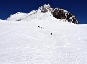
Climb Mt. Shasta via Avalanche Gulch
5.011 mi / 7200 ft gainThe Avalanche Gulch route is the second easiest, non-technical route to the summit of Mt. Shasta after the Clear Creek Route, but is by far the most popular. Many people complete this climb in one day from the trailhead, but you also have the opportunity to overnight at Horse Camp (7,950 ft.) or ...Read more

