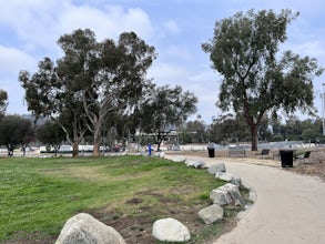
Newbury Park, California
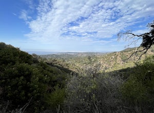
Newbury Park, California is home to some of the best trails and outdoor activities. The top must-visit is the Satwiwa Loop Trail, a moderate 1.5-mile loop that offers scenic views of the Santa Monica Mountains and the Pacific Ocean. The trail passes by a historic Chumash Native American site and a stunning wildflower meadow. For a more challenging hike, the Boney Mountain Trail is a 6-mile round trip with panoramic vistas and unique rock formations. The Dos Vientos Community Park is a great place for family picnics, while the Conejo Creek North Park features a duck pond and beautiful gardens. For birdwatching and wildlife viewing, the Rancho Sierra Vista/Satwiwa is a must. Don't miss the chance to explore these outdoor adventures in and near Newbury Park.
Top Spots in and near Newbury Park
-
Rancho Palos Verdes, California
Terranea Beach Sea Cave
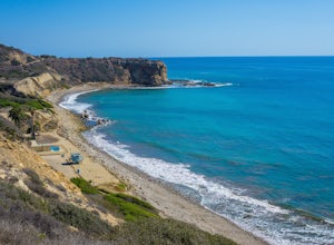
4.31.63 mi / 210 ft gainHead to the Pelican Cove parking lot where there’s plenty of free parking right at the trailhead. From the parking lot, take the Terranea Beach Trail and you will see views of the Point Vicente Lighthouse down the coast to your right. Continue on the trail through the luxury Terranea Resort whic...Read more -
Ventura, California
Prisoner's Cove to Scorpion Anchorage
5.013.19 mi / 2474 ft gainTo get to Santa Cruz Island you will need to book a ferry with Island Packers. On their website, you can only book roundtrip tickets in and out of the same location so for this trip you will need to call and book a ferry into Prisoner's Harbor and out of Scorpion Anchorage. You can call them at (...Read more -
Ventura, California
Chinese Harbor via Prisoners Harbor
14.11 mi / 2703 ft gainThe hike to Chinese Harbor is a 14-mile out-and-back hike from Prisoners Harbor on Santa Cruz Island or a much more manageable 8-mile out-and-back hike from Del Norte backcountry campground. If you are spending the day on the island courtesy of Island Packers, a trek to Chinese Harbor might be di...Read more -
Los Angeles, California
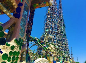
Watts Towers
3.0Watts Towers are a quick 15-20 minute ride from Downtown Los Angeles on the Metro. Since I love weird, interesting things, plus the towers are in my backyard, I had to take a trip to check them out! When getting off the train, I half expected to see the towers spiraling off in the distance. After...Read more -
La Cañada Flintridge, California
Teepee Trail
5.02.55 mi / 1145 ft gainHidden in the small community of La Canada, California, the trailhead is pretty hidden! From the 210, take the exit for Highway 2/Angeles Crest Highway. Head north (towards the mountains) for about a mile. As the highway begins to curve, you will come across a small side-street, Harter Lane. Turn...Read more -
Montecito, California
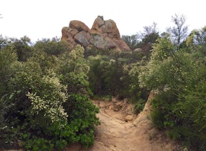
Saddle Rock Loop
4.03.37 mi / 984 ft gainBegin at the trailhead in the parking area on E. Valley Road. You'll gain some elevation (don't forget your water). You'll know when you arrive at Saddle Rock--you can't miss this conspicuous rock formation. Enjoy the sights from here. If you plan carefully and hike up on a clear day, you may eve...Read more -
Los Angeles, California
Sunset Hike in Ascot Hills
3.5Ascot Hills Park is a great hidden gem located a few miles east of Los Angeles. There is a parking lot with plenty of parking but the gates close at sunset, which is a great time to go, so if you plan on staying later, park outside the gates where there is ample street parking. Depending on the s...Read more -
Rancho Palos Verdes, California
Burma Road Trail & Ishibashi Trail Loop
4.35.09 mi / 1148 ft gainGetting There: The easiest way to get to Portuguese Bend Nature Reserve is by following Crenshaw Boulevard up Rancho Palos Verdes to the very end of the street. You can park on either side of the street near Del Cerro Park, which also happens to be a great place for picnics if you want to eat bef...Read more -
Rancho Palos Verdes, California
Sacred Cove View Trail
4.52.08 mi / 292 ft gainThis area is spectacular - the views of the cliffs, the channels of water entering the caves, and the marine life (sea lions, whales, dolphins, sea urchin and sea anemone) are huge draws. Bring anyone here that has a sense of adventure and be ready to get wet. Only attempt swimming across the cha...Read more -
Montecito, California
Tangerine Falls
4.51.15 mi / 886 ft gainThis waterfall can be fairly dry during the year, so keep your eyes out for a recent rainstorm to get things going. When you start the hike on East Folk Trail, at 0.25 miles, cross over the creek and join West Fork Trail. A little over another half mile, West Fork starts to head uphill, but you c...Read more -
Montecito, California
West Fork of Cold Spring Trail
3.45 mi / 1135 ft gainIf you love the mountains above Santa Barbara but hate the crowds, stick to the canyon trails on the east side. The trails running up Cold Spring canyon offer a variety of experiences without all the noise. To find the West Fork of Cold Spring Trail, take the Olive Mill Rd. exit from the 101 fre...Read more -
Montecito, California
Cold Spring Trail Loop
5.02.67 mi / 883 ft gainCold Spring Trail Loop is a loop trail that takes you by a river located near Santa Barbara, California.Read more -
Rancho Palos Verdes, California
Abalone Cove Shoreline Park
4.3Abalone Cove Shoreline Park is a Palos Verdes gem. This 64-acre reserve is a state ecological preserve. There is something for everyone here, whether you want to relax and lay out or be adventurous and swim across channels to get to sea caves. The large parking area is very easy to find and costs...Read more -
Pasadena, California
Lower Arroyo Seco Loop
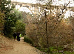
4.02.88 mi / 230 ft gainNestled next to the CA-134, this trail presents a relaxing atmosphere while only a 30 minute drive from Downtown Los Angeles and a 5 minute drive from Old Town Pasadena. From bird-watching to archery, this trail provides a peaceful atmosphere with no lapse in beauty. The trail which is around 1....Read more -
Pasadena, California
Arroyo Terrace Trail
5.01.54 mi / 194 ft gainArroyo Terrace Trail is a loop trail that takes you by a river located near Pasadena, California.Read more -
Pasadena, California
Central Arroyo Seco Community Recreation Loop
5.00.66 mi / 36 ft gainBeautiful views of the Rose Bowl and surrounding San Gabriel Mountains. A protected .75 mile loop, that offers an easy path, to stroll along. You’ll find convenient water filling stations, clean bathrooms, and a fitness area, along the path. Easy parking all around.Read more


