Mount Hamilton, California
Mount Hamilton in California offers some of the best trails and outdoor activities for those seeking scenic outdoor adventures. One must-visit is the Grant Ranch County Park, a sprawling area with a network of trails that takes you through rolling hills and pastures. The park is known for its unique rock formations and a peaceful lake, making it a top spot for hiking, picnicking, and fishing. The Mount Hamilton Observatory is another top attraction, providing stunning views of the surrounding landscape. For a challenging hike, tackle the Copernicus Peak Trail, the highest point in the park. This trail offers panoramic views and a glimpse of the region's diverse flora and fauna. Whether you're a seasoned hiker or a casual walker, Mount Hamilton offers an array of outdoor activities to suit all preferences.
Top Spots in and near Mount Hamilton
-
Felton, California
Hike to Limestone Kilns and Big Ben Redwood
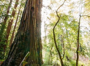
5.08 mi / 1500 ft gainHenry Cowell Redwood State Park is a super easy destination to get to from Santa Cruz, but the seclusion of the Fall Creek Unit makes this a big bang for buck hike. This hike will take you to Big Ben, a medium sized old growth Redwood, and the abandoned Henry Cowell Lime and Cement Company Kilns ...Read more -
Portola Valley, California
Hike the Windy Hill Loop
4.37.2 mi / 1400 ft gainThis 7.2-mile loop starts by heading out of the parking lot and onto the Spring Ridge Trail. Head Southeast On Spring Ridge Trail until you connect with Hamms Gulch Trail. When you jump on Hamms Gulch, head southwest for ~3.4 miles as you circle the far end of the OSP. At this point, you will con...Read more -
La Honda, California
Hike through Portola Redwoods State Park
4.87 miLike redwood hikes? We do too, they're always very scenic and take you away from the hustle and bustle of the bay area. Not to mention, they also stay cool during the summer months. If you want a hike in the middle of the peninsula, this is a great bet.When starting this hike, head out from headq...Read more -
Santa Cruz, California
Hike the Rincon Fire Trail
5.01 mi / 300 ft gainThe Rincon Fire Trail Starts at a small dirt parking lot next to CA-9 and traverses down the mountain to the San Lorenzo River Connecting with the Pipeline Trail. The trail can be a simple one of a mile out and back or up to 5 miles depending on your preference. The elevation will change by about...Read more -
Santa Cruz, California
Surf Pleasure Point
4.0Pleasure Point is located on the east side of Santa Cruz, California. It is a right hand point break that breaks year round. It is a popular surf spot for many people that live in the San Francisco Bay Area. There are 3 different peaks that break at Pleasure Point. Sewers, which is the furthest ...Read more -
Santa Cruz, California
A Beach Bonfire in Santa Cruz at Twin Lakes SB
This one-mile stretch of beach is the perfect option for those looking for a peaceful Santa Cruz experience, but without the crowds. The beach features soft sand, playful surf, an awesome view of Walton Lighthouse, and a handful of fire pits to choose from. It's a great spot to spend the entire d...Read more -
Santa Cruz, California
Bonfire at Seabright State Beach
5.0This is a wide, beautiful beach that's an amazing spot to spend the day and enjoy a bonfire at night. Seabright is probably the most popular spot in Santa Cruz for a bonfire, due to its convenient proximity to the Beach Boardwalk. But luckily, this beach is tucked in between the San Lorenzo River...Read more -
Portola Valley, California
Sunrise Hike at Windy Hill
5.0There are a few options to this hike. Usually I would recommend parking in the lot on Portola Road, but because the preserve doesn't open until 30 minutes before sunrise, it's best to park up on Skyline Boulevard (Highway 35). There are two places to park up on Skyline, but the main parking lot i...Read more -
La Honda, California
Hike the Brook Trail Loop
7.1 mi / 1500 ft gainThe Brook Trail Loop is a beautiful hike, starting off in Sam McDonald County Park and later entering into Pescadero Creek County Park. This adventure can be done in any season, with the trails almost entirely shaded for even the hottest summer days. Starting off from the Heritage Grove trailhead...Read more -
Santa Cruz, California
Photograph the UC Santa Cruz Arboretum
5.0No matter the time you'll decide to visit the UC Santa Cruz Arboretum, you'll have thousands of interesting plants and birds to see and watch. The Arboretum is located on the west side of UCSC campus, between the main campus entrance and the west entrance. Parking is 5$ for adults and 2$ for chil...Read more -
Santa Cruz, California
Surf Cowell's Cove
4.8Cowell's Cove is located just south of Santa Cruz’s iconic Steamer Lane. The break is a slow pealing right, and is a very user-friendly wave for beginners. It can get crowded on weekends, especially when it's sunny, but no need to worry, there are a lot people out on foam boards and most are begi...Read more -
Livermore, California
Condor, Volvan, Stone Corral, Coyote Loop
4.54.38 mi / 620 ft gainThis regional preserve is perfect for day hikes. There are also designated campsites and even a backpack campsite. Horses and dogs are welcome in the preserve. There are many different clearly marked trails that one can choose from. A good 4.5 mile loop is to start at the Park Residence entrance...Read more -
Boulder Creek, California
Hike the Berry Creek Falls Loop
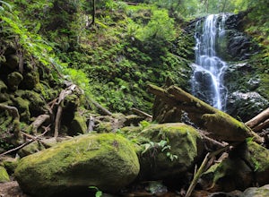
4.811 mi / 2000 ft gainNestled in California's oldest state park, the popular Berry Creek Falls Loop hike begins at the Big Basin park headquarters. If you're up for 11 miles, a thousand feet of elevation gain through towering redwoods and along serene creeks, and spread out over a half-day, then this is the hike for y...Read more -
Boulder Creek, California
Camp at Big Basin Redwoods State Park
4.00.5 miBig Basin is currently closed including the campgrounds. Please visit the Parks.ca.gov site for updated details. An hour away from the thrumming city of San Jose, ancient immense trees live in a forest full of vibrant ferns and rushing waterfalls. Big Basin Redwoods State Park encompasses 10,00...Read more -
Boulder Creek, California
Hike the Ocean View Summit Loop
4.06 mi / 600 ft gainThis hike begins at the Big Basin park headquarters. If you're up for 6 miles through giant redwoods and along serene creeks, and with an ocean view, then this is the hike for you. Ocean view summit loop starts on the Gazos Creek Road bridge, next turn right on to the Middle Ridge Fire Road, whic...Read more -
Boulder Creek, California
Big Basin's Sunset Trail Camp
4.89.46 mi / 2146 ft gainThis trail and campsite is currently closed (learn more). Looking for a more authentic hiking and camping weekend, without having to drive hours away to find it? Then the Sunset Trail Camp within Big Basin Redwoods SP is your ticket. To access this site, you'll need to hike the famous Skyline-to...Read more

