Moss Beach, California
Looking for the best hiking in Moss Beach? We've got you covered with the top trails, trips, hiking, backpacking, camping and more around Moss Beach. The detailed guides, photos, and reviews are all submitted by the Outbound community.
Top Hiking Spots in and near Moss Beach
-
Saratoga, California
Backpack Castle Rock State Park
4.7Castle Rock Trail Camp has a different policy than other backcountry camps in the area (i.e. campsites along Skyline to the Sea). This campground is open all year and is available on a first come, first served basis. If you can, grab a spot a Frog Flat Camp. To get to the camp, park your car at t...Read more -
Los Gatos, California
Hike the Saratoga Gap Trail
4.64.7 miThe Saratoga Gap Trail is relatively lightly trafficked trail that is good year round, although waterfalls peak in late winter and spring. Overall, this 4.7 mile partial loop hike is moderate, with about 1000 feet in elevation change. Trailhead elevation is about 3090 feet. The featured hike desc...Read more -
Fairfax, California
Carson Falls
4.03.75 mi / 863 ft gainAre you tired of crowds on your hikes? First, shame on you for getting up so late and moving so slowly. Did you really need Philz before you got on the trail? Ok, now that you’ve been thoroughly chastised, let’s start planning a hike to the less-frequented Carson Falls. Like any of the falls in ...Read more -
Bolinas, California
Point Reyes' Wildcat Camp via Coast Trail
5.011.19 mi / 1926 ft gainIn order to make this trip possible, go to recreation.gov and make a reservation for Wildcat Camp (available year-round). On your way to the trailhead, make sure to stop by the Bear Valley Visitor Center to grab your camping permit. For more information, visit: http://www.nps.gov/pore/planyourvis...Read more -
Bolinas, California
Bass Lake via Palomarin Trailhead
4.26.11 miFollow the Coast Trail from Palomarin Trailhead to Bass Lake. It's a fairly easy ~2.5-3 miles to the Lake. As soon as you pass the lake, on the left you will see a narrow unmarked dirt trail. Take this trail and you'll get to a nice clearing with easy lake access (this will be a great spot for lu...Read more -
Bolinas, California
Glen Camp Loop via the Palomarin Trailhead
4.715.72 mi / 3091 ft gainDay 1 Before heading to the trailhead, make sure to stop by the Bear Valley Visitor Center to pick up your permit. To stay overnight in Point Reyes, you must stay at one of the trail camps. Camping anywhere else in the park is not allowed. Permits for the trail camps can be booked up to 6 mo...Read more -
Bolinas, California
Backpack to Coast Camp in Point Reyes via Palomarin Trailhead
20.5 mi / 2705 ft gainSpanning from just north of the small town of Bolinas (about an hour north of San Francisco) across Inverness ridge and to the top of Tomales Point, Point Reyes National Seashore is as stunning park featuring breathtaking ocean views and solitude among the grassy hillsides and forested ridges. Th...Read more -
Bolinas, California
Alamere Falls via Palomarin Trailhead
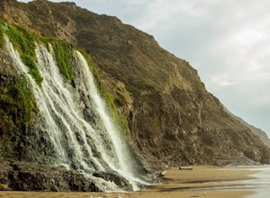
4.513.54 mi / 1614 ft gainAlamere Falls is the tallest waterfall in the bay area. It is known as a tide fall because it empties directly into the Pacific Ocean. This is extremely unique because there are only 34 tide falls in the world and two in California, the other being McWay Falls in Big Sur. Enjoy stunning views of...Read more -
Richmond, California
Hike the Wildcat Canyon Loop
4.010.5 mi / 2300 ft gainStarting off on Wildcat Creek Trail, the trail is wide and rolling. After about 4 miles make a left on Jewel Trail, then onto Sylvan Trail. Another left puts you on Wildcat Peak Trail. Be sure to check your map, as many trails intersect here. Wildcat Peak Trail runs into Nimitz Way, at which poin...Read more -
San Rafael, California
Gold Hill Grade to Nike Missile Site
4.04.37 mi / 988 ft gainThe Gold Hill Grade to Nike Missile Site trail in San Rafael, California, is a moderately challenging hike. The trail spans approximately 4.37 miles round trip, with an elevation gain of about 988 feet. The path is well-maintained and marked, making it suitable for hikers of varying skill levels....Read more -
Sanborn County Park, California
Hike Sanborn County Park via the San Andreas Trail
4.04.2 mi / 1282 ft gainThis is a moderately rated 4.2 mile trail that winds through the redwoods west of Saratoga. It features a dirt trail with tall trees and a creek. The hike is very tranquil and there is lot s of greenery. There are big rocks in the creek that can you can sit on. People often meditate here as i...Read more -
Lafayette, California
Lafayette Reservoir via Nature Area Rim Trail
5.05 mi / 758 ft gainLafayette Reservoir is perfect for canoeing, mountain biking, trail running, and hiking. The Reservoir trail system is also used for nature walks and birding. The loop has several high points that have amazing views. The trails become very muddy after wet weather - so tread with caution. Th...Read more -
Moraga, California
Bollinger Creek Loop Trail
1.43 mi / 213 ft gainLas Trampas Regional Wilderness offers an extensive trail system for hikers, horseback riders and mountain bikers. The trail is open year round and dogs are allowed. The Las Trampas and Bollinger faults spread apart to reveal a wonderful wilderness area with ancient remnants of beaches. The entir...Read more -
Fremont, California
Mission Peak via Hidden Valley Trail
4.26.16 mi / 2116 ft gainBreathtaking views of the Bay Area are your reward for making this climb to the top of Mission Peak. It’s a 3-mile trek to the top of the peak and then back down the same way. This is a moderate hike that provides a nice workout – so be prepared. Park at the Stanford Avenue entrance gate. There ...Read more -
Richmond, California
Explore Point Pinole Shoreline
5.0Point Pinole Regional Shoreline is a 2,315-acre parkland that juts out into the San Pablo Bay. Only a brief car ride from San Francisco, this is a great spot for a Sunday stroll, picnic or simply to find a quiet space.There are several short trails to choose from that wind through eucalyptus grov...Read more -
San Rafael, California
China Camp Loop
4.09.23 mi / 1716 ft gainPark at the lot in the China Camp State Park. Hop onto the Bay View trail to gain to begin the loop trail. Switchbacks take you up to a long and easy path passing through shaded and open areas. Enjoy the grasslands speckled with oak trees and coyote brush. You can see the San Rafael bay and bridg...Read more

