Macdoel, California
Looking for the best hiking in Macdoel? We've got you covered with the top trails, trips, hiking, backpacking, camping and more around Macdoel. The detailed guides, photos, and reviews are all submitted by the Outbound community.
Top Hiking Spots in and near Macdoel
-
Dunsmuir, California
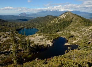
Heart Lake in the Klamath Mountains
4.52.38 mi / 636 ft gainScenes like this are rarely so accessible. Heart Lake is nestled in a bowl below Castle Peak, on the edge of the Castle Crags Wilderness just west of I-5 and the city of Mt. Shasta. The parking lot and trailhead are both located on the shore of Castle Lake, a much larger lake that is stunning in ...Read more -
Castella, California
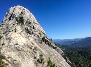
Hike Crags Trail to Castle Dome
4.45.1 mi / 2135 ft gainOne of the gems in the Shasta area, Castle Crags. You can spot these dramatic granite towers from a distance and their jagged formations beckon climbers and hikers alike. Imagine a slice of the Dolomites plucked out of Italy and placed in Northern California. Crags Trail to Castle Dome winds up t...Read more -
Gazelle, California
Hike the Fen Trail at Kangaroo Lake
The Fen Trail around Kangaroo Lake is a beautiful secluded camping and hiking area in the Klamath Forest of Northern California. It connects to the Pacific Crest Trail (PCT), where you can hike up through Oregon and Washington to Canada, or south through to Yosemite.The trailhead starts at the Ka...Read more -
Ashland, Oregon
Hike and Climb Pilot Rock
8 mi / 1000 ft gainPilot Rock is one of the most prominent features in the Cascade-Siskiyou National Monument and is visible from over 40 miles away in the Shasta Valley of northern California and the Rogue Valley of Southern Oregon.Similar to Devil’s Tower in Wyoming, though much smaller in stature, Pilot Rock is ...Read more -
Ashland, Oregon
Hike to Hobart Bluff
2.5 mi / 200 ft gainHobart Bluff is part of the Western Cascades, a range of weathered volcanic mountains that are much older than the High Cascades that most people think of today, the range of Shasta, Rainier, and Hood. These mountains are shorter as a result of the work of time and usually have summits wrapped in...Read more -
Ashland, Oregon
Summit Mt. Ashland
5.05 mi / 1550 ft gainSituated in Southern Oregon right near the California border lies the Siskiyou Mountain Range's tallest peak, Mount Ashland. Mount Ashland is a very popular area for many recreational activities, one of the most popular activities is skiing. The ski area was opened up in 1963 and has changed hand...Read more -
Burney, California
Northshore Campground
The name of the campground, Northshore Campground, speaks for itself. It's located on the northern side of Lake Britton, across the water from the main state park camping area. This is nice for us as it's easier to get a spot, and it's much quieter. Campground Reservations It's a PG&E campgr...Read more -
Trinity Center, California
Stoddard Lake
5.07.01 mi / 1325 ft gainThe trail is a bit rocky, so wear sturdy hiking boots or trail runners. While your elevation gain is only 800 total, you will travel upwards of 1,982ft in elevation given the ups and downs of the trail. At mile 1.75, there is a spring that feeds into a large meadow. At mile 3, there is another sp...Read more -
Burney, California
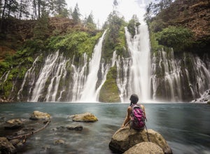
Burney Falls
4.90.97 mi / 82 ft gainBurney Falls can be seen right from the parking area, but this scenic loop is a great hike for all levels of hiking ability. Heading out on this trail will take you to the base of this 129 foot tall waterfall. The Hike Burney Falls has a 1.3 mile loop trail that takes approximately 30 minutes ...Read more

