Klamath, California
Looking for the best photography in Klamath? We've got you covered with the top trails, trips, hiking, backpacking, camping and more around Klamath. The detailed guides, photos, and reviews are all submitted by the Outbound community.
Top Photography Spots in and near Klamath
-
Crescent City, California
Drive Walker Road
5.0Walker Road is one of the places where parts of Star Wars IV: A New Hope were filmed! It's a beautiful site in the Redwoods with an extra amount of huge, leafy ferns. Once you turn onto Walker Road, it's a quick drive through the redwood trees and ferns to the Smith River at the end. There are a ...Read more -
Humboldt County, California
Hike to Tall Trees Grove, Redwood NP
5.03.9 mi / 690 ft gainNOTE: You need a permit, albeit free, to do this hike.First, you'll need to go to the Thomas H. Kuchel Visitor Center just off Highway 101 south of Orick, CA. Once there, write down your license plate number and go up to the counter and ask one of the rangers for a permit for Tall Trees Access Ro...Read more -
Humboldt County, California
Hike the Emerald Ridge - Redwood Creek Loop
6 mi / 900 ft gainThis loop begins at the Tall Trees Trailhead. To access this parking area, you must have a permit that you can obtain from the Kuchel ranger station. The gate is locked. When you get the permit, the ranger will also give you the combination to the gate. Once you drive through, close the gate ...Read more -
Orick, California
Tall Trees Grove, Redwood Creek, Emerald Ridge Loop
4.44.41 mi / 1043 ft gainDay 1: Check with the Rangers station before heading up for best camping opportunities. Assuming you've checked with the rangers for approval...if there are openings, off of the main road, there are side streets with access to the beaches. Pull into one of these areas and drive down as far as you...Read more -
Crescent City, California
Devil's Punchbowl, Six Rivers National Forest
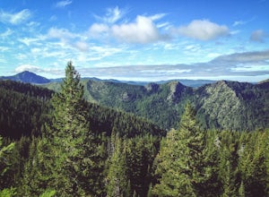
4.08.33 mi / 1660 ft gainLocated in extreme Northern California, the Siskiyou Mountains are the largest sub-range of the Klamath Mountain range and among the most rugged. The Siskiyou Wilderness, designated in 1984, encompasses three national forests: Siskiyou, Klamath and Six Rivers for a total of 182,802 acres. Because...Read more -
Orick, California
Hike Lyons Ranch
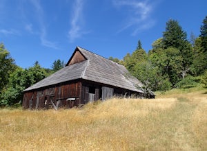
4 miThis is really a dirt road that is gated off from Bald Hills Road. The trail head parking can fit about 6 cars but seldom do people venture out this way. After all, the attraction of Redwood National Park is the redwoods but this high prairie is definitely worth exploring.The walk to the ranch is...Read more -
Del Norte County, California
Backpack to Raspberry Lake
1.012 mi / 1800 ft gainIf you wish to experience the beauty of the Siskiyou Wilderness and avoid the crowds associated with The Devil’s Punchbowl, then consider a visit to Raspberry Lake. Beginning at the Young’s Valley Trailhead (Coordinates: 41.889919, -123.654755), this hike is a great option for those seeking wide...Read more -
Trinidad, California
Watch a Sunset at College Cove Beach
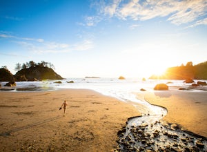
5.00.25 miFollow the trail leading from the end of the parking lot down onto the beach. From the parking lot to the beach the walk is about a quarter of a mile, with a slight decrease in elevation as you move down to the beach. To get to the beach, take 72B off of Highway 101 and turn west onto Main Stree...Read more -
Trinidad, California
Hike Trinidad Head
4.81.5 mi / 300 ft gainPark in the large parking lot at Trinidad Beach. The trailhead is at the south end of the parking lot. The loop trail can be hiked in either direction.The trail is half dirt singletrack, half paved switchbacks, and climbs steadily to the top of Trinidad Head. The view of the ocean and California ...Read more -
Trinidad, California
Explore Luffenholtz Beach Park
On a road trip with a friend in July of 2019, this beach came recommended to us. The tidepools, rocks cutting into the sea, and photography opportunities made it a spectacular stop. There are stairs down to the beach and we were the only ones at the park. If I remember correctly, it’s quite a n...Read more -
Brookings, Oregon
Explore the Marine Garden at Harris Beach SP
The Marine Garden at Harris Beach State Park is one of the 7 designated Marine Garden's on the Oregon Coast where the ecosystem is protected and the collection and disturbance of tidal flora and fauna is prohibited. Interpretive hikes and guides are available through the State Park system, as are...Read more -
Brookings, Oregon
Camp at Harris Beach SP
4.0Harris Beach State Park on the Southern Oregon Coast and about a quarter mile north of the town of Brookings, Oregon features a variety of campsites, including yurts, full RV hookups, and even a hiker/biker camp for individuals hiking the Oregon Coast Trail and/or biking the PCH. From either the...Read more -
Fort Jones, California
Sky High Lakes in the Marble Mountains
5.011.88 mi / 2070 ft gainThe Marble Mountains are part of the Klamaths, a biologically and geologically diverse range of peaks and ridges often overshadowed by its western neighbors in the Cascades. The Marble Rim is the signature feature of this subrange, a white wall of rock that glimmers in the sun. The nearby Sky Hig...Read more -
Brookings, Oregon
Explore Natural Bridges at Samuel H. Boardman State Scenic Corridor
4.86 mi / 0 ft gainThe Samuel H. Boardman Scenic Corridor is 12 miles of rugged, steep coastline with many hidden & secluded beaches and coves, and the Natural Bridges section is one of the most iconic (and most photographed) along the entire Corridor.There are several hikes above and around the natural bridges...Read more -
Brookings, Oregon
Explore Thunder Rock Cove at Samuel H Boardman State Scenic Corridor
1.5 mi / 400 ft gainOne of many magical nooks and crannies to explore all along the Samuel H. Boardman State Scenic Corridor, Thunder Rock Cove sits between the iconic (and more popular) Natural Bridges and Secret Beach. The hike to the cover overlook is an easy .75 mile hike down from the Thunder Rock pull-off tha...Read more

