Johnsville, California
Looking for the best photography in Johnsville? We've got you covered with the top trails, trips, hiking, backpacking, camping and more around Johnsville. The detailed guides, photos, and reviews are all submitted by the Outbound community.
Top Photography Spots in and near Johnsville
-
Nevada City, California
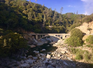
Hike the Independence Trail
4.5Starting from the free easy access parking lot right off highway 49 you head left up the trail. You will notice two trails side by side, one wider path for wheelchair access and another slightly narrower path for hikers on foot.The trail is set on the cliff side overlooking the South Fork of the ...Read more -
Truckee, California
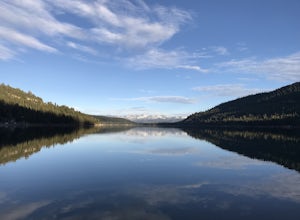
China Cove Loop at Donner Lake
4.63.11 miThis is a casual hike in an area with a ton of history. Stop by the museum before or after your hike to learn about the Donner Party, the Transcontinental Railroad, and local Native Americans Park at the Donner Lake and Memorial State Park Visitor Center and walk west towards the lake. Cross the...Read more -
Penn Valley, California
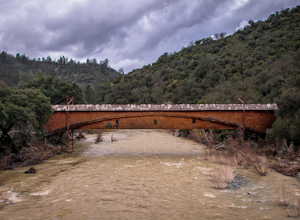
Visit the Bridgeport Covered Bridge
4.0The famed and picturesque Bridgeport Covered Bridge, spanning the width of the Yuba River, was originally built in 1862. It was an integral passage for a freight hauling route from San Fransisco to Nevada. This historic site is now protected and is no longer able to be walked or driven through as...Read more -
Truckee, California
The Five Lakes Hike
4.0The Five Lakes Trail is located in the Granite Chief Wilderness in between Alpine Meadows and Squaw Valley ski resorts and is easily accessible at the intersection of Alpine Meadows and Deer Park roads. The 5-mile moderate trail ascends approximately 900-1000 ft. along granite canyons and pine f...Read more -
Olympic Valley, California
Hike the Shirley Canyon Cascades Trail
3.6 mi / 2109 ft gainThis trail has lots of elevation over a short distance, be warned! The Shirley Canyon Cascades Trail is close to Olympic Valley in the North Lake Tahoe region. Dogs are allowed on this trail if kept on leash.Read more -
Olympic Valley, California
Hike the Thunder Mountain Trail
5.03.2 mi / 2000 ft gainThe Thunder Mountain Trail is the perfect hike to explore the Squaw Valley Alpine Meadows. Squaw may be famed for its mountain ski runs in the winter, but when the snow melts in the summer, beautiful alpine meadows line the mountain and the ski runs turn into hiking trails! The Thunder Mountain T...Read more -
Oroville, California
Hike to Hollow Falls
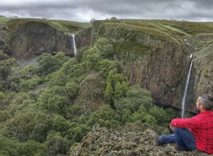
5.01 miThe first step of this fun little hike is to park at the handy parking lot located at 2488 Cherokee Rd., Oroville, CA up on Table Mountain. Many people park here for the hike to the more well-known Phantom Falls, which is a much longer hike than the one to Hollow Falls. From the lot, look for an ...Read more -
Oroville, California
Hike to Phantom Falls
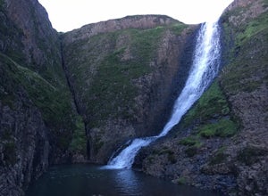
4.64.2 mi / 850 ft gainDropping off a 135 ft cliff is a very well hidden waterfall with no trails leading to it. But if you do find it, it is an epic natural wonder.It is best to come here in the winter months, after a lot of rain. But it is also well worth coming in the spring when the wildflowers on Table Mountain ar...Read more -
Reno, Nevada
Hunter Creek Trail
3.06.43 mi / 1362 ft gainJust outside of Reno find a fun little hike through the hills along a creek, ending at a beautiful waterfall. The trail is heavily trafficked and easy to follow with two creek crossings. It is mostly a moderate but steady climb on the way out, with just a few steep spots. The parking lot has ...Read more -
Colfax, California
Hike The Historical Stevens Trail
5.08 mi / 3376 ft gainBest known as one of the most popular hiking and biking trails to the North Fork American River, in part because of the easy access from Colfax. However, this is a remote trail, and hikers are advised to bring plenty of fluids as well as carry a whistle. The entire trail is primarily shaded, pa...Read more -
Olympic Valley, California
Hike to Lake Estelle and Five Lakes
6 mi / 1000 ft gainThis hike starts at Alpine Meadows Base Camp and finishes on Alpine Meadows Road. The end point is less than a half mile from the base, and an easy walk up a slight hill. Park at base camp and head on the trail to the far right of all of the lifts. Proceed up the trail for half a mile (this is th...Read more -
Grass Valley, California
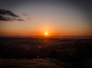
Photograph a Sunset on Wolf Mountain
5.0While all of the hiking trails to the Wolf Mountain summit cross private land, Wolf Mountain Road provides public access to several excellent viewpoints overlooking the Central Valley and the nearby ruins of old radio towers.To get there take McCourtney Road west from CA Highway 49/20 and go 3.2 ...Read more -
Plumas County, California
Camp at Last Chance Creek Campground on Lake Almanor
This PG&E campsite is located on the northern most inlet of Lake Almanor and is slightly more remote than the other sites around Lake Almanor. The campground offers spectacular views and easy access to great fishing. To get there, head east out of the town of Chester on Highway 36. After cros...Read more -
Tahoe City, California
Ride Twin Peaks in Lake Tahoe's Backcountry
This trip is best done in two days with an approach day and then a descent day. Get started at the base of the Sherwood Chair on the backside of the Alpine ski area. Head up, outside of the ski area boundary toward the high ridge.Once on the ridge, you follow it south for a few miles until reachi...Read more

