Half Moon Bay, California
Looking for the best photography in Half Moon Bay? We've got you covered with the top trails, trips, hiking, backpacking, camping and more around Half Moon Bay. The detailed guides, photos, and reviews are all submitted by the Outbound community.
Top Photography Spots in and near Half Moon Bay
-
Woodside, California
Hike through Wunderlich County Park
5.04.5 mi / 1400 ft gainLocated in the iconic Silicon Valley town of Woodside, Wunderlich County Park offers a number of hiking trails as well as some horseback riding trails through the wilderness. Once in the parking lot, you will see a number of stables, riding ring, as well as a beautiful historic stable that was o...Read more -
Pacifica, California
Mori Point Loop
4.82.54 mi / 276 ft gainStart at the parking lots close to the pier, where bathrooms are also available. Walk along the pier to watch the sunset as it begins. Next, walk along Sharp Park Beach to discover the plethora of wild flowers and friendly locals always ready to guide you on your walk. Take the stairs up to the...Read more -
Pacifica, California
Milagra Overlook Trail
5.02.51 mi / 558 ft gainFound this hike with some friends after spending some time googling in my car when we were in the area looking for a quick hike with a view! Dog friendly Free parking (but quite limited) Ocean views Known to have gorgeous wildflower blooms (we were not there during this)Porta-potty type toilet...Read more -
Daly City, California
Mussel Rock Loop
4.01.95 mi / 322 ft gainMussel rock, a three-story, 50 million year old rock that has been carried some 500 miles northwest from Southern California, is where the San Andreas fault meets the Pacific Ocean. It's also an excellent spot to drink some wine and catch a sunset. From San Francisco, take Highway 1 south towar...Read more -
Palo Alto, California
Hike the Arastradero Preserve Loop
3.04.5 mi / 600 ft gainGetting There: From Hwy 280, take the Page Mill Road exit and head West on Page Mill Road, away from Downtown Palo Alto (if you're taking 101, exit on Oregon Expressway). Then turn right on Arastradero Road. There will be a small sign indicating the dirt parking lot on the eastern side of the str...Read more -
Loma Mar, California
Camp Under the Redwoods at Memorial Park
With old growth redwoods and a creek swimming area, Memorial Park is a perfect escape from the hustle and bustle of the Bay Area. Memorial Park is only a few miles east of the town of Pescadero. To get here, you can either approach from Highway 1 and drive up Pescadero Creek Road or take Highway ...Read more -
Loma Mar, California
Bike Pescadero Creek County Park
5.012.5 mi / 1350 ft gainPescadero Creek County Park and the connected Sam McDonald and Memorial Park are located deep in the Santa Cruz Mountains holding a vast network of secluded trails. From biking to backpacking, this area is a perfect place for a day or weekend adventure. This area also has the added bonus having r...Read more -
La Honda, California
Hike the Brook Trail Loop
7.1 mi / 1500 ft gainThe Brook Trail Loop is a beautiful hike, starting off in Sam McDonald County Park and later entering into Pescadero Creek County Park. This adventure can be done in any season, with the trails almost entirely shaded for even the hottest summer days. Starting off from the Heritage Grove trailhead...Read more -
Stanford, California
Sunset Picnic at Kite Hill
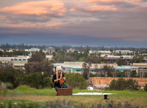
4.0Kite Hill is nothing more than what the name describes. A simple ascent less than 100 feet in elevation. But that 100 feet is all you need to feel like you discovered a little escape from the buzz below.To get there, you can park directly at the base of Kite Hill along Peter Coutts Rd and simply ...Read more -
Los Altos, California
Park Day at Foothills Park
1.7Disclaimer: Foothills Park requires proof of residence in Palo Alto or being accompanied by a resident of the city. Learn more here.Foothills Park is 2.7 miles west of 280 after exiting Page Mill. After exiting you take a short scenic drive up the hill and come to the park entrance on your right...Read more -
Pescadero, California
Catch a Sunset at Bean Hollow State Beach
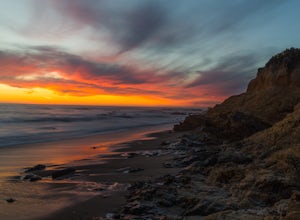
5.0There are a bunch of places to photograph this beach if you head north on the trail that runs along the beach.There is parking at the beach but it can fill up quickly!The only warning you need is about the tide. Make sure you are watching it the entire time because it can creep up on you and will...Read more -
Redwood City, California
Hike Russian Ridge
4.54 miRussian Ridge offers a great place to jump on the trail and in the right season, see some of the best wildflowers blooming. On top of that, you get access to amazing views from the ridge. Once you hit your parking space, add a little extra warm up before jumping on the trail to make this 3.7-mil...Read more -
Los Altos, California
Hike the Monte Bello Open Space Preserve Loop
4.52.9 mi / 600 ft gainThis hike is best done in the late fall, winter, and spring so that the creek is running and the hills are green. Starting at the preserve parking lot, the first half of the hike is predominantly downhill. At the main trailhead, start in the direction of the Stevens Creek Nature Trail, as told by...Read more -
Los Altos, California
Hike to Black Mountain and Stevens Creek Canyon
4.06 mi / 950 ft gainThis hike can be done during any season, but for the creek to be running and for more comfortable temperatures, it is best to go on a cool winter or spring day. Starting at the preserve parking lot, take the Stevens Creek nature trail, allowing you to witness spectacular views of a large, foreste...Read more -
San Francisco, California
Fort Funston Trail
4.71.81 mi / 253 ft gainFort Funston is an SF gem I discovered when looking for a dog friendly hike near the city. Located west of Lake Merced, you'll find a gorgeous Northern California beach oasis where you and your dog can run wild and free :). Parking is located at the top of the park where you'll descend a steep se...Read more -
Pescadero, California
Hike the Little Butano Creek Trail
1.5 miThis short hike follows Little Butano Creek through a lush redwood forest. The trail crosses the creek multiple times as you walk over redwood pine needles and through pockets of ferns. Dogs can join on this trail, but must be on leash.Read more

