Frazier Park, California
Looking for the best hiking in Frazier Park? We've got you covered with the top trails, trips, hiking, backpacking, camping and more around Frazier Park. The detailed guides, photos, and reviews are all submitted by the Outbound community.
Top Hiking Spots in and near Frazier Park
-
Ojai, California
Matilija Falls
5.08.6 mi / 0 ft gainNote: This trail is temporarily closed. For more updates, please visit the Forest Service website for more updates. ...If you've read most of my blogs, you'll probably notice I have a fascination for waterfalls! I've done this hike multiple times, but it wasn't until this day where I saw these ...Read more -
Stevenson Ranch, California
Mentryville: Pico Canyon Trail
7.07 mi / 1388 ft gainMentryville: Pico Canyon Trail is an out-and-back trail that takes you past scenic surroundings located near Stevenson Ranch, California.Read more -
Stevenson Ranch, California
Hike the Towsley Canyon Loop
4.75.1 mi / 1340 ft gainThe Towsley Canyon Loop can be done in either a clockwise or counter-clockwise loop. The clockwise path starts with a gradual ascent through Wiley Canyon and steep descent into the Towsley Gorge while a counter-clockwise route starts with a steep climb out of Towsley Canyon and a gradual descent ...Read more -
Ventura, California
Hike Arroyo Verde Park
3.5 mi / 800 ft gainArroyo Verde Park is a small parked tucked in the hills above Ventura, California, and has a network of trails running up and down the hills surrounding the valley in the center of the park. The entrance to the park is at the intersection of Foothill Road Day Road, east of downtown Ventura. There...Read more -
Thousand Oaks, California
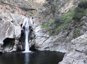
Paradise Falls Loop
4.32.26 mi / 300 ft gainThe hike to Paradise Falls is about 1.5 miles one way with around 300 feet elevation change. Take it easy starting the hike because the real challenge is the change in elevation going back to your car since you'll be going uphill. At the trailhead, follow the signs indicating the location of Para...Read more -
Thousand Oaks, California
Hiking Wildwood Regional Park
3.8Wildwood Regional Park is open year-round, easily accessible, and offers great routes for hiking, running, biking, and even horseback riding. There are also two waterfalls inside the park—the larger of the two, Paradise Falls, cascades 40 feet into a large pool. To catch some beautiful views of t...Read more -
Agua Dulce, California
Vasquez Rocks
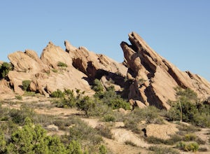
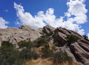
5.02.42 mi / 367 ft gainThis is a Natural Park Area located in Santa Clarita, within the Sierra Pelona Mountains. It features amazing diagonal rock formations, created because of the force between two tectonic plates pushing against each other. This place is a photographer's paradise, and every spot in this 900+ acre l...Read more -
Santa Clarita, California
Hike the PCT and Foot Trail Loop through Vasquez Rocks
5.05.5 mi / 287 ft gainThe Pacific Crest Trail and foot trail hike is a 5-mile loop with a quick PCT branch-off that leads under the 14 freeway through a long, well-maintained (but very dark) tunnel. Pull into the well-marked parking lot and stop in the visitor center to take a look at the topographical park model and...Read more -
Los Angeles, California
Stoney Point Park Loop
4.00.73 mi / 141 ft gainOnce you've parked along Topanga Canyon Blvd, make your way down the street and start the trail off near the steel gate, close to the horse stables. As you make your way in, you will notice some rock climbers practicing on the lower elevation rocks. Make your way around this rocky park, counter-...Read more -
Los Angeles, California
Stoney Point via North End
4.01.42 mi / 240 ft gainStoney Point via North End is an out-and-back trail where you may see local wildlife located near Chatsworth, California.Read more -
Los Angeles, California
Porter Ranch Ridge
4.03.36 mi / 548 ft gainPorter Ranch Ridge is an out-and-back trail where you may see local wildlife located near Los Angeles, California.Read more -
Los Angeles, California
Hike up Chatsworth Park North
1 miFrom the parking lot, make your way through the park until you reach the bottom of a hill filled with huge rocks and boulders. It is very hard to miss.From here, you can pick any trail you wish. They will all lead up to the top. There's a lot of rock scrambling involved, as well as boulder hoppin...Read more -
Los Angeles, California
Reseda Point
4.00.2 mi / 30 ft gainFrom the 118 FWY, exit Reseda and head north until you pass by Calle Vista Circle. Once passed, make a U-turn and park on the side of the street. Here you will find the trailhead for the Palisades Trail Hike. To get to the scenic lookout, simply walk up the short trail leading up the hill, and h...Read more -
Ventura, California
Backpack to Del Norte Campground on Santa Cruz Island
5.07 mi / 700 ft gainDel Norte Backcountry Campground is located on Santa Cruz Island, one of the islands that makes up Channel Islands National Park. It is California's largest island and is almost three times the size of Manhattan. The easiest way to get to the island is to take Island Packers, a ferry service that...Read more -
Oak Park, California
China Flat Trail to Simi Peak
5.05.03 mi / 1398 ft gainFrom the trailhead, simply follow the trail headed up the mountain. The first 2 miles is the hardest part of the hike, because of the steep ascent. Continue on until you hit a junction. Turn left, and you will eventually see an old rusty gate, and a sign which says "China Flat Trail". You will ...Read more -
Newbury Park, California
Boney Peak
4.012.04 mi / 3025 ft gainThe hike begins at the parking lot for Rancho Sierra Vista in Newbury Park, CA just outside LA. Pull into the parking lot and walk on the dirt road until you see the trail for Boney Peak. It is easy to find because the peak can be seen from the beginning of the trail. The trail is generally an in...Read more

